Estimated Value: $184,692 - $225,000
3
Beds
2
Baths
1,144
Sq Ft
$175/Sq Ft
Est. Value
About This Home
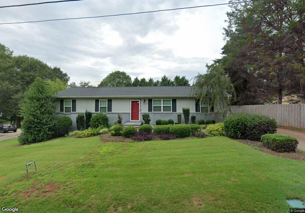
This home is located at 208 Locust Dr, Greer, SC 29651 and is currently estimated at $200,173, approximately $174 per square foot. 208 Locust Dr is a home located in Spartanburg County with nearby schools including Woodland Elementary School, Greer Middle School, and Greer High School.
Ownership History
Date
Name
Owned For
Owner Type
Purchase Details
Closed on
May 10, 2017
Sold by
Brady Christopher
Bought by
Burnett Nellia S and Sanchez Jerry J
Current Estimated Value
Home Financials for this Owner
Home Financials are based on the most recent Mortgage that was taken out on this home.
Original Mortgage
$97,145
Outstanding Balance
$80,832
Interest Rate
4.12%
Mortgage Type
FHA
Estimated Equity
$119,341
Purchase Details
Closed on
Feb 12, 2008
Sold by
Holden Joseph A and Holden Wanda J
Bought by
Brady Christopher
Home Financials for this Owner
Home Financials are based on the most recent Mortgage that was taken out on this home.
Original Mortgage
$96,978
Interest Rate
5.65%
Mortgage Type
FHA
Create a Home Valuation Report for This Property
The Home Valuation Report is an in-depth analysis detailing your home's value as well as a comparison with similar homes in the area
Home Values in the Area
Average Home Value in this Area
Purchase History
| Date | Buyer | Sale Price | Title Company |
|---|---|---|---|
| Burnett Nellia S | $100,500 | None Available | |
| Brady Christopher | $98,500 | None Available |
Source: Public Records
Mortgage History
| Date | Status | Borrower | Loan Amount |
|---|---|---|---|
| Open | Burnett Nellia S | $97,145 | |
| Previous Owner | Brady Christopher | $96,978 |
Source: Public Records
Tax History
| Year | Tax Paid | Tax Assessment Tax Assessment Total Assessment is a certain percentage of the fair market value that is determined by local assessors to be the total taxable value of land and additions on the property. | Land | Improvement |
|---|---|---|---|---|
| 2022 | $752 | $3,988 | $800 | $3,188 |
| 2021 | $752 | $3,988 | $800 | $3,188 |
| 2020 | $742 | $3,988 | $800 | $3,188 |
| 2019 | $742 | $3,988 | $800 | $3,188 |
| 2018 | $742 | $3,988 | $800 | $3,188 |
| 2017 | $637 | $3,380 | $800 | $2,580 |
| 2016 | $622 | $3,380 | $800 | $2,580 |
| 2015 | $617 | $3,380 | $800 | $2,580 |
| 2014 | $612 | $3,380 | $800 | $2,580 |
Source: Public Records
Map
Nearby Homes
- 210 Locust Dr
- 206 Locust Dr
- 207 Locust Dr
- 211 Locust Dr
- 212 Locust Dr
- 205 Locust Dr
- 204 Locust Dr
- 708 Harvey Rd
- 100 Locust Dr
- 706 Harvey Rd
- 231 Pleasant Oak Ct
- 201 Locust Dr
- 227 Pleasant Oak Ct
- 0 Locust Hill Unit 1229222
- 202 Locust Dr
- 704 Harvey Rd
- 205 Acorn Dr
- 230 Pleasant Oak Ct
- 707 & 709 Harvey Rd
- 223 Pleasant Oak Ct
Your Personal Tour Guide
Ask me questions while you tour the home.