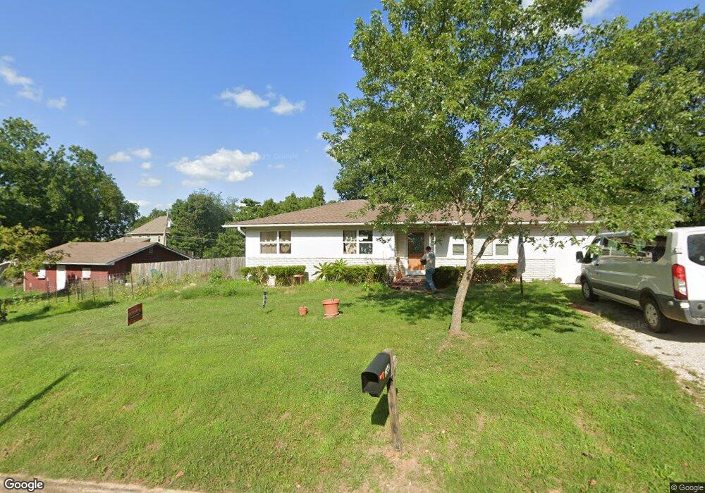
208 Pine St West Plains, MO 65775
Estimated Value: $136,211 - $195,000
Studio
--
Bath
1,152
Sq Ft
$145/Sq Ft
Est. Value
About This Home
This home is located at 208 Pine St, West Plains, MO 65775 and is currently estimated at $166,553, approximately $144 per square foot. 208 Pine St is a home with nearby schools including West Plains Senior High School and Faith Assembly Christian School.
Ownership History
Date
Name
Owned For
Owner Type
Purchase Details
Closed on
Aug 15, 2017
Sold by
Deckard Carolyn and Estate Of Thomas O Mooney
Bought by
Hanson Andrew N and Hanson Cynthia N
Current Estimated Value
Home Financials for this Owner
Home Financials are based on the most recent Mortgage that was taken out on this home.
Original Mortgage
$63,300
Outstanding Balance
$52,705
Interest Rate
3.88%
Mortgage Type
New Conventional
Estimated Equity
$113,848
Purchase Details
Closed on
Jun 7, 2013
Sold by
Mooney Thomas O
Bought by
Mooney Thomas O
Create a Home Valuation Report for This Property
The Home Valuation Report is an in-depth analysis detailing your home's value as well as a comparison with similar homes in the area
Home Values in the Area
Average Home Value in this Area
Purchase History
| Date | Buyer | Sale Price | Title Company |
|---|---|---|---|
| Hanson Andrew N | -- | Brill Title Company | |
| Mooney Thomas O | -- | Brill Title Company |
Source: Public Records
Mortgage History
| Date | Status | Borrower | Loan Amount |
|---|---|---|---|
| Open | Hanson Andrew N | $63,300 |
Source: Public Records
Tax History
| Year | Tax Paid | Tax Assessment Tax Assessment Total Assessment is a certain percentage of the fair market value that is determined by local assessors to be the total taxable value of land and additions on the property. | Land | Improvement |
|---|---|---|---|---|
| 2025 | $713 | $17,220 | $2,240 | $14,980 |
| 2024 | $709 | $15,370 | -- | -- |
| 2023 | $709 | $15,370 | $0 | $0 |
| 2022 | $671 | $14,570 | $0 | $0 |
| 2020 | $599 | $12,700 | $0 | $0 |
| 2019 | $622 | $12,700 | $0 | $0 |
| 2018 | $622 | $12,700 | $0 | $0 |
| 2017 | $619 | $12,700 | $0 | $0 |
Source: Public Records
Map
Nearby Homes
- 0 N Kentucky Ave
- 215 Or 217 S Utah Ave
- 215 & 217 S Utah Ave
- 223 N Utah Ave
- 1444 W 2nd St
- Lot 2 Webster Ave
- Lot 1 Webster Ave
- 999 Preacher Roe Blvd
- 1211 W Main St
- 1903 Catalina Dr
- 115 N Harlin Dr
- 000 Bear Valley Dr
- 1462 W 5th St
- 607 Nevada Ave
- 824 N Utah St
- 1451 W 5th St
- 1050 Nichols Dr
- 824 W Leyda St
- 1416 W 6th St
- Tbd N Kentucky Ave
Your Personal Tour Guide
Ask me questions while you tour the home.