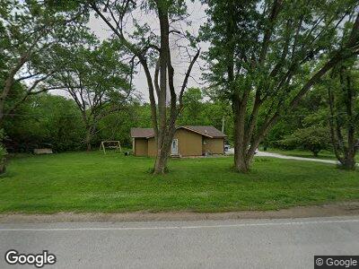
20825 Mcpherson Ave Council Bluffs, IA 51503
Estimated Value: $289,645 - $419,000
2
Beds
1
Bath
870
Sq Ft
$378/Sq Ft
Est. Value
About This Home
This home is located at 20825 Mcpherson Ave, Council Bluffs, IA 51503 and is currently estimated at $329,161, approximately $378 per square foot. 20825 Mcpherson Ave is a home located in Pottawattamie County with nearby schools including College View Elementary School, Gerald W. Kirn Middle School, and Abraham Lincoln High School.
Ownership History
Date
Name
Owned For
Owner Type
Purchase Details
Closed on
Jun 23, 2010
Sold by
Pleake Keith E and Pleake Linda K
Bought by
Justesen Kevin B and Justesen Cynthia D
Current Estimated Value
Home Financials for this Owner
Home Financials are based on the most recent Mortgage that was taken out on this home.
Original Mortgage
$71,250
Outstanding Balance
$48,732
Interest Rate
4.77%
Mortgage Type
New Conventional
Estimated Equity
$258,074
Create a Home Valuation Report for This Property
The Home Valuation Report is an in-depth analysis detailing your home's value as well as a comparison with similar homes in the area
Home Values in the Area
Average Home Value in this Area
Purchase History
| Date | Buyer | Sale Price | Title Company |
|---|---|---|---|
| Justesen Kevin B | $75,000 | None Available |
Source: Public Records
Mortgage History
| Date | Status | Borrower | Loan Amount |
|---|---|---|---|
| Open | Justesen Kevin B | $71,250 |
Source: Public Records
Tax History Compared to Growth
Tax History
| Year | Tax Paid | Tax Assessment Tax Assessment Total Assessment is a certain percentage of the fair market value that is determined by local assessors to be the total taxable value of land and additions on the property. | Land | Improvement |
|---|---|---|---|---|
| 2024 | $2,400 | $186,500 | $66,900 | $119,600 |
| 2023 | $2,400 | $186,500 | $66,900 | $119,600 |
| 2022 | $1,696 | $114,100 | $37,700 | $76,400 |
| 2021 | $2,619 | $114,100 | $37,700 | $76,400 |
| 2020 | $1,798 | $114,100 | $37,700 | $76,400 |
| 2019 | $1,666 | $114,100 | $37,700 | $76,400 |
| 2018 | $1,636 | $102,700 | $37,793 | $64,907 |
| 2017 | $1,636 | $102,700 | $37,793 | $64,907 |
| 2015 | $1,572 | $98,800 | $37,793 | $61,007 |
| 2014 | $1,516 | $95,468 | $37,793 | $57,675 |
Source: Public Records
Map
Nearby Homes
- LOT 12 Mcpherson Ave
- 114 Antioch Dr
- 85.69 Acres Eastern Hills Dr
- 415 Cloverdale Dr
- 204 Marinda Dr
- 201 Woodcliff Cir
- 1301 Afton Cir
- 4019 Gladbrook Dr
- 4105 Gladbrook Dr
- 204 Upland Dr
- LOT 13 Fannin Cir
- 1409 Aster Dr
- 1601 Tipton Dr
- LOT 12 Fannin Cir
- 225 Kingsridge Dr
- 4103 Briarwood Dr
- LOT 10 Fannin Cir
- 209 Shaley Cir
- 4 Butternut Cir
- 1742 Blackthorn St
- 20825 Mcpherson Ave
- 20854 Mcpherson Ave
- 20848 Mcpherson Ave
- 17400 Sunnydale Rd
- 20830 Mcpherson Ave
- 3 Aeroplane Ln
- 20790 Mcpherson Ave
- 20798 Mcpherson Ave
- 1 Aeroplane Ln
- 20946 Mcpherson Ave
- 20697 Mcpherson Ave
- 17440 Sunnydale Rd
- 20740 Mcpherson Ave
- 20968 Mcpherson Ave
- 20736 Mcpherson Ave
- 17474 Sunnydale Rd
- 17510 Sunnydale Rd
- 21020 Mcpherson Ave
- 17313 Hubbard Rd
- 20580 Mcpherson Ave