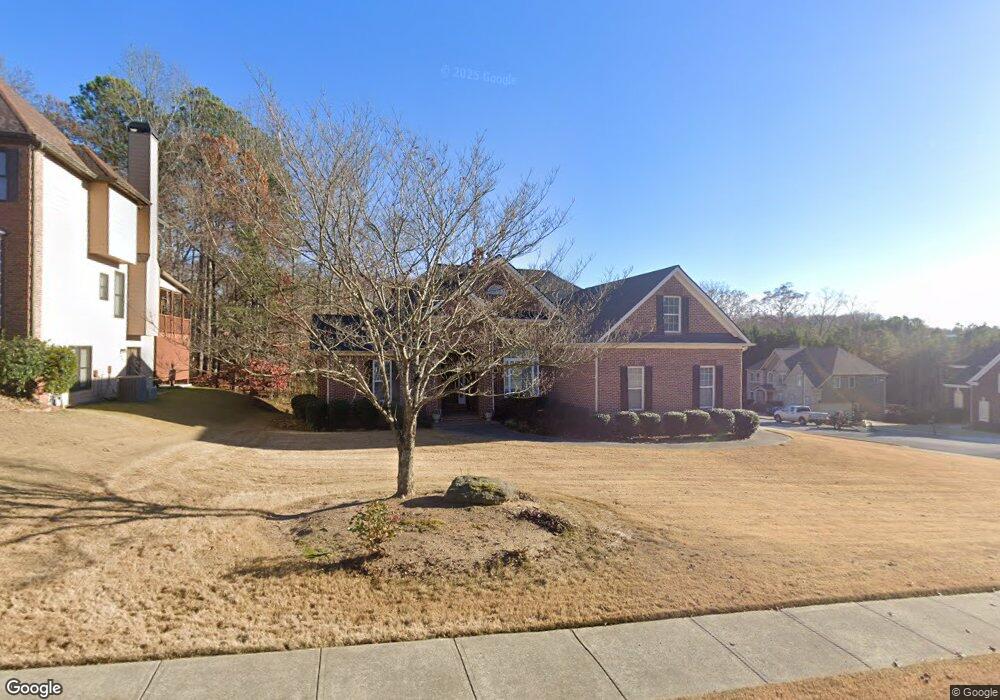
2085 Misty Oaks Dr Unit 3 Buford, GA 30519
Estimated Value: $509,410 - $562,000
4
Beds
4
Baths
2,191
Sq Ft
$246/Sq Ft
Est. Value
About This Home
This home is located at 2085 Misty Oaks Dr Unit 3, Buford, GA 30519 and is currently estimated at $538,103, approximately $245 per square foot. 2085 Misty Oaks Dr Unit 3 is a home located in Gwinnett County with nearby schools including Harmony Elementary School and Glenn C. Jones Middle School.
Ownership History
Date
Name
Owned For
Owner Type
Purchase Details
Closed on
Jul 9, 2003
Sold by
Homestead Dev Corp
Bought by
Cordero Enemir
Current Estimated Value
Home Financials for this Owner
Home Financials are based on the most recent Mortgage that was taken out on this home.
Original Mortgage
$167,200
Outstanding Balance
$64,484
Interest Rate
4.25%
Estimated Equity
$473,619
Create a Home Valuation Report for This Property
The Home Valuation Report is an in-depth analysis detailing your home's value as well as a comparison with similar homes in the area
Home Values in the Area
Average Home Value in this Area
Purchase History
| Date | Buyer | Sale Price | Title Company |
|---|---|---|---|
| Cordero Enemir | $55,000 | -- |
Source: Public Records
Mortgage History
| Date | Status | Borrower | Loan Amount |
|---|---|---|---|
| Open | Cordero Enemir | $167,200 |
Source: Public Records
Tax History
| Year | Tax Paid | Tax Assessment Tax Assessment Total Assessment is a certain percentage of the fair market value that is determined by local assessors to be the total taxable value of land and additions on the property. | Land | Improvement |
|---|---|---|---|---|
| 2025 | $2,054 | $226,840 | $54,400 | $172,440 |
| 2024 | $2,040 | $196,880 | $39,600 | $157,280 |
| 2023 | $2,040 | $172,640 | $39,600 | $133,040 |
| 2022 | $1,999 | $172,640 | $39,600 | $133,040 |
| 2021 | $1,972 | $138,880 | $30,720 | $108,160 |
| 2020 | $1,970 | $138,880 | $30,720 | $108,160 |
| 2019 | $1,807 | $138,880 | $30,720 | $108,160 |
| 2018 | $1,789 | $119,320 | $28,000 | $91,320 |
| 2016 | $1,744 | $109,040 | $25,600 | $83,440 |
| 2015 | $1,566 | $93,800 | $18,400 | $75,400 |
| 2014 | -- | $87,760 | $18,400 | $69,360 |
Source: Public Records
Map
Nearby Homes
- 3843 Morning Meadow Ln
- 2151 E Maddox Rd
- 2140 Harvest Ridge Cir
- 2398 E Maddox Rd
- 2380 Black Bear Ct
- 2352 E Maddox Rd
- 2101 E Maddox Rd
- 2350 E Maddox Rd
- 4316 Woodland Bank Blvd
- 4023 Lost Oak Dr
- 2727 Lost Mill Trace
- 4245 Woodland Bank Blvd
- 3663 Lost Oak Dr
- 1970 Sturbridge Ln Unit 1
- 2249 White Alder Dr
- 101 Maddox Rd
- 4041 Lost Mill Ln
- 2551 E Maddox Rd
- 4017 S South Bogan Rd
- 1781 Plunketts Rd
- 2135 Misty Oaks Dr
- 2120 Misty Oaks Dr Unit 3
- 2075 Misty Oaks Dr
- 2110 Misty Oaks Dr
- 2145 Misty Oaks Dr
- 2130 Misty Oaks Dr Unit 3
- 2090 Misty Oaks Dr
- 2100 Misty Oaks Dr Unit 3
- 2065 Misty Oaks Dr
- 2070 Misty Oaks Dr
- 2155 Misty Oaks Dr
- 2140 Misty Oaks Dr Unit 3
- 3848 Morning Meadow Ln
- 3858 Morning Meadow Ln
- 2055 Misty Oaks Dr
- 3868 Morning Meadow Ln Unit 41
- 3868 Morning Meadow Ln
- 2145 E Maddox Rd
- 2145 E Maddox Rd Unit N/
- 3878 Morning Meadow Ln
Your Personal Tour Guide
Ask me questions while you tour the home.