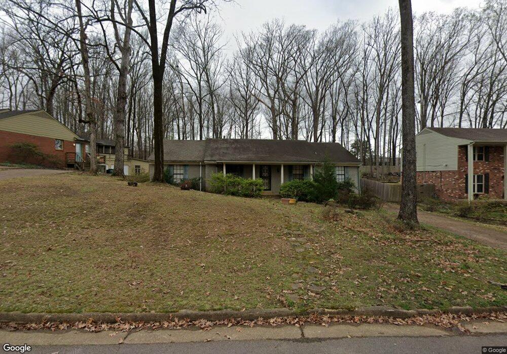
2085 Sonning Dr Germantown, TN 38138
Estimated Value: $332,000 - $412,000
4
Beds
2
Baths
2,099
Sq Ft
$179/Sq Ft
Est. Value
About This Home
This home is located at 2085 Sonning Dr, Germantown, TN 38138 and is currently estimated at $376,345, approximately $179 per square foot. 2085 Sonning Dr is a home located in Shelby County with nearby schools including Farmington Elementary School, Houston Middle School, and Houston High School.
Ownership History
Date
Name
Owned For
Owner Type
Purchase Details
Closed on
Mar 26, 1997
Sold by
Arrant Mark A and Arrant Julie A
Bought by
Alavi Sadegh and Alavi Ozra A
Current Estimated Value
Home Financials for this Owner
Home Financials are based on the most recent Mortgage that was taken out on this home.
Original Mortgage
$60,000
Outstanding Balance
$6,745
Interest Rate
6.37%
Estimated Equity
$369,600
Purchase Details
Closed on
Jun 3, 1996
Sold by
Trammell Claudia
Bought by
Arrant Mark A and Arrant Julie A
Home Financials for this Owner
Home Financials are based on the most recent Mortgage that was taken out on this home.
Original Mortgage
$99,200
Interest Rate
7.05%
Create a Home Valuation Report for This Property
The Home Valuation Report is an in-depth analysis detailing your home's value as well as a comparison with similar homes in the area
Home Values in the Area
Average Home Value in this Area
Purchase History
| Date | Buyer | Sale Price | Title Company |
|---|---|---|---|
| Alavi Sadegh | $129,000 | -- | |
| Arrant Mark A | $124,000 | Mid South Title Insurance Co |
Source: Public Records
Mortgage History
| Date | Status | Borrower | Loan Amount |
|---|---|---|---|
| Open | Alavi Sadegh | $60,000 | |
| Previous Owner | Arrant Mark A | $99,200 |
Source: Public Records
Tax History Compared to Growth
Tax History
| Year | Tax Paid | Tax Assessment Tax Assessment Total Assessment is a certain percentage of the fair market value that is determined by local assessors to be the total taxable value of land and additions on the property. | Land | Improvement |
|---|---|---|---|---|
| 2025 | $1,610 | $88,225 | $13,725 | $74,500 |
| 2024 | $1,610 | $47,500 | $8,425 | $39,075 |
| 2023 | $2,483 | $47,500 | $8,425 | $39,075 |
| 2022 | $2,405 | $47,500 | $8,425 | $39,075 |
| 2021 | $2,884 | $60,500 | $8,425 | $52,075 |
| 2020 | $2,429 | $40,475 | $8,425 | $32,050 |
| 2019 | $1,639 | $40,475 | $8,425 | $32,050 |
| 2018 | $1,639 | $40,475 | $8,425 | $32,050 |
| 2017 | $2,301 | $55,975 | $8,425 | $47,550 |
| 2016 | $1,584 | $36,250 | $0 | $0 |
| 2014 | $1,584 | $36,250 | $0 | $0 |
Source: Public Records
Map
Nearby Homes
- 2057 Sonning Dr
- 7956 Woodford Ln
- 2133 Cranbrook Dr
- 2062 Bensonwood Dr
- 2279 Pinnacle Creek Dr
- 8043 Farmington Blvd
- 1911 Brierbrook Rd
- 1914 Malabar Dr
- 7924 Signature Cove
- 7772 Radford Ridge Rd
- 1899 River Valley Dr
- 2155 Wickersham Ln
- 1847 Gray Ridge Cove Unit 2
- 2211 Wickersham Ln
- 1838 Fernspring Cove Unit 36
- 2390 Lennox Dr
- 1841 Eagle Branch Cove Unit 1
- 1843 Eagle Branch Cove Unit 50
- 1822 Dragonfly Cove Unit 79
- 1824 Crossflower Cove Unit 94
- 2075 Sonning Dr
- 2093 Sonning Dr
- 2065 Sonning Dr
- 2105 Sonning Dr
- 2078 Sonning Dr
- 0 Woodside Dr Unit 3212243
- 0 Woodside Dr
- 2A Woodside Dr
- 0 Woodside Dr Unit 10200950
- 0 Woodside Dr Unit 10165287
- 0 Woodside Dr Unit 10148561
- 0 Woodside Dr Unit 10121453
- 0 Woodside Dr Unit 10097698
- 0 Woodside Dr Unit 10080622
- 0 Woodside Dr Unit 10065450
- 2086 Sonning Dr
- 2092 Sonning Dr
- 2066 Sonning Dr
- 2098 Sonning Dr
- 2115 Sonning Dr