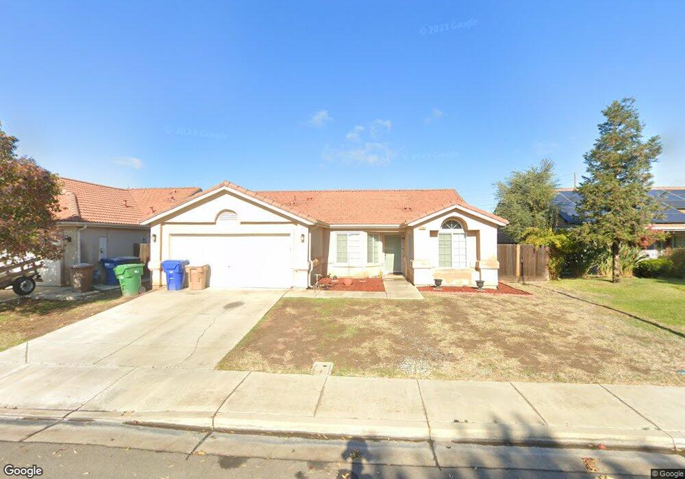
2086 W Fir Ave Merced, CA 95348
Franklin NeighborhoodEstimated Value: $317,000 - $383,000
3
Beds
2
Baths
1,379
Sq Ft
$261/Sq Ft
Est. Value
About This Home
This home is located at 2086 W Fir Ave, Merced, CA 95348 and is currently estimated at $359,628, approximately $260 per square foot. 2086 W Fir Ave is a home located in Merced County with nearby schools including Franklin Elementary School, Rudolph Rivera Middle School, and Buhach Colony High School.
Ownership History
Date
Name
Owned For
Owner Type
Purchase Details
Closed on
Oct 9, 2008
Sold by
Christiana Bank & Trust Company
Bought by
Perry Erika G
Current Estimated Value
Home Financials for this Owner
Home Financials are based on the most recent Mortgage that was taken out on this home.
Original Mortgage
$56,801
Outstanding Balance
$36,797
Interest Rate
5.9%
Mortgage Type
FHA
Estimated Equity
$322,831
Purchase Details
Closed on
Mar 28, 2008
Sold by
Cabrera Rolando
Bought by
Christiana Bank & Trust Co
Purchase Details
Closed on
Dec 6, 2006
Sold by
El Capitan Estates Llc
Bought by
Cabrera Rolando
Home Financials for this Owner
Home Financials are based on the most recent Mortgage that was taken out on this home.
Original Mortgage
$256,750
Interest Rate
7.86%
Mortgage Type
Purchase Money Mortgage
Create a Home Valuation Report for This Property
The Home Valuation Report is an in-depth analysis detailing your home's value as well as a comparison with similar homes in the area
Home Values in the Area
Average Home Value in this Area
Purchase History
| Date | Buyer | Sale Price | Title Company |
|---|---|---|---|
| Perry Erika G | $110,000 | First American Title Company | |
| Christiana Bank & Trust Co | $170,000 | None Available | |
| Cabrera Rolando | $321,000 | None Available |
Source: Public Records
Mortgage History
| Date | Status | Borrower | Loan Amount |
|---|---|---|---|
| Open | Perry Erika G | $56,801 | |
| Previous Owner | Cabrera Rolando | $256,750 |
Source: Public Records
Tax History Compared to Growth
Tax History
| Year | Tax Paid | Tax Assessment Tax Assessment Total Assessment is a certain percentage of the fair market value that is determined by local assessors to be the total taxable value of land and additions on the property. | Land | Improvement |
|---|---|---|---|---|
| 2025 | $2,301 | $141,639 | $64,380 | $77,259 |
| 2024 | $2,301 | $138,863 | $63,118 | $75,745 |
| 2023 | $1,876 | $136,141 | $61,881 | $74,260 |
| 2022 | $2,167 | $133,472 | $60,668 | $72,804 |
| 2021 | $1,615 | $130,856 | $59,479 | $71,377 |
| 2020 | $1,626 | $129,516 | $58,870 | $70,646 |
| 2019 | $1,604 | $126,977 | $57,716 | $69,261 |
| 2018 | $2,010 | $124,488 | $56,585 | $67,903 |
| 2017 | $1,949 | $122,048 | $55,476 | $66,572 |
| 2016 | $1,974 | $119,656 | $54,389 | $65,267 |
| 2015 | $1,484 | $117,860 | $53,573 | $64,287 |
| 2014 | $2,460 | $115,552 | $52,524 | $63,028 |
Source: Public Records
Map
Nearby Homes
- 2868 Beachwood Dr
- 2125 W Antley St
- 2139 W Chesler St
- 2052 W Solis St
- 2931 Elm Ave
- 2094 W Pincay St
- 2228 Drake Ave
- 2577 Lobo Ave
- 2679 Lobo Ave
- 1905 Belcher Ave
- 3119 Lorrie Ct
- 2897 Sohan Dr
- 3533 San Isidro Ave
- 3583 Sarasota Ave
- 0 Franklin Rd Unit 224022200
- 0 Franklin Rd Unit MC25059688
- 0 W Cardella Rd
- 3622 N State Highway 59
- 3469 San Joaquin Ct
- 3251 Cheyenne Dr
- 2074 W Fir Ave
- 2098 W Fir Ave
- 2795 N Drake Ave
- 2108 W Fir Ave
- 2062 W Fir Ave
- 2783 N Drake Ave
- 2107 W Rock Creek Ct
- 2083 W Fir Ave
- 2101 W Rock Creek Ct
- 2075 W Fir Ave
- 2091 W Fir Ave
- 2801 N Drake Ave
- 2122 W Fir Ave
- 2107 W Fir Ave
- 2063 W Fir Ave
- 2813 N Drake Ave
- 2121 W Fir Ave
- 2134 W Fir Ave
- 2131 W Rock Creek Ct
- 2084 W Little Sandy Dr