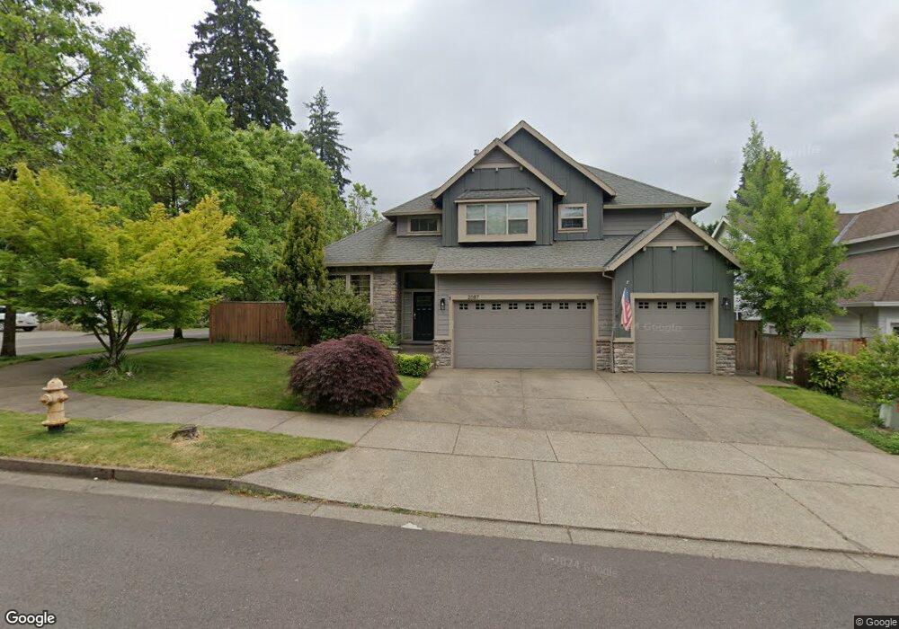
2087 Fields Dr West Linn, OR 97068
Willamette NeighborhoodEstimated Value: $877,040 - $1,130,000
4
Beds
3
Baths
3,000
Sq Ft
$332/Sq Ft
Est. Value
About This Home
This home is located at 2087 Fields Dr, West Linn, OR 97068 and is currently estimated at $995,260, approximately $331 per square foot. 2087 Fields Dr is a home located in Clackamas County with nearby schools including Willamette Primary School, Athey Creek Middle School, and West Linn High School.
Ownership History
Date
Name
Owned For
Owner Type
Purchase Details
Closed on
Sep 1, 2012
Sold by
Fahey Michael T and Fahey Tami L
Bought by
Cox Jeffrey D and Cox Megan E
Current Estimated Value
Home Financials for this Owner
Home Financials are based on the most recent Mortgage that was taken out on this home.
Original Mortgage
$392,000
Outstanding Balance
$270,536
Interest Rate
3.59%
Mortgage Type
New Conventional
Estimated Equity
$724,724
Purchase Details
Closed on
Apr 26, 2006
Sold by
Icon Construction & Development Llc
Bought by
Fahey Ii Michael T and Fahey Tami L
Home Financials for this Owner
Home Financials are based on the most recent Mortgage that was taken out on this home.
Original Mortgage
$349,111
Interest Rate
6.29%
Mortgage Type
Fannie Mae Freddie Mac
Create a Home Valuation Report for This Property
The Home Valuation Report is an in-depth analysis detailing your home's value as well as a comparison with similar homes in the area
Home Values in the Area
Average Home Value in this Area
Purchase History
| Date | Buyer | Sale Price | Title Company |
|---|---|---|---|
| Cox Jeffrey D | $490,000 | Stewart Title | |
| Fahey Ii Michael T | $599,111 | Fidelity Natl Title Co Of Or |
Source: Public Records
Mortgage History
| Date | Status | Borrower | Loan Amount |
|---|---|---|---|
| Open | Cox Jeffrey D | $392,000 | |
| Previous Owner | Fahey Ii Michael T | $349,111 |
Source: Public Records
Tax History
| Year | Tax Paid | Tax Assessment Tax Assessment Total Assessment is a certain percentage of the fair market value that is determined by local assessors to be the total taxable value of land and additions on the property. | Land | Improvement |
|---|---|---|---|---|
| 2025 | $10,192 | $528,845 | -- | -- |
| 2024 | $9,810 | $513,442 | -- | -- |
| 2023 | $9,810 | $498,488 | $0 | $0 |
| 2022 | $9,260 | $483,969 | $0 | $0 |
| 2021 | $8,790 | $469,873 | $0 | $0 |
| 2020 | $8,850 | $456,188 | $0 | $0 |
| 2019 | $8,439 | $442,901 | $0 | $0 |
| 2018 | $8,062 | $430,001 | $0 | $0 |
| 2017 | $7,737 | $417,477 | $0 | $0 |
| 2016 | $7,508 | $405,317 | $0 | $0 |
Source: Public Records
Map
Nearby Homes
- 2083 Ostman Rd
- 2077 Ostman Rd
- 1220 Farrview Ct
- 812 Wendy Ct
- 769 Nicole Dr
- 1310 Sherri Ct
- 2250 River Heights Cir
- 1679 Timothy Ln
- 1694 16th St
- 1721 Dollar St Unit 1721
- 1690 16th St
- 23044 SW Ulsky Rd
- 850 Springtree Ln Unit 850
- 25545 Katherine Ct
- 1791 Blankenship Rd
- 1324 Farrvista Dr
- 4335 Summerlinn Dr
- 1640 Village Park Place
- 3850 Summerlinn Dr Unit 58
- 3650 Summerlinn Dr Unit 49
Your Personal Tour Guide
Ask me questions while you tour the home.