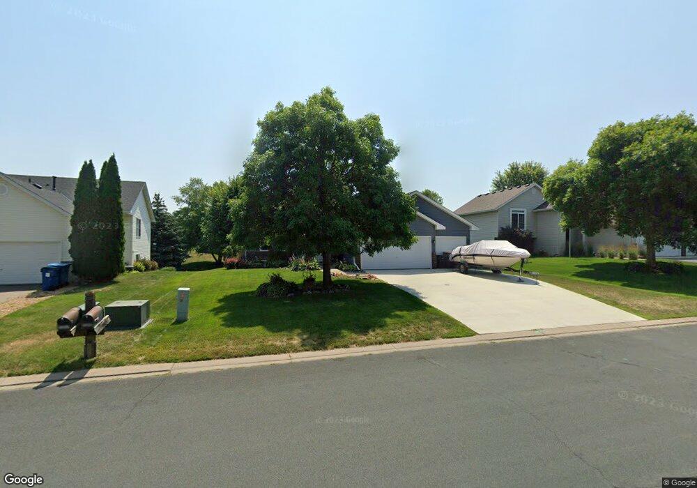
2089 Pheasant Run St Shakopee, MN 55379
Estimated Value: $387,182 - $429,000
3
Beds
2
Baths
1,204
Sq Ft
$337/Sq Ft
Est. Value
About This Home
This home is located at 2089 Pheasant Run St, Shakopee, MN 55379 and is currently estimated at $406,046, approximately $337 per square foot. 2089 Pheasant Run St is a home located in Scott County with nearby schools including Sun Path Elementary School, Shakopee West Middle School, and Shakopee Senior High School.
Ownership History
Date
Name
Owned For
Owner Type
Purchase Details
Closed on
Apr 1, 2003
Sold by
Tushie John D and Tushie Tami M
Bought by
Herold Jason P and Herold Kimberly A
Current Estimated Value
Purchase Details
Closed on
Feb 11, 2000
Sold by
Key-Land Homes
Bought by
Tushie John D and Tushie Tami M
Purchase Details
Closed on
Sep 1, 1999
Sold by
Pheasant Run Of Shakopee L L P
Bought by
Key-Land Homes
Create a Home Valuation Report for This Property
The Home Valuation Report is an in-depth analysis detailing your home's value as well as a comparison with similar homes in the area
Home Values in the Area
Average Home Value in this Area
Purchase History
| Date | Buyer | Sale Price | Title Company |
|---|---|---|---|
| Herold Jason P | $239,900 | -- | |
| Tushie John D | $165,057 | -- | |
| Key-Land Homes | $42,900 | -- |
Source: Public Records
Mortgage History
| Date | Status | Borrower | Loan Amount |
|---|---|---|---|
| Closed | Key-Land Homes | -- |
Source: Public Records
Tax History Compared to Growth
Tax History
| Year | Tax Paid | Tax Assessment Tax Assessment Total Assessment is a certain percentage of the fair market value that is determined by local assessors to be the total taxable value of land and additions on the property. | Land | Improvement |
|---|---|---|---|---|
| 2025 | $3,580 | $348,400 | $140,000 | $208,400 |
| 2024 | $3,566 | $351,200 | $140,000 | $211,200 |
| 2023 | $3,814 | $337,700 | $134,200 | $203,500 |
| 2022 | $3,448 | $353,600 | $152,500 | $201,100 |
| 2021 | $3,050 | $279,700 | $122,000 | $157,700 |
| 2020 | $3,290 | $272,000 | $117,000 | $155,000 |
| 2019 | $3,382 | $259,000 | $104,000 | $155,000 |
| 2018 | $3,570 | $0 | $0 | $0 |
| 2016 | $3,232 | $0 | $0 | $0 |
| 2014 | -- | $0 | $0 | $0 |
Source: Public Records
Map
Nearby Homes
- 2052 Wilhelm Ct
- 2518 Green Ash Ave
- 2529 Green Ash Ave
- Berkley Plan at Arbor Bluff - Venture Collection
- 2551 Aspen Ct
- Clark Plan at Arbor Bluff - Venture Collection
- 2548 Aspen Ct
- Itasca Plan at Arbor Bluff - Landmark Collection
- Sequoia Plan at Arbor Bluff - Venture Collection
- Markham Plan at Arbor Bluff - Venture Collection
- 2340 Rock Elm Rd
- Lewis Plan at Arbor Bluff - Landmark Collection
- McKinley Plan at Arbor Bluff - Landmark Collection
- 2584 Aspen Ct
- 2606 Green Ash Ave
- Marquette Plan at Arbor Bluff - Venture Collection
- 2689 Aspen Dr
- Sinclair Plan at Arbor Bluff - Landmark Collection
- Burnham Plan at Arbor Bluff - Venture Collection
- Washburn Plan at Arbor Bluff - Landmark Collection
- 2095 Pheasant Run St
- 2083 Pheasant Run St
- 2429 Ponds Way
- 2077 Pheasant Run St
- 2101 Pheasant Run St
- 2425 Ponds Way
- 2080 Pheasant Run St
- 2437 Ponds Way
- 2126 Chester St
- 2074 Pheasant Run St
- 2071 Pheasant Run St
- 2421 Ponds Way
- 2441 Ponds Way
- 2118 Chester St
- 2115 Chester St
- 2068 Pheasant Run St
- 2426 Ponds Way
- 2445 Ponds Way
- 2430 Ponds Way
- 2417 Ponds Way