
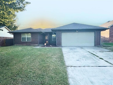
209 Bradgate Dr Yukon, OK 73099
Westgate NeighborhoodAbout This Home
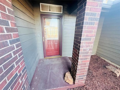
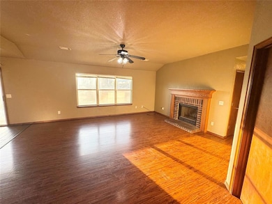
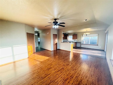
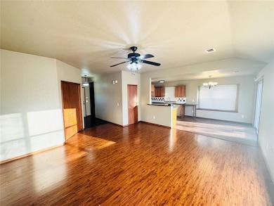
Move-in ready 4-bedroom, 2-bathroom home located in the highly desired Mustang School District. This home features brand-new vinyl flooring throughout and an open living area that’s perfect for everyday living.
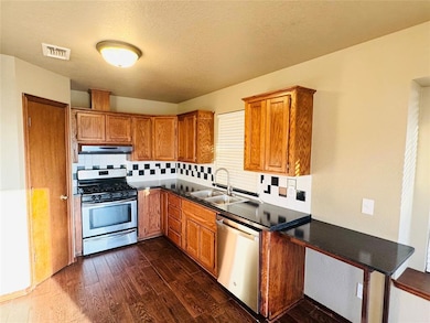
The kitchen comes equipped with a dishwasher, cooking range, and built-in microwave, along with plenty of cabinet and counter space. The primary bedroom includes a private bathroom, and the additional bedrooms offer flexible space for family, guests, or a home office.
Enjoy a nice-sized yard and convenient access to shopping, dining, and major highways.
Great location, recent updates, and Mustang schools—schedule your showing today!
Home Details
Home Type
- Single Family
Est. Annual Taxes
- $2,216
Year Built
- Built in 1995
Lot Details
- 6,674 Sq Ft Lot
Home Design
- 1,654 Sq Ft Home
- Brick Frame
- Architectural Shingle Roof
Bedrooms and Bathrooms
- 4 Bedrooms
- 2 Full Bathrooms
Schools
- Mustang Creek Elementary School
- Mustang North Middle School
- Mustang High School
Map
Source: MLSOK
MLS Number: 1197901
APN: 090021729
Disclaimer: Certain information contained herein is derived from information provided by parties other than Homes.com. All information provided is deemed reliable, but is not guaranteed to be accurate and should be independently verified.
![]() IDX information is provided exclusively for personal, non-commercial use, and may not be used for any purpose other than to identify prospective properties consumers may be interested in purchasing.
IDX information is provided exclusively for personal, non-commercial use, and may not be used for any purpose other than to identify prospective properties consumers may be interested in purchasing.
Information is deemed reliable but not guaranteed.
This information is not verified for authenticity or accuracy, is not guaranteed and may not reflect all real estate activity in the market.
Copyright 2025 MLSOK, Inc. All rights reserved.
- 304 Bradgate Dr
- 321 Bradgate Dr
- 12517 Park Ave
- 417 Haven St
- 12521 NW 3rd St
- 429 Haven St
- 445 Haven St
- 313 Pergola St
- 520 Kearny Ln
- 12629 NW 4th St
- 421 Pergola St
- 213 Harrogate Dr
- Maverick Plan at The Springs at Skyline Trails
- Jack Plan at The Springs at Skyline Trails
- Kirkland Plan at The Springs at Skyline Trails
- Lucca Plan at The Springs at Skyline Trails
- Lane Plan at The Springs at Skyline Trails
- Indalo Plan at The Springs at Skyline Trails
- Montoro Plan at The Springs at Skyline Trails
- Hayden Plan at The Springs at Skyline Trails
- 12712 NW 2nd St
- 520 Kearny Ln
- 12300 NW 4th St
- 100 N Eastgate Dr
- 12409 SW 2nd St
- 12800 NW 6th St
- 12333 SW 2nd St
- 600 Irish Ln
- 515 N Czech Hall Rd
- 12940 NW 4th Terrace
- 12925 Willow Villas Dr Unit B
- 616 Maleah Place Unit B
- 12337 SW 6th St
- 12600 NW 10th St
- 621 Christian Ln
- 800 Cassandra Ln
- 12916 SW 6th St
- 409 Sage Brush Rd
- 11857 NW 7th St
- 13049 SW 5th St
