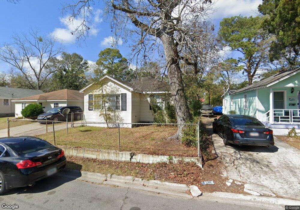
209 Forrest Ave Savannah, GA 31404
East Savannah NeighborhoodEstimated Value: $197,832 - $269,000
3
Beds
2
Baths
1,060
Sq Ft
$217/Sq Ft
Est. Value
About This Home
This home is located at 209 Forrest Ave, Savannah, GA 31404 and is currently estimated at $229,958, approximately $216 per square foot. 209 Forrest Ave is a home located in Chatham County with nearby schools including Shuman Elementary School, Hubert Middle School, and Savannah Arts Academy.
Ownership History
Date
Name
Owned For
Owner Type
Purchase Details
Closed on
Dec 14, 2021
Sold by
Elyseum Properties Inc
Bought by
Orchard Platinum Llc
Current Estimated Value
Purchase Details
Closed on
Jul 1, 2019
Sold by
Fishing Fool Llc
Bought by
Elyseum Properties Inc
Purchase Details
Closed on
Jul 1, 2011
Sold by
Mcintosh R L
Bought by
Stanford William A and 209 Forrest Avenue Trust Trustee
Purchase Details
Closed on
Jun 1, 2005
Sold by
Not Provided
Bought by
Stanford William A and 209 Forrest Avenue Trust Trustee
Create a Home Valuation Report for This Property
The Home Valuation Report is an in-depth analysis detailing your home's value as well as a comparison with similar homes in the area
Home Values in the Area
Average Home Value in this Area
Purchase History
| Date | Buyer | Sale Price | Title Company |
|---|---|---|---|
| Orchard Platinum Llc | $3,550,000 | -- | |
| Elyseum Properties Inc | $2,982,000 | -- | |
| Fishing Fool Llc | -- | -- | |
| Stanford William A | $37,608 | -- | |
| Stanford William A | $67,000 | -- |
Source: Public Records
Tax History
| Year | Tax Paid | Tax Assessment Tax Assessment Total Assessment is a certain percentage of the fair market value that is determined by local assessors to be the total taxable value of land and additions on the property. | Land | Improvement |
|---|---|---|---|---|
| 2025 | $2,146 | $65,600 | $17,400 | $48,200 |
| 2024 | $15 | $63,120 | $17,400 | $45,720 |
| 2023 | $636 | $52,120 | $8,400 | $43,720 |
| 2022 | $977 | $34,776 | $7,104 | $27,672 |
| 2021 | $1,468 | $31,680 | $4,200 | $27,480 |
| 2020 | $705 | $25,360 | $4,200 | $21,160 |
| 2019 | $1,327 | $22,320 | $4,200 | $18,120 |
| 2018 | $1,060 | $21,240 | $4,200 | $17,040 |
| 2017 | $297 | $7,120 | $1,400 | $5,720 |
| 2016 | $208 | $7,120 | $1,400 | $5,720 |
| 2015 | $368 | $7,120 | $1,400 | $5,720 |
| 2014 | $395 | $7,120 | $0 | $0 |
Source: Public Records
Map
Nearby Homes
- 101 Forrest Ave
- 1919 Duval St
- 320 Forrest Ave
- 1911 Greenwood St
- 1919 Greenwood St
- 41 Lawton Ave
- 1915 Causton Bluff Rd
- 1923 New Mexico St
- 2102 Auburn St
- 1812 E Gwinnett St
- 2106 Auburn St
- 3 Gordonston Ave
- 2109 Hanson St
- 2118 E Gwinnett St
- 2130 Hanson St
- 1700 Skidaway Rd
- 0 Mosley St Unit SA345182
- 0 Mosley St Unit 10657096
- 2227 Utah St
- 4 Edgewood Rd
- 215 Forrest Ave
- 207 Forrest Ave
- 219 Forrest Ave
- 201 Forrest Ave
- 221 Forrest Ave
- 210 Forrest Ave
- 214 Forrest Ave
- 206 Lawton Ave
- 216 Forrest Ave
- 206 Forrest Ave
- 202 Lawton Ave
- 212 Lawton Ave
- 204 Forrest Ave
- 220 Forrest Ave
- 223 Forrest Ave
- 214 Lawton Ave
- 216 Lawton Ave
- 229 Forrest Ave
- 205 Lawton Ave
- 201 Lawton Ave
Your Personal Tour Guide
Ask me questions while you tour the home.