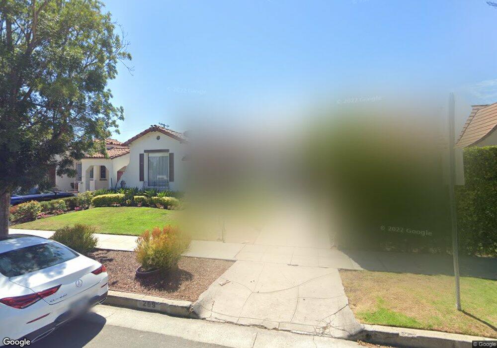
209 S Clark Dr Beverly Hills, CA 90211
Estimated Value: $2,141,205 - $2,704,000
3
Beds
2
Baths
1,768
Sq Ft
$1,408/Sq Ft
Est. Value
About This Home
This home is located at 209 S Clark Dr, Beverly Hills, CA 90211 and is currently estimated at $2,489,301, approximately $1,407 per square foot. 209 S Clark Dr is a home located in Los Angeles County with nearby schools including Horace Mann Elementary School, Beverly Hills High School, and Harkham Hillel Hebrew Academy.
Ownership History
Date
Name
Owned For
Owner Type
Purchase Details
Closed on
Dec 28, 2024
Sold by
209 S Clark Drive Llc
Bought by
Hazon Family Living Trust
Current Estimated Value
Purchase Details
Closed on
Feb 15, 2023
Sold by
Howard Shilo and Howard Juliette
Bought by
209 S Clark Dr Llc
Purchase Details
Closed on
Jul 31, 2002
Sold by
Howard Shilo and Howard Juliette
Bought by
Howard Shilo
Create a Home Valuation Report for This Property
The Home Valuation Report is an in-depth analysis detailing your home's value as well as a comparison with similar homes in the area
Home Values in the Area
Average Home Value in this Area
Purchase History
| Date | Buyer | Sale Price | Title Company |
|---|---|---|---|
| Hazon Family Living Trust | -- | None Listed On Document | |
| Hazon Family Living Trust | -- | None Listed On Document | |
| 209 S Clark Dr Llc | -- | -- | |
| Howard Shilo | -- | -- | |
| Howard Shilo | -- | -- |
Source: Public Records
Tax History Compared to Growth
Tax History
| Year | Tax Paid | Tax Assessment Tax Assessment Total Assessment is a certain percentage of the fair market value that is determined by local assessors to be the total taxable value of land and additions on the property. | Land | Improvement |
|---|---|---|---|---|
| 2025 | $5,861 | $2,468,400 | $1,978,800 | $489,600 |
| 2024 | $5,861 | $466,955 | $350,283 | $116,672 |
| 2023 | $5,762 | $457,800 | $343,415 | $114,385 |
| 2022 | $5,603 | $448,825 | $336,682 | $112,143 |
| 2021 | $5,433 | $440,026 | $330,081 | $109,945 |
| 2019 | $5,280 | $426,977 | $320,292 | $106,685 |
| 2018 | $4,993 | $418,606 | $314,012 | $104,594 |
| 2016 | $4,778 | $402,353 | $301,819 | $100,534 |
| 2015 | $4,578 | $396,310 | $297,286 | $99,024 |
| 2014 | $4,439 | $388,548 | $291,463 | $97,085 |
Source: Public Records
Map
Nearby Homes
- 209 S Swall Dr
- 240 S Swall Dr
- 143 N Arnaz Dr Unit 204
- 143 N Arnaz Dr Unit 304
- 138 N Swall Dr
- 121 N Almont Dr Unit 303
- 121 N Almont Dr Unit 103
- 869 S Wooster St Unit 103
- 152 S Oakhurst Dr Unit 304
- 272 S Doheny Dr Unit 1
- 200 N Swall Dr Unit PH53
- 130 S Carson Rd
- 858 S Shenandoah St
- 828 S Bedford St Unit 202
- 489 S Willaman Dr
- 300 N Swall Dr Unit 307
- 300 N Swall Dr Unit 106
- 300 N Swall Dr Unit 305
- 300 N Swall Dr Unit 452
- 300 N Swall Dr Unit 308
- 205 S Clark Dr
- 215 S Clark Dr
- 201 S Clark Dr
- 208 S Swall Dr
- 212 S Swall Dr
- 204 S Swall Dr
- 221 S Clark Dr
- 216 S Swall Dr
- 200 S Swall Dr Unit PH 1
- 200 S Swall Dr Unit PH
- 200 S Swall Dr Unit 558
- 200 S Swall Dr Unit 351
- 200 S Swall Dr Unit 304
- 200 S Swall Dr Unit PH58
- 200 S Swall Dr Unit PH1
- 200 S Swall Dr Unit PH9
- 200 S Swall Dr Unit P-54
- 200 S Swall Dr Unit 502
- 200 S Swall Dr Unit 511
- 200 S Swall Dr Unit 507