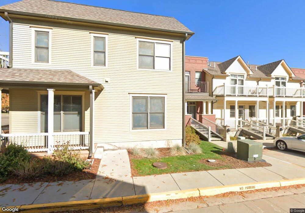
2090 23rd St Unit 1 Boulder, CO 80302
Whittier NeighborhoodEstimated Value: $852,000 - $982,000
2
Beds
2
Baths
1,226
Sq Ft
$742/Sq Ft
Est. Value
About This Home
This home is located at 2090 23rd St Unit 1, Boulder, CO 80302 and is currently estimated at $910,276, approximately $742 per square foot. 2090 23rd St Unit 1 is a home located in Boulder County with nearby schools including Whittier Elementary School, Casey Middle School, and Boulder High School.
Ownership History
Date
Name
Owned For
Owner Type
Purchase Details
Closed on
Oct 21, 2003
Sold by
Residential Llc
Bought by
If Then Llc
Current Estimated Value
Purchase Details
Closed on
Dec 5, 2002
Sold by
If Residential Llc
Bought by
Power Stephen B
Home Financials for this Owner
Home Financials are based on the most recent Mortgage that was taken out on this home.
Original Mortgage
$31,200
Interest Rate
6.28%
Mortgage Type
Unknown
Create a Home Valuation Report for This Property
The Home Valuation Report is an in-depth analysis detailing your home's value as well as a comparison with similar homes in the area
Home Values in the Area
Average Home Value in this Area
Purchase History
| Date | Buyer | Sale Price | Title Company |
|---|---|---|---|
| If Then Llc | -- | -- | |
| Power Stephen B | $387,365 | -- | |
| If Residential Llc | -- | -- |
Source: Public Records
Mortgage History
| Date | Status | Borrower | Loan Amount |
|---|---|---|---|
| Previous Owner | If Residential Llc | $31,200 | |
| Previous Owner | Power Stephen B | $300,700 |
Source: Public Records
Tax History
| Year | Tax Paid | Tax Assessment Tax Assessment Total Assessment is a certain percentage of the fair market value that is determined by local assessors to be the total taxable value of land and additions on the property. | Land | Improvement |
|---|---|---|---|---|
| 2025 | $5,929 | $61,806 | -- | $61,806 |
| 2024 | $5,929 | $61,806 | -- | $61,806 |
| 2023 | $5,827 | $67,469 | -- | $71,154 |
| 2022 | $5,774 | $62,182 | $0 | $62,182 |
| 2021 | $5,506 | $63,971 | $0 | $63,971 |
| 2020 | $4,866 | $55,906 | $0 | $55,906 |
| 2019 | $4,792 | $55,906 | $0 | $55,906 |
| 2018 | $4,413 | $50,897 | $0 | $50,897 |
| 2017 | $4,275 | $56,269 | $0 | $56,269 |
| 2016 | $3,966 | $45,818 | $0 | $45,818 |
| 2015 | $3,756 | $36,298 | $0 | $36,298 |
| 2014 | $3,052 | $36,298 | $0 | $36,298 |
Source: Public Records
Map
Nearby Homes
- 2201 Pearl St Unit 224
- 2201 Pearl St Unit 118
- 2336 Spruce St Unit 5
- 1916 23rd St Unit 6
- 2240 Bluff St
- 2317 Walnut St
- 2230 20th St
- 1894 Folsom St
- 1938 Spruce St
- 2475 Walnut St
- 2340 Panorama Ave
- 2515 Bluff St
- 2155 Walnut St
- 1850 Folsom St Unit 411
- 1850 Folsom St Unit 212
- 1850 Folsom St Unit 503
- 1850 Folsom St Unit 402
- 2324 19th St
- 2227 Canyon Blvd Unit 253B
- 2227 Canyon Blvd Unit 306A
- 2098 23rd St Unit 2
- 2308 Spruce St Unit 6
- 2304 Spruce St Unit 4
- 2306 Spruce St Unit 5
- 2070 23rd St Unit 1
- 2050 23rd St Unit 3
- 2076 23rd St Unit 4
- 2084 23rd St Unit 6
- 2330 Spruce St Unit 4
- 2320 Spruce St Unit 3
- 2312 Spruce St Unit 2
- 2310 Spruce St Unit 1
- 2080 23rd St Unit 5
- 2060 23rd St Unit 2
- 2336 Spruce St Unit 6
- 2336 Spruce St Unit 4
- 2336 Spruce St Unit 3
- 2336 Spruce St Unit 2
- 2336 Spruce St Unit 1
- 2336 Spruce St Unit B
Your Personal Tour Guide
Ask me questions while you tour the home.