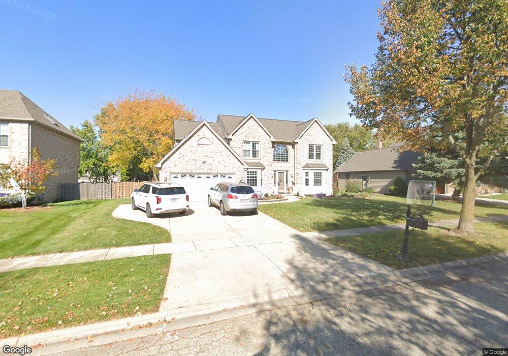
2090 Carlisle St Algonquin, IL 60102
Estimated Value: $522,084 - $569,000
4
Beds
3
Baths
2,946
Sq Ft
$183/Sq Ft
Est. Value
About This Home
This home is located at 2090 Carlisle St, Algonquin, IL 60102 and is currently estimated at $540,021, approximately $183 per square foot. 2090 Carlisle St is a home located in McHenry County with nearby schools including Westfield Community School, Kenneth E Neubert Elementary School, and Harry D Jacobs High School.
Ownership History
Date
Name
Owned For
Owner Type
Purchase Details
Closed on
Jun 8, 2010
Sold by
Gariti Vincenzo and Gariti Vincenza
Bought by
Zalud Anthony N and Janke Kelli J
Current Estimated Value
Home Financials for this Owner
Home Financials are based on the most recent Mortgage that was taken out on this home.
Original Mortgage
$240,000
Outstanding Balance
$162,106
Interest Rate
5.13%
Mortgage Type
New Conventional
Estimated Equity
$377,915
Purchase Details
Closed on
Jan 3, 1995
Sold by
G Meese & Associates Ltd
Bought by
Meyers Jeffrey R and Meyers Geralyn M
Home Financials for this Owner
Home Financials are based on the most recent Mortgage that was taken out on this home.
Original Mortgage
$200,000
Interest Rate
9.27%
Purchase Details
Closed on
Mar 24, 1994
Sold by
Steel City National Bank Of Chicago
Bought by
G Meese & Associates Ltd
Create a Home Valuation Report for This Property
The Home Valuation Report is an in-depth analysis detailing your home's value as well as a comparison with similar homes in the area
Purchase History
| Date | Buyer | Sale Price | Title Company |
|---|---|---|---|
| Zalud Anthony N | $300,000 | Heritage Title Company | |
| Meyers Jeffrey R | $233,500 | Chicago Title | |
| G Meese & Associates Ltd | $53,000 | -- |
Source: Public Records
Mortgage History
| Date | Status | Borrower | Loan Amount |
|---|---|---|---|
| Open | Zalud Anthony N | $240,000 | |
| Previous Owner | Meyers Jeffrey R | $200,000 |
Source: Public Records
Tax History
| Year | Tax Paid | Tax Assessment Tax Assessment Total Assessment is a certain percentage of the fair market value that is determined by local assessors to be the total taxable value of land and additions on the property. | Land | Improvement |
|---|---|---|---|---|
| 2024 | $11,773 | $158,504 | $29,151 | $129,353 |
| 2023 | $11,197 | $141,762 | $26,072 | $115,690 |
| 2022 | $10,736 | $131,185 | $35,101 | $96,084 |
| 2021 | $10,312 | $122,215 | $32,701 | $89,514 |
| 2020 | $10,047 | $117,888 | $31,543 | $86,345 |
| 2019 | $9,810 | $112,833 | $30,190 | $82,643 |
| 2018 | $9,363 | $104,234 | $27,889 | $76,345 |
| 2017 | $9,181 | $98,195 | $26,273 | $71,922 |
| 2016 | $9,054 | $92,098 | $24,642 | $67,456 |
| 2013 | -- | $88,338 | $22,988 | $65,350 |
Source: Public Records
Map
Nearby Homes
- 2051 Carlisle St
- 20 Peach Tree Ct Unit 4153
- 18 Peach Tree Ct Unit 4154
- 2069 Peach Tree Ln Unit 4116
- 1157 Sawmill Ln
- 1900 Waverly Ln
- 760 Regal Ln
- 2380 Dawson Ln Unit 165
- 1002 Interloch Ct Unit 152
- 1820 Crofton Dr
- 681 Majestic Dr
- 2612 Loren Ln Unit 293
- 1181 Glenmont St
- 1030 Glenmont St
- 700 Fairfield Ln
- 1221 Glenmont St
- 895 Eineke Blvd
- 2602 Amber Ln Unit 49
- 1920 Jester Ln
- 1231 Glenmont St
- 2090 Carlisle St
- 2070 Carlisle St
- 2070 Carlisle St
- 2110 Carlisle St
- 2051 Tunbridge Trail
- 2041 Tunbridge Trail
- 2041 Tunbridge Trail
- 2050 Carlisle St
- 2061 Tunbridge Trail
- 2111 Carlisle St
- 1370 Carlisle St
- 2091 Carlisle St
- 2031 Tunbridge Trail
- 2071 Tunbridge Trail
- 1425 Carlisle St
- 2030 Carlisle St
- 2071 Carlisle St
- 2021 Tunbridge Trail
- 2090 Burnham Ct
- 1380 Carlisle St
Your Personal Tour Guide
Ask me questions while you tour the home.