2090 County Road 4055 Whitewright, TX 75491
Estimated payment $44,635/month
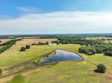
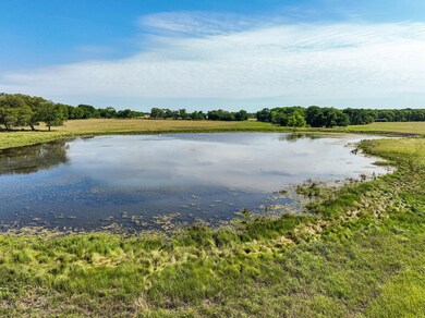
Highlights
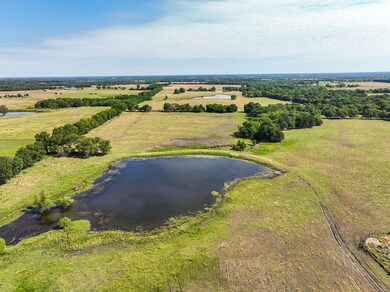
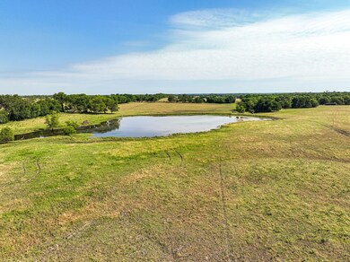
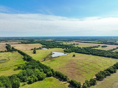
- Pond
- 5 Stock Tanks or Ponds
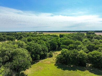
- Pasture
- Whitewright Middle School Rated A-
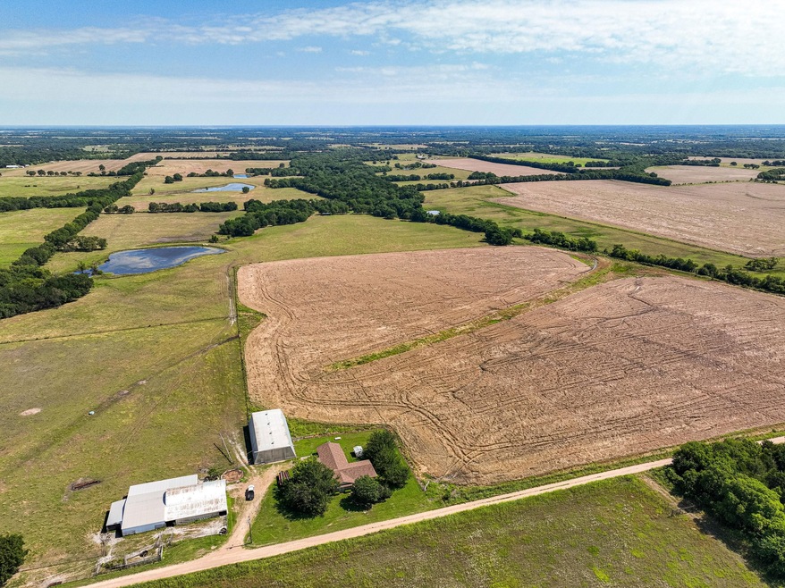
About This Lot
497 acres with a great mix of pasture land, wooded areas and productive farmland is located southwest of Bonham in fast growing Fannin County. This property has approximately 8700 feet of road frontage on three sides and virtually no floodplain, making it a great choice for development or future development. Located only 5.5 miles off State HWY 121 and and 3.75 miles to US HWY 82 provides for a quick commutes to the McKinney-Frisco area as well as the Sherman-Denison area. The subject property lies about 8 miles west-southwest of already growing Bonham which is poised for continued rapid growth as State HWY 121 expands to a divided 4 lane highway in the near future.

Property Details
Property Type
- Land
Est. Annual Taxes
- $3,337
Lot Details
- Dirt Road
- Barbed Wire
- Few Trees
- Current uses include agriculture, grazing, hunting/fishing, agribusiness
- Soil Types include Black
Farming
- 5 Stock Tanks or Ponds
- Pasture
Utilities
- Co-Op Water
- Aerobic Septic System
Additional Features
- Pond
- Easements include natural gas
Map
Home Values in the Area
Average Home Value in this Area
Tax History
| Year | Tax Paid | Tax Assessment Tax Assessment Total Assessment is a certain percentage of the fair market value that is determined by local assessors to be the total taxable value of land and additions on the property. | Land | Improvement |
|---|---|---|---|---|
| 2024 | $3,337 | $474,580 | $273,920 | $200,660 |
| 2023 | $3,260 | $235,009 | $0 | $0 |
| 2022 | $3,678 | $227,722 | $0 | $0 |
| 2021 | $3,235 | $0 | $0 | $0 |
| 2020 | $999 | $0 | $0 | $0 |
| 2019 | $3,313 | $0 | $0 | $0 |
| 2018 | $3,316 | $0 | $0 | $0 |
| 2017 | $3,355 | $0 | $0 | $0 |
| 2016 | $1,083 | $0 | $0 | $0 |
| 2015 | -- | $0 | $0 | $0 |
| 2014 | -- | $0 | $0 | $0 |
Property History
| Date | Event | Price | Change | Sq Ft Price |
|---|---|---|---|---|
| 06/11/2025 06/11/25 | Price Changed | $8,008,418 | -2.5% | -- |
| 11/22/2024 11/22/24 | For Sale | $8,212,446 | -- | -- |
- 5523 Fm 1752 S
- TBD Fm 1752 Rd
- 9324 S Fm 898
- 10948 Fm 898
- 0000 Cr 4030
- 10948 Farm To Market Road 898
- 002 County Road 4040
- 001 County Road 4040
- 5185 E Line Rd
- 984 County Road 4027
- 6078 E Line Rd
- Hwy 56 W Sam Rayburn
- TBD Fm 2645
- TBD Hwy 82
- 233 Marshall Cir
- TBD County Road 4075
- 2564 Eastline Rd
- TBD County Rd 4506
- 112 Oak Hill Rd
- 508 E Maple St
- 112 E Oak St
- 10382 W Us Highway 82 Unit AT
- 12638 U S 82
- 388 County Rd 4421
- 300 Carrie Mabrie St
- 340 Sunnyside Dr Unit B
- 365 Sunnyside Dr Unit A
- 504 Bonham St
- 12432 Eastline Rd
- 601 Thomas St Unit 1
- 707 S 6th St
- 905 W 7th St
- 713 W Sam Rayburn Dr Unit West
- 206 Henderson St
- 304 S 3rd St
- 406 W 6th St Unit 2
- 708 Union Ave
- 105 SE 4th St Unit 1
- 1634-1662 Kennedy St
- 412 E 7th St Unit 1