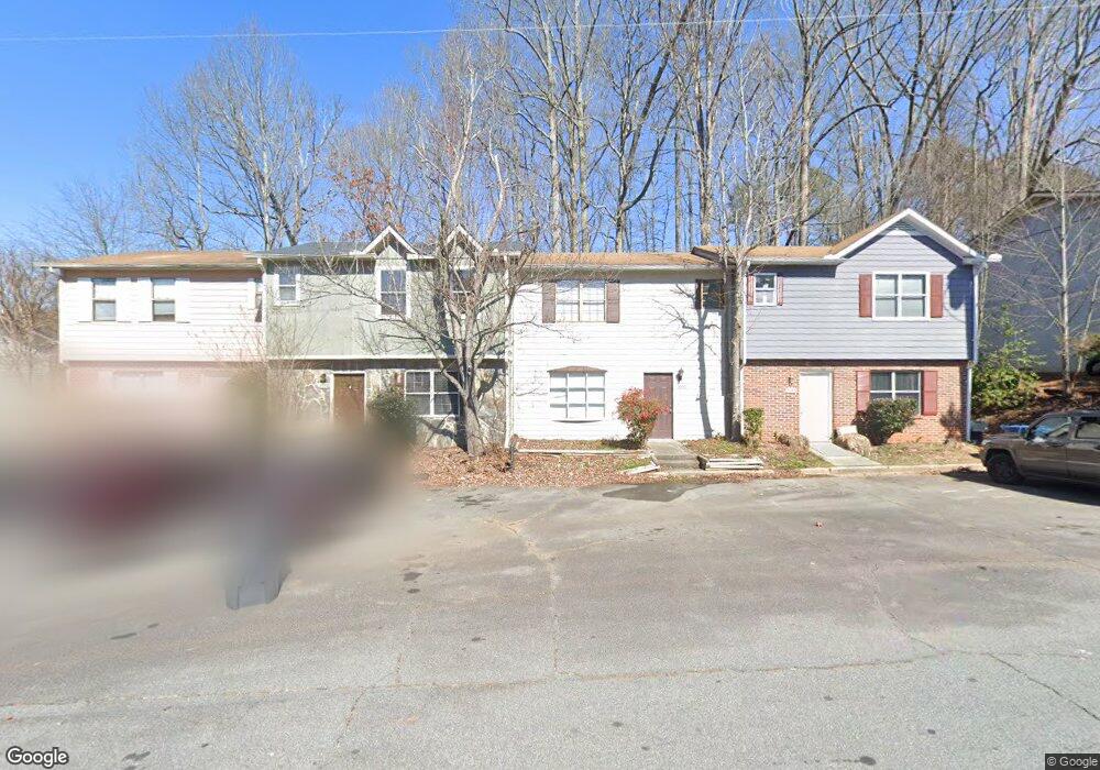
2090 Lenoa Ln Austell, GA 30106
Estimated Value: $167,000 - $211,000
2
Beds
3
Baths
1,056
Sq Ft
$180/Sq Ft
Est. Value
About This Home
This home is located at 2090 Lenoa Ln, Austell, GA 30106 and is currently estimated at $189,552, approximately $179 per square foot. 2090 Lenoa Ln is a home located in Cobb County with nearby schools including Deerwood Elementary School, Clarkdale Elementary School, and Garrett Middle School.
Ownership History
Date
Name
Owned For
Owner Type
Purchase Details
Closed on
Feb 27, 2024
Sold by
Sionit Malihe
Bought by
Shookhtimisionit Family Revocable Trust and Sionit
Current Estimated Value
Purchase Details
Closed on
Dec 12, 2012
Sold by
Spicewood Rentals Llc
Bought by
Sionit Malihe
Purchase Details
Closed on
Jan 28, 2011
Sold by
Lch Atlanta Llc
Bought by
Spicewood Rentals Llc
Purchase Details
Closed on
Sep 7, 2010
Sold by
Safier Harold and Safier Faith
Bought by
Lch Atlanta Llc
Create a Home Valuation Report for This Property
The Home Valuation Report is an in-depth analysis detailing your home's value as well as a comparison with similar homes in the area
Home Values in the Area
Average Home Value in this Area
Purchase History
| Date | Buyer | Sale Price | Title Company |
|---|---|---|---|
| Shookhtimisionit Family Revocable Trust | -- | None Listed On Document | |
| Sionit Malihe | $38,500 | -- | |
| Spicewood Rentals Llc | $28,000 | -- | |
| Lch Atlanta Llc | $10,205 | -- |
Source: Public Records
Tax History Compared to Growth
Tax History
| Year | Tax Paid | Tax Assessment Tax Assessment Total Assessment is a certain percentage of the fair market value that is determined by local assessors to be the total taxable value of land and additions on the property. | Land | Improvement |
|---|---|---|---|---|
| 2025 | $1,645 | $54,584 | $16,000 | $38,584 |
| 2024 | $1,646 | $54,584 | $16,000 | $38,584 |
| 2023 | $1,474 | $48,892 | $10,000 | $38,892 |
| 2022 | $632 | $20,820 | $4,000 | $16,820 |
| 2021 | $632 | $20,820 | $4,000 | $16,820 |
| 2020 | $593 | $19,524 | $4,000 | $15,524 |
| 2019 | $593 | $19,524 | $4,000 | $15,524 |
| 2018 | $593 | $19,524 | $4,000 | $15,524 |
| 2017 | $436 | $15,180 | $4,000 | $11,180 |
| 2016 | $436 | $15,180 | $4,000 | $11,180 |
| 2015 | $447 | $15,180 | $4,000 | $11,180 |
| 2014 | $451 | $15,180 | $0 | $0 |
Source: Public Records
Map
Nearby Homes
- 2092 Lenoa Ln
- 2088 Lenoa Ln
- 2094 Lenoa Ln
- 2086 Lenoa Ln
- 2084 Lenoa Ln
- 2096 Lenoa Ln
- 2082 Lenoa Ln
- 2082 Lenoa Ln Unit 2082
- 2098 Lenoa Ln
- 2080 Lenoa Ln
- 2080 Lenoa Ln Unit 2080
- 2100 Lenoa Ln
- 2091 Lenoa Ln
- 2093 Lenoa Ln
- 2089 Lenoa Ln
- 2087 Lenoa Ln
- 2095 Lenoa Ln
- 2102 Lenoa Ln Unit 2102
- 2097 Lenoa Ln
- 2078 Lenoa Ln