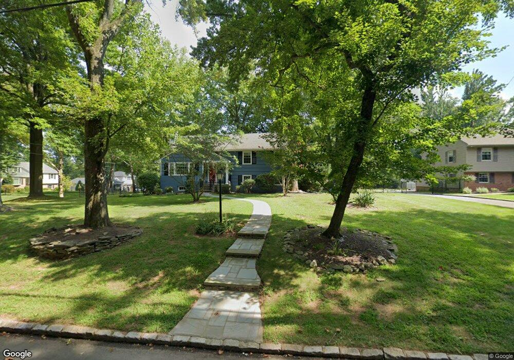
2092 Brookside Dr Scotch Plains, NJ 07076
Estimated Value: $706,931 - $1,101,000
--
Bed
--
Bath
1,677
Sq Ft
$554/Sq Ft
Est. Value
About This Home
This home is located at 2092 Brookside Dr, Scotch Plains, NJ 07076 and is currently estimated at $928,983, approximately $553 per square foot. 2092 Brookside Dr is a home located in Union County with nearby schools including William J. McGinn Elementary School, Terrill Middle School, and Scotch Plains-Fanwood High School.
Ownership History
Date
Name
Owned For
Owner Type
Purchase Details
Closed on
Jul 8, 2011
Sold by
Argast Irene M
Bought by
Fonder Daniel J and Pastir Susan L
Current Estimated Value
Home Financials for this Owner
Home Financials are based on the most recent Mortgage that was taken out on this home.
Original Mortgage
$358,000
Outstanding Balance
$247,106
Interest Rate
4.58%
Mortgage Type
New Conventional
Estimated Equity
$681,877
Create a Home Valuation Report for This Property
The Home Valuation Report is an in-depth analysis detailing your home's value as well as a comparison with similar homes in the area
Home Values in the Area
Average Home Value in this Area
Purchase History
| Date | Buyer | Sale Price | Title Company |
|---|---|---|---|
| Fonder Daniel J | $447,500 | Multiple |
Source: Public Records
Mortgage History
| Date | Status | Borrower | Loan Amount |
|---|---|---|---|
| Open | Fonder Daniel J | $358,000 |
Source: Public Records
Tax History Compared to Growth
Tax History
| Year | Tax Paid | Tax Assessment Tax Assessment Total Assessment is a certain percentage of the fair market value that is determined by local assessors to be the total taxable value of land and additions on the property. | Land | Improvement |
|---|---|---|---|---|
| 2025 | $13,451 | $114,300 | $52,600 | $61,700 |
| 2024 | $13,054 | $114,300 | $52,600 | $61,700 |
| 2023 | $13,054 | $114,300 | $52,600 | $61,700 |
| 2022 | $12,899 | $114,300 | $52,600 | $61,700 |
| 2021 | $12,877 | $114,300 | $52,600 | $61,700 |
| 2020 | $12,815 | $114,300 | $52,600 | $61,700 |
| 2019 | $12,720 | $114,300 | $52,600 | $61,700 |
| 2018 | $12,507 | $114,300 | $52,600 | $61,700 |
| 2017 | $12,229 | $114,300 | $52,600 | $61,700 |
| 2016 | $11,994 | $114,300 | $52,600 | $61,700 |
| 2015 | $11,797 | $114,300 | $52,600 | $61,700 |
| 2014 | $11,408 | $114,300 | $52,600 | $61,700 |
Source: Public Records
Map
Nearby Homes
- 2154 W Broad St
- 1466 Lamberts Mill Rd
- 119 Lamberts Mill Rd
- 2 Brookside Ct
- 314 Highgate Ave
- 1933 W Broad St
- 1933 Mary Ellen Ln
- 2116 Newark Ave
- 525 Edgar Rd
- 524 Edgar Rd
- 2 Dutch Ln
- 614 Dorian Rd
- 57 Rambling Dr
- 2212 Shady Ln
- 724 South Ave W Unit 724A
- 676 Vermont St
- 350 W Dudley Ave
- 187 King St
- 2314 Longfellow Ave
- 538 Westfield Ave