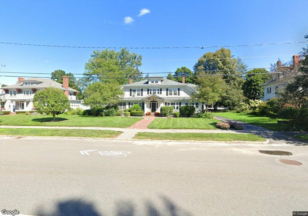
2093 Elm St Manchester, NH 03104
Estimated Value: $917,000 - $989,000
4
Beds
4
Baths
3,976
Sq Ft
$243/Sq Ft
Est. Value
About This Home
This home is located at 2093 Elm St, Manchester, NH 03104 and is currently estimated at $964,957, approximately $242 per square foot. 2093 Elm St is a home located in Hillsborough County with nearby schools including Webster School, Hillside Middle School, and Manchester Central High School.
Ownership History
Date
Name
Owned For
Owner Type
Purchase Details
Closed on
Apr 30, 2010
Sold by
Anne C Zachos T
Bought by
Munoz John J and Munoz Andrea N
Current Estimated Value
Home Financials for this Owner
Home Financials are based on the most recent Mortgage that was taken out on this home.
Original Mortgage
$416,000
Interest Rate
4.99%
Mortgage Type
Purchase Money Mortgage
Create a Home Valuation Report for This Property
The Home Valuation Report is an in-depth analysis detailing your home's value as well as a comparison with similar homes in the area
Home Values in the Area
Average Home Value in this Area
Purchase History
| Date | Buyer | Sale Price | Title Company |
|---|---|---|---|
| Munoz John J | $520,000 | -- |
Source: Public Records
Mortgage History
| Date | Status | Borrower | Loan Amount |
|---|---|---|---|
| Open | Munoz John J | $61,975 | |
| Open | Munoz John J | $410,000 | |
| Closed | Munoz John J | $61,975 | |
| Closed | Munoz John J | $416,000 |
Source: Public Records
Tax History Compared to Growth
Tax History
| Year | Tax Paid | Tax Assessment Tax Assessment Total Assessment is a certain percentage of the fair market value that is determined by local assessors to be the total taxable value of land and additions on the property. | Land | Improvement |
|---|---|---|---|---|
| 2024 | $15,368 | $784,900 | $140,600 | $644,300 |
| 2023 | $14,803 | $784,900 | $140,600 | $644,300 |
| 2022 | $14,317 | $784,900 | $140,600 | $644,300 |
| 2021 | $13,877 | $784,900 | $140,600 | $644,300 |
| 2020 | $13,856 | $561,900 | $100,600 | $461,300 |
| 2019 | $13,665 | $561,900 | $100,600 | $461,300 |
| 2018 | $6,321 | $561,900 | $100,600 | $461,300 |
| 2017 | $13,104 | $561,900 | $100,600 | $461,300 |
| 2016 | $839 | $561,900 | $100,600 | $461,300 |
| 2015 | $12,175 | $519,400 | $86,300 | $433,100 |
| 2014 | $12,206 | $519,400 | $86,300 | $433,100 |
| 2013 | $11,775 | $519,400 | $86,300 | $433,100 |
Source: Public Records
Map
Nearby Homes
- 861 Chestnut St
- 490 River Rd Unit 13
- 490 River Rd Unit 30
- 490 River Rd Unit 3
- 300 River Rd Unit 508/608
- 300 River Rd Unit 312
- 300 River Rd Unit 102
- 11 N Adams St
- 35 Andrew St Unit 25
- 26 W Webster St
- 6 Ray St
- 22 Andrew St Unit 2
- 113 Bay St
- 65 Victoria St Unit 42
- 55 Trenton St
- 96 River Rd Unit 203
- 96 River Rd Unit 305
- 96 River Rd Unit 205
- 55 River Rd Unit 9F
- 55 River Rd Unit 7G