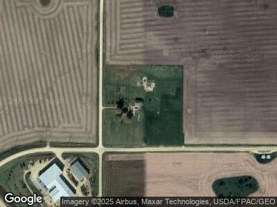
2095 270th Ave de Witt, IA 52742
Estimated Value: $285,000 - $379,000
5
Beds
3
Baths
1,716
Sq Ft
$193/Sq Ft
Est. Value
About This Home
This home is located at 2095 270th Ave, de Witt, IA 52742 and is currently estimated at $331,702, approximately $193 per square foot. 2095 270th Ave is a home located in Clinton County with nearby schools including Ekstrand Elementary School, Central Dewitt Intermediate School, and Central Dewitt Middle School.
Ownership History
Date
Name
Owned For
Owner Type
Purchase Details
Closed on
Dec 22, 2015
Sold by
Weber Ronald
Bought by
Pinter Stephan R and Pinter Joyce A
Current Estimated Value
Purchase Details
Closed on
May 27, 2011
Sold by
Co Community Care Inc
Bought by
Pinter Stephan R and Pinter Joyce A
Home Financials for this Owner
Home Financials are based on the most recent Mortgage that was taken out on this home.
Original Mortgage
$120,000
Interest Rate
4.81%
Mortgage Type
New Conventional
Create a Home Valuation Report for This Property
The Home Valuation Report is an in-depth analysis detailing your home's value as well as a comparison with similar homes in the area
Home Values in the Area
Average Home Value in this Area
Purchase History
| Date | Buyer | Sale Price | Title Company |
|---|---|---|---|
| Pinter Stephan R | $23,500 | None Available | |
| Pinter Stephan R | $160,000 | None Available |
Source: Public Records
Mortgage History
| Date | Status | Borrower | Loan Amount |
|---|---|---|---|
| Previous Owner | Pinter Stephan R | $120,000 |
Source: Public Records
Tax History Compared to Growth
Tax History
| Year | Tax Paid | Tax Assessment Tax Assessment Total Assessment is a certain percentage of the fair market value that is determined by local assessors to be the total taxable value of land and additions on the property. | Land | Improvement |
|---|---|---|---|---|
| 2024 | $3,418 | $308,460 | $125,040 | $183,420 |
| 2023 | $3,418 | $308,460 | $125,040 | $183,420 |
| 2022 | $2,208 | $293,520 | $125,040 | $168,480 |
| 2021 | $2,246 | $166,270 | $45,910 | $120,360 |
| 2020 | $2,246 | $160,540 | $45,910 | $114,630 |
| 2019 | $2,262 | $160,540 | $0 | $0 |
| 2018 | $2,222 | $160,540 | $0 | $0 |
| 2017 | $2,222 | $160,540 | $0 | $0 |
| 2016 | $2,486 | $177,900 | $0 | $0 |
| 2015 | $2,486 | $159,260 | $0 | $0 |
| 2014 | $2,246 | $159,260 | $0 | $0 |
| 2013 | $2,214 | $0 | $0 | $0 |
Source: Public Records
Map
Nearby Homes
- 0 260th Unit 6323061
- 2260 260th Ave
- lot 2 225th St
- lot 1 225th St
- 207 Welton Ave
- 1506 17th St
- 2516 Westwood St
- 1637 Hickory Bend Ct
- 2124 Meadowview Ct
- 923 Brookview Dr
- 610 12th St
- 1114 5th Ave
- 285th Ave Old Hwy 61 Unit Parcel 1808582000
- 285th Ave Old Hwy 61 Unit Parcels 1808590000/
- 285th Ave Old Hwy 61 Unit Parcel1808582000/18
- 302 Silver Creek Rd
- 706 8th St
- 1308 6th St
- 705 8th St
- 819 7th St
- 2095 270th Ave
- 2058 270th Ave
- 2123 267th Ave
- 2766 210th St
- 0000 267th Ave
- 2717 218th St
- 2155 267th Ave
- 2149 275th Ave
- 2015 270th Ave
- 2009 Highway 61
- 2007 Highway 61
- 2057 Highway 61
- 2027 Highway 61
- 2027 Hwy 61
- 2026 Highway 61
- 2161 267th Ave
- 0 212th Unit 4101758
- 2169 267th Ave
- 2727 218th St
- 2738 218th St