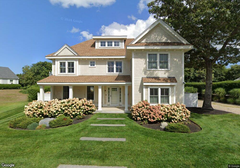
21 Arnolds Cartway Brewster, MA 02631
Estimated Value: $1,466,000 - $2,580,000
3
Beds
1
Bath
800
Sq Ft
$2,629/Sq Ft
Est. Value
About This Home
This home is located at 21 Arnolds Cartway, Brewster, MA 02631 and is currently estimated at $2,103,233, approximately $2,629 per square foot. 21 Arnolds Cartway is a home located in Barnstable County with nearby schools including Stony Brook Elementary School, Eddy Elementary School, and Nauset Regional Middle School.
Ownership History
Date
Name
Owned For
Owner Type
Purchase Details
Closed on
Nov 30, 2018
Sold by
Bushnell Janice
Bought by
Janice Bushnell Ret
Current Estimated Value
Purchase Details
Closed on
Mar 9, 2004
Sold by
Arnolds Cartway Llc
Bought by
Bushnell Janice and Bushnell Robert D
Home Financials for this Owner
Home Financials are based on the most recent Mortgage that was taken out on this home.
Original Mortgage
$392,000
Interest Rate
5.62%
Mortgage Type
Purchase Money Mortgage
Purchase Details
Closed on
Feb 29, 1996
Sold by
Sage Rt
Bought by
Watson Kenneth L and Watson Rebecca
Home Financials for this Owner
Home Financials are based on the most recent Mortgage that was taken out on this home.
Original Mortgage
$86,000
Interest Rate
7.02%
Mortgage Type
Purchase Money Mortgage
Create a Home Valuation Report for This Property
The Home Valuation Report is an in-depth analysis detailing your home's value as well as a comparison with similar homes in the area
Home Values in the Area
Average Home Value in this Area
Purchase History
| Date | Buyer | Sale Price | Title Company |
|---|---|---|---|
| Janice Bushnell Ret | -- | -- | |
| Bushnell Janice | -- | -- | |
| Bushnell Janice | $490,000 | -- | |
| Watson Kenneth L | $129,000 | -- |
Source: Public Records
Mortgage History
| Date | Status | Borrower | Loan Amount |
|---|---|---|---|
| Previous Owner | Watson Kenneth L | $338,000 | |
| Previous Owner | Watson Kenneth L | $348,000 | |
| Previous Owner | Bushnell Janice | $392,000 | |
| Previous Owner | Watson Kenneth L | $86,000 |
Source: Public Records
Tax History Compared to Growth
Tax History
| Year | Tax Paid | Tax Assessment Tax Assessment Total Assessment is a certain percentage of the fair market value that is determined by local assessors to be the total taxable value of land and additions on the property. | Land | Improvement |
|---|---|---|---|---|
| 2025 | $12,995 | $1,888,800 | $814,300 | $1,074,500 |
| 2024 | $12,222 | $1,794,700 | $768,300 | $1,026,400 |
| 2023 | $11,770 | $1,683,800 | $754,400 | $929,400 |
| 2022 | $11,121 | $1,416,700 | $628,500 | $788,200 |
| 2021 | $10,670 | $1,243,600 | $546,400 | $697,200 |
| 2020 | $10,486 | $1,216,500 | $546,400 | $670,100 |
| 2019 | $10,114 | $1,178,800 | $525,500 | $653,300 |
| 2018 | $4,512 | $546,200 | $525,500 | $20,700 |
| 2017 | $4,965 | $591,800 | $525,500 | $66,300 |
| 2016 | $4,892 | $580,300 | $515,300 | $65,000 |
| 2015 | $4,703 | $569,400 | $505,100 | $64,300 |
Source: Public Records
Map
Nearby Homes
- 21 Arnold's Cartway
- 31 Arnolds Cartway
- 317 Robbins Hill Rd
- 9 Arnolds Cartway
- 26 Arnolds Cartway
- 43 Arnolds Cartway
- 341 Robbins Hill Rd
- 36 Arnolds Cartway
- 36 Arnold's Cartway
- 311 Robbins Hill Rd
- 319 Robbins Hill Rd
- 345 Robbins Hill Rd
- 58 Arnolds Cartway
- 297 Robbins Hill Rd
- 31 Warrens Rd
- 45 Warrens Rd
- 322 Robbins Hill Rd
- 354 Robbins Hill Rd
- 373 Robbins Hill Rd
- 375 Robbins Hill Rd