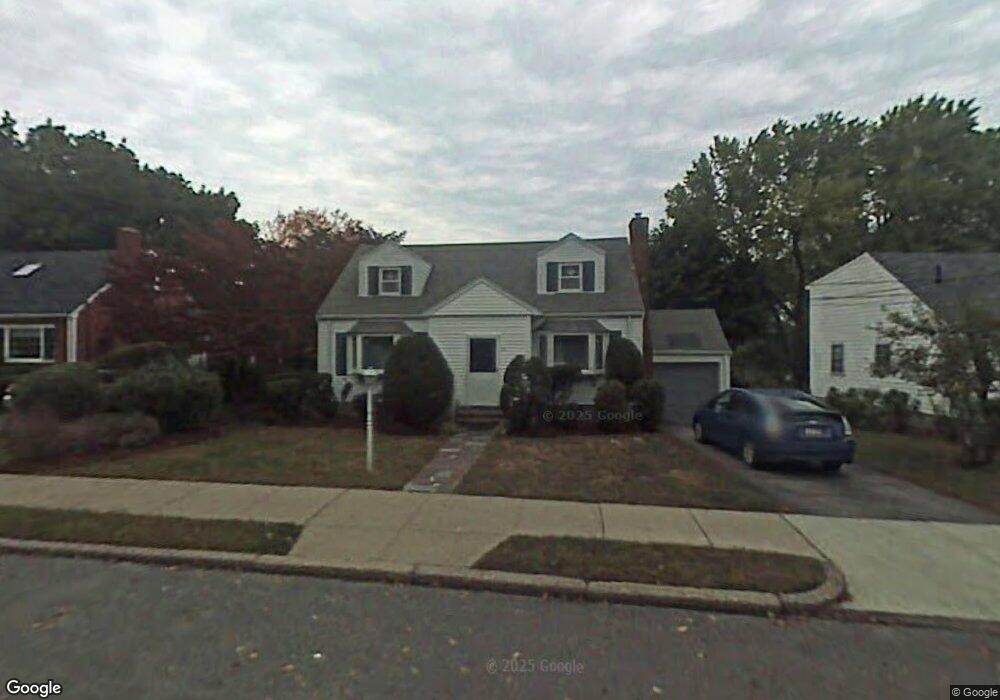
21 Barbara Rd West Newton, MA 02465
West Newton NeighborhoodEstimated Value: $920,000 - $1,316,914
4
Beds
2
Baths
1,514
Sq Ft
$735/Sq Ft
Est. Value
About This Home
This home is located at 21 Barbara Rd, West Newton, MA 02465 and is currently estimated at $1,112,229, approximately $734 per square foot. 21 Barbara Rd is a home located in Middlesex County with nearby schools including Franklin Elementary School, F.A. Day Middle School, and Newton North High School.
Ownership History
Date
Name
Owned For
Owner Type
Purchase Details
Closed on
Jul 27, 1998
Sold by
Butko Peter and Luo Yuan
Bought by
Chan Kin-Wei A
Current Estimated Value
Home Financials for this Owner
Home Financials are based on the most recent Mortgage that was taken out on this home.
Original Mortgage
$190,000
Interest Rate
6.99%
Mortgage Type
Purchase Money Mortgage
Purchase Details
Closed on
Jan 15, 1998
Sold by
Ambush Ft and Ambush Tanna L
Bought by
Butko Peter and Luo Yuan
Home Financials for this Owner
Home Financials are based on the most recent Mortgage that was taken out on this home.
Original Mortgage
$185,600
Interest Rate
7.08%
Mortgage Type
Purchase Money Mortgage
Create a Home Valuation Report for This Property
The Home Valuation Report is an in-depth analysis detailing your home's value as well as a comparison with similar homes in the area
Home Values in the Area
Average Home Value in this Area
Purchase History
| Date | Buyer | Sale Price | Title Company |
|---|---|---|---|
| Chan Kin-Wei A | $254,000 | -- | |
| Butko Peter | $218,400 | -- |
Source: Public Records
Mortgage History
| Date | Status | Borrower | Loan Amount |
|---|---|---|---|
| Open | Butko Peter | $230,000 | |
| Closed | Butko Peter | $190,000 | |
| Previous Owner | Butko Peter | $185,600 |
Source: Public Records
Tax History
| Year | Tax Paid | Tax Assessment Tax Assessment Total Assessment is a certain percentage of the fair market value that is determined by local assessors to be the total taxable value of land and additions on the property. | Land | Improvement |
|---|---|---|---|---|
| 2025 | $7,633 | $778,900 | $760,400 | $18,500 |
| 2024 | $7,381 | $756,200 | $738,300 | $17,900 |
| 2023 | $6,962 | $683,900 | $560,600 | $123,300 |
| 2022 | $6,661 | $633,200 | $519,100 | $114,100 |
| 2021 | $6,428 | $597,400 | $489,700 | $107,700 |
| 2020 | $6,237 | $597,400 | $489,700 | $107,700 |
| 2019 | $6,061 | $580,000 | $475,400 | $104,600 |
| 2018 | $5,814 | $537,300 | $432,100 | $105,200 |
| 2017 | $5,637 | $506,900 | $407,600 | $99,300 |
| 2016 | $5,492 | $482,600 | $380,900 | $101,700 |
| 2015 | $5,236 | $451,000 | $356,000 | $95,000 |
Source: Public Records
Map
Nearby Homes
- 279-281 Ash St
- 24 Tolman St Unit 1
- 24 Tolman St Unit 2
- 25 Tolman St Unit 2
- 105 Adams Ave
- 138 Myrtle St Unit 2
- 215 Ash St Unit 3
- 60 Lindbergh Ave
- 24 Mague Ave Unit 24
- 312 Newton St Unit 1A
- 308 Newton St Unit 1
- 26 Friend St
- 40 Dexter St
- 14 Cottage Place Unit 14
- 31-37 Washington Ave
- 214 River St Unit 214
- 8 Elm St Unit 8
- 106 River St Unit 18
- 6 Elm St Unit 6
- 16 Elm St Unit 16
- 17 Barbara Rd
- 27 Barbara Rd
- 16 Farmington Rd
- 22 Farmington Rd
- 11 Barbara Rd
- 33 Barbara Rd
- 26 Barbara Rd
- 20 Barbara Rd
- 10 Farmington Rd
- 32 Barbara Rd
- 113 Cherry St
- 16 Barbara Rd
- 28 Farmington Rd
- 28 Farmington Rd Unit 1
- 15 Barbara Rd
- 105 Cherry St
- 39 Barbara Rd
- 39 Barbara Rd
- 121 Cherry St
- 38 Barbara Rd
Your Personal Tour Guide
Ask me questions while you tour the home.