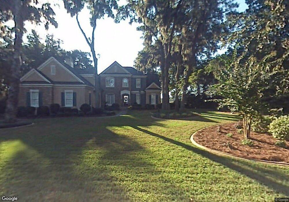
21 Bartow Point Dr Savannah, GA 31404
East Savannah NeighborhoodEstimated Value: $1,403,000 - $2,231,000
4
Beds
4
Baths
4,652
Sq Ft
$399/Sq Ft
Est. Value
About This Home
This home is located at 21 Bartow Point Dr, Savannah, GA 31404 and is currently estimated at $1,853,829, approximately $398 per square foot. 21 Bartow Point Dr is a home located in Chatham County with nearby schools including Marshpoint Elementary School, Coastal Middle School, and Islands High School.
Ownership History
Date
Name
Owned For
Owner Type
Purchase Details
Closed on
Dec 14, 2016
Sold by
Cooper and Pyles Joellen
Bought by
Page Patrick D and Page Fallon A
Current Estimated Value
Home Financials for this Owner
Home Financials are based on the most recent Mortgage that was taken out on this home.
Original Mortgage
$867,200
Outstanding Balance
$709,175
Interest Rate
3.94%
Mortgage Type
New Conventional
Estimated Equity
$1,144,654
Purchase Details
Closed on
Jan 7, 2013
Sold by
Cooper-Pyles Joellen
Bought by
Cooper-Pyles Joellen
Create a Home Valuation Report for This Property
The Home Valuation Report is an in-depth analysis detailing your home's value as well as a comparison with similar homes in the area
Home Values in the Area
Average Home Value in this Area
Purchase History
| Date | Buyer | Sale Price | Title Company |
|---|---|---|---|
| Page Patrick D | $1,084,000 | -- | |
| Cooper-Pyles Joellen | -- | -- |
Source: Public Records
Mortgage History
| Date | Status | Borrower | Loan Amount |
|---|---|---|---|
| Open | Page Patrick D | $867,200 |
Source: Public Records
Tax History Compared to Growth
Tax History
| Year | Tax Paid | Tax Assessment Tax Assessment Total Assessment is a certain percentage of the fair market value that is determined by local assessors to be the total taxable value of land and additions on the property. | Land | Improvement |
|---|---|---|---|---|
| 2025 | $39,589 | $734,000 | $280,000 | $454,000 |
| 2024 | $39,589 | $684,000 | $280,000 | $404,000 |
| 2023 | $28,095 | $711,560 | $280,000 | $431,560 |
| 2022 | $22,887 | $586,440 | $204,000 | $382,440 |
| 2021 | $22,887 | $433,600 | $204,000 | $229,600 |
| 2020 | $15,572 | $490,560 | $204,000 | $286,560 |
| 2019 | $25,245 | $527,840 | $204,000 | $323,840 |
| 2018 | $25,949 | $514,080 | $204,000 | $310,080 |
| 2017 | $15,265 | $433,600 | $171,272 | $262,328 |
Source: Public Records
Map
Nearby Homes
- 21 Pipers Pond Ln
- 39 Bartow Point Dr
- 16 Pipers Pond Ln
- 202 John Wesley Way
- 210 John Wesley Way
- 217 John Wesley Way
- 505 Sandhill Rd
- 325 Manor Dr
- 329 Manor Dr
- 0 Riverview Dr
- 207 Barley Dr
- 906 Tara St
- 911 Juanita St
- 2231 Causton Bluff Rd
- 000 Perry Cove
- 000000 Perry Cove
- 11 Shipwatch Rd
- 1024 Cheryl St
- 2230 Iowa St
- 2103 New Mexico St
- 23 Bartow Point Dr
- 24 Bartow Point Dr
- 25 Bartow Point Dr
- 26 Bartow Point Dr
- 19 Bartow Point Dr
- 22 Bartow Point Dr
- 28 Bartow Point Dr
- 27 Bartow Point Dr
- 20 Bartow Point Dr
- 17 Bartow Point Dr
- 310 Causton Harbour Dr
- 5 Saint Augustine Bend
- 30 Bartow Point Dr
- 312 Causton Harbour Dr
- 7 Saint Augustine Bend
- 9 Saint Augustine Bend
- 18 Bartow Point Dr
- 41 Saint Augustine Bend
- 29 Bartow Point Dr
- 15 Bartow Point Dr