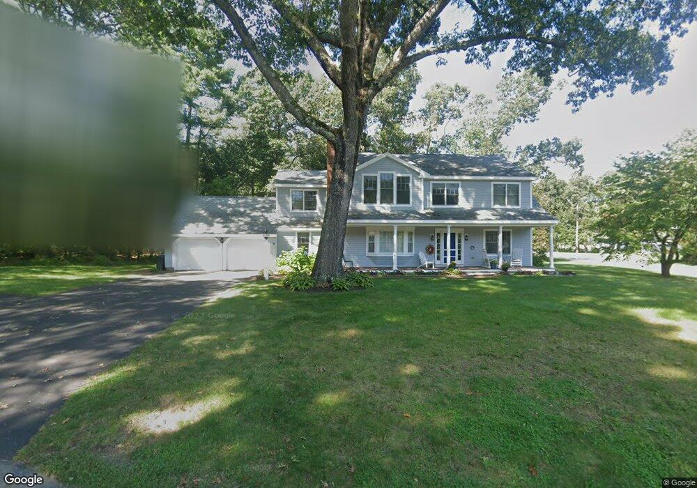
21 Birch Rd Andover, MA 01810
West Andover NeighborhoodEstimated Value: $1,088,000 - $1,289,000
About This Home
This home is located at 21 Birch Rd, Andover, MA 01810 and is currently estimated at $1,195,520, approximately $467 per square foot. 21 Birch Rd is a home located in Essex County with nearby schools including West Elementary School, Andover West Middle School, and Andover High School.
Ownership History
We collect this data history from publicly available records. To have your information removed, we recommend requesting removal directly through your county’s website.
Purchase Details
Purchase Details
Purchase Details
Home Values in the Area
Average Home Value in this Area
Purchase History
We collect this data history from publicly available records. To have your information removed, we recommend requesting removal directly through your county’s website.
| Date | Buyer | Sale Price | Title Company |
|---|---|---|---|
| $625,000 | -- | ||
| $625,000 | -- | ||
| $625,000 | -- | ||
| $542,000 | -- | ||
| $542,000 | -- | ||
| $265,000 | -- | ||
| $265,000 | -- |
Mortgage History
We collect this data history from publicly available records. To have your information removed, we recommend requesting removal directly through your county’s website.
| Date | Status | Borrower | Loan Amount |
|---|---|---|---|
| Open | $100,000 | ||
| Closed | $125,000 |
Tax History
We collect this data history from publicly available records. To have your information removed, we recommend requesting removal directly through your county’s website.
| Year | Tax Paid | Tax Assessment Tax Assessment Total Assessment is a certain percentage of the fair market value that is determined by local assessors to be the total taxable value of land and additions on the property. | Land | Improvement |
|---|---|---|---|---|
| 2025 | $12,468 | $998,200 | $553,100 | $445,100 |
| 2024 | $11,966 | $929,000 | $532,600 | $396,400 |
| 2023 | $11,454 | $838,500 | $479,600 | $358,900 |
| 2022 | $10,871 | $744,600 | $417,200 | $327,400 |
| 2021 | $10,412 | $681,000 | $379,300 | $301,700 |
| 2020 | $9,991 | $665,600 | $370,200 | $295,400 |
| 2019 | $9,530 | $624,100 | $338,200 | $285,900 |
| 2018 | $9,207 | $588,700 | $325,100 | $263,600 |
| 2017 | $8,807 | $580,200 | $318,800 | $261,400 |
| 2016 | $8,599 | $580,200 | $318,800 | $261,400 |
| 2015 | $8,287 | $553,600 | $306,600 | $247,000 |
Map
- 25 Crenshaw Ln Unit 15-2
- 10 Lancaster Place
- 38 Crenshaw Ln
- 145 High Plain Rd
- 4 Farnham Cir
- 9 Muirfield Cir Unit 9
- 4 Andover Country Club Ln
- 10 Hemlock Rd
- 57 Juniper Rd
- 11 Leah Way Unit 11
- 13 Leah Way
- 25 Clubview Dr Unit 25
- 15 Juniper Rd
- 24 Bobby Jones Dr
- 48 Reservation Rd
- 2 Dove Ln Unit 2
- 2 Dove Ln
- 21 Clubview Dr Unit 21
- 11 Swan Ln Unit 11
- 11 Swan Ln
Ask me questions while you tour the home.