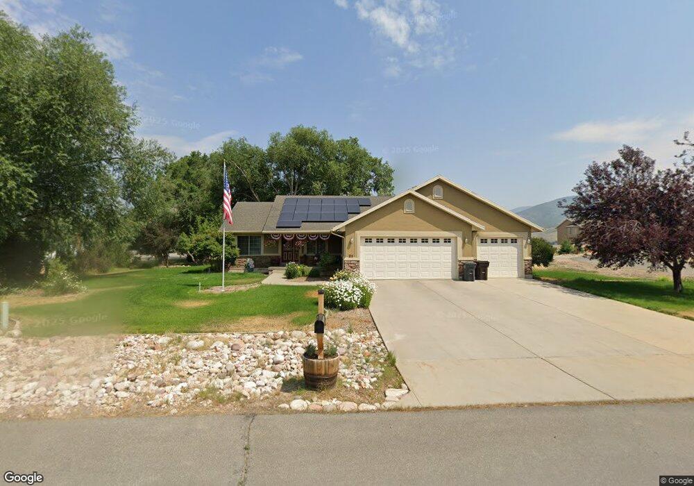
21 E Til''S Way Francis, UT 84036
Kamas Valley NeighborhoodEstimated Value: $677,000 - $759,000
3
Beds
2
Baths
1,586
Sq Ft
$447/Sq Ft
Est. Value
About This Home
This home is located at 21 E Til''S Way, Francis, UT 84036 and is currently estimated at $708,774, approximately $446 per square foot. 21 E Til''S Way is a home located in Summit County with nearby schools including South Summit Elementary School and South Summit High School.
Ownership History
Date
Name
Owned For
Owner Type
Purchase Details
Closed on
Dec 19, 2019
Sold by
Tilleman Scott D and Tilleman Coleen B
Bought by
Dalsing Dakota K and Dalsing Hope G
Current Estimated Value
Home Financials for this Owner
Home Financials are based on the most recent Mortgage that was taken out on this home.
Original Mortgage
$378,787
Outstanding Balance
$333,955
Interest Rate
3.6%
Mortgage Type
New Conventional
Estimated Equity
$374,819
Purchase Details
Closed on
May 11, 2012
Sold by
Wells Fargo Bank Na
Bought by
Secreatry Of Hud
Purchase Details
Closed on
Mar 21, 2012
Sold by
Wells Fargo Bank
Bought by
Secretary Of Hud
Purchase Details
Closed on
Feb 2, 2012
Sold by
Houston Jeffery E and Houston Angela
Bought by
Wells Fargo Bank Na
Create a Home Valuation Report for This Property
The Home Valuation Report is an in-depth analysis detailing your home's value as well as a comparison with similar homes in the area
Home Values in the Area
Average Home Value in this Area
Purchase History
| Date | Buyer | Sale Price | Title Company |
|---|---|---|---|
| Dalsing Dakota K | -- | Us Title Insurance Agency | |
| Secreatry Of Hud | -- | Inwest Title | |
| Secretary Of Hud | -- | Inwest Title | |
| Secreatry Of Hud | -- | Inwest Title | |
| Wells Fargo Bank Na | -- | Etitle Ins Agency |
Source: Public Records
Mortgage History
| Date | Status | Borrower | Loan Amount |
|---|---|---|---|
| Open | Dalsing Dakota K | $378,787 |
Source: Public Records
Tax History Compared to Growth
Tax History
| Year | Tax Paid | Tax Assessment Tax Assessment Total Assessment is a certain percentage of the fair market value that is determined by local assessors to be the total taxable value of land and additions on the property. | Land | Improvement |
|---|---|---|---|---|
| 2024 | $2,057 | $333,812 | $132,000 | $201,812 |
| 2023 | $2,057 | $333,812 | $132,000 | $201,812 |
| 2022 | $2,237 | $320,182 | $121,000 | $199,182 |
| 2021 | $1,886 | $210,448 | $66,000 | $144,448 |
| 2020 | $1,882 | $205,633 | $66,000 | $139,633 |
| 2019 | $1,628 | $159,350 | $46,200 | $113,150 |
| 2018 | $1,381 | $140,451 | $39,600 | $100,851 |
| 2017 | $1,306 | $135,532 | $39,600 | $95,932 |
| 2016 | $1,312 | $128,153 | $39,600 | $88,553 |
| 2015 | $1,212 | $115,749 | $0 | $0 |
| 2013 | $1,306 | $115,749 | $0 | $0 |
Source: Public Records
Map
Nearby Homes
- 1775 S State Road 32
- 117 Scenic Heights Rd
- 117 Scenic Heights Rd Unit 512
- 1978 Deer Park Dr
- 1978 Deer Park Dr Unit 8
- 133 Scenic Heights Rd Unit 509
- 133 Scenic Heights Rd
- 202 Scenic Heights Rd
- 202 Scenic Heights Rd Unit 9
- 68 Scenic Heights Rd
- 68 Scenic Heights Rd Unit 203
- 2002 Deer Park Dr
- 2002 Deer Park Dr Unit 25
- 1987 Wren Woods Way
- 1987 Wren Woods Way Unit 24
- 1986 Wren Woods Way
- 1986 Wren Woods Way Unit 13
- 1181 Big Sky Trail - Lot 39 Unit 39
- 431 Aspen Rd
- 2341 Spring Hollow Rd
- 21 Tils Way
- 1871 S State Road 32
- 21 Til's Way
- 22 Til's Way
- 22 Tils Way
- 22 E Til''S Way
- 22 Tils Way Unit 11
- 1880 Parleys Loop
- 1880 S Parley's Loop
- 1875 Parley's
- 1875 Parleys Loop
- 1875 Parleys Loop
- 1875 Parleys Loop Unit 2
- 1950 Parleys Loop
- 1950 Parleys Loop Unit 13
- 1926 S State Road 32
- 1885 Parleys Loop
- 1910 Parleys Loop
- 1910 S Parley's Loop
- 1945 S State Road 32