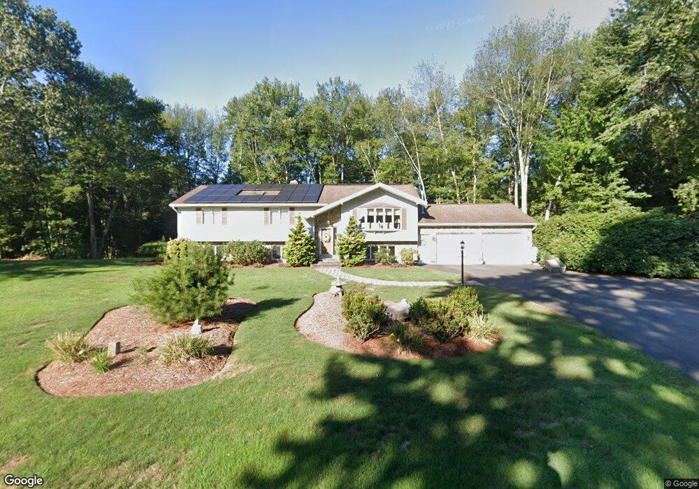
21 Farm Lea Dr Somers, CT 06071
Estimated Value: $468,941 - $557,000
4
Beds
3
Baths
1,610
Sq Ft
$323/Sq Ft
Est. Value
About This Home
This home is located at 21 Farm Lea Dr, Somers, CT 06071 and is currently estimated at $519,235, approximately $322 per square foot. 21 Farm Lea Dr is a home located in Tolland County with nearby schools including Somers Elementary School, Mabelle B. Avery Middle School, and Somers High School.
Ownership History
Date
Name
Owned For
Owner Type
Purchase Details
Closed on
May 17, 2022
Sold by
Minukas John S and Minukas Dianne W
Bought by
Minukas Dianne W
Current Estimated Value
Purchase Details
Closed on
Mar 16, 2009
Sold by
Gingras Robert and Gingras Margarette
Bought by
Pratt Dianne and Minukas John
Home Financials for this Owner
Home Financials are based on the most recent Mortgage that was taken out on this home.
Original Mortgage
$210,000
Interest Rate
5.18%
Mortgage Type
Purchase Money Mortgage
Create a Home Valuation Report for This Property
The Home Valuation Report is an in-depth analysis detailing your home's value as well as a comparison with similar homes in the area
Home Values in the Area
Average Home Value in this Area
Purchase History
| Date | Buyer | Sale Price | Title Company |
|---|---|---|---|
| Minukas Dianne W | -- | None Available | |
| Minukas Dianne W | -- | None Available | |
| Pratt Dianne | $335,000 | -- | |
| Pratt Dianne | $335,000 | -- |
Source: Public Records
Mortgage History
| Date | Status | Borrower | Loan Amount |
|---|---|---|---|
| Previous Owner | Pratt Dianne | $150,000 | |
| Previous Owner | Pratt Dianne | $210,000 |
Source: Public Records
Tax History Compared to Growth
Tax History
| Year | Tax Paid | Tax Assessment Tax Assessment Total Assessment is a certain percentage of the fair market value that is determined by local assessors to be the total taxable value of land and additions on the property. | Land | Improvement |
|---|---|---|---|---|
| 2025 | $6,556 | $217,000 | $78,600 | $138,400 |
| 2024 | $6,284 | $217,000 | $78,600 | $138,400 |
| 2023 | $6,143 | $217,000 | $78,600 | $138,400 |
| 2022 | $5,981 | $217,000 | $78,600 | $138,400 |
| 2021 | $5,785 | $217,000 | $78,600 | $138,400 |
| 2020 | $5,403 | $197,400 | $78,600 | $118,800 |
| 2019 | $5,195 | $189,800 | $86,900 | $102,900 |
| 2018 | $5,195 | $189,800 | $86,900 | $102,900 |
| 2017 | $4,834 | $189,800 | $86,900 | $102,900 |
| 2016 | $4,597 | $189,800 | $86,900 | $102,900 |
| 2015 | $4,760 | $203,700 | $91,400 | $112,300 |
| 2014 | $4,760 | $203,700 | $91,400 | $112,300 |
Source: Public Records
Map
Nearby Homes
- 35 Cantlewood Dr
- 49 Bridle Path Dr
- 35 Therese Dr
- 557 Hall Hill Rd
- 603 Hall Hill Rd
- 144 Watchaug Rd
- 42 Schneider Rd
- 23 Hampden Rd
- 31 Meade Ln
- 155 Sheridan Rd
- 4 Copley Cir
- 2 Meacham Dr Unit 2
- 11 Northfield Rd
- 192 Main St
- 138 Main St
- 49 Stafford Rd
- 436 Taylor Rd
- 80 Pease Rd
- 369 Turnpike Rd
- 121 Florida Rd
- 16 Farm Lea Dr
- 30 Farm Lea Dr
- 24 Farm Lea Dr
- 25 Watchaug Rd
- 428 Hall Hill Rd
- 432 Hall Hill Rd
- 442 Hall Hill Rd
- 29 Farm Lea Dr
- 5 Blue Ridge Dr
- 11 Watchaug Rd
- 421 Hall Hill Rd
- 49 Carriage Dr
- 439 Hall Hill Rd
- 31 Watchaug Rd
- 448 Hall Hill Rd
- 39 Carriage Dr
- 5 Carriage Dr
- 13 Carriage Dr
- 35 Carriage Dr
- 407 Hall Hill Rd