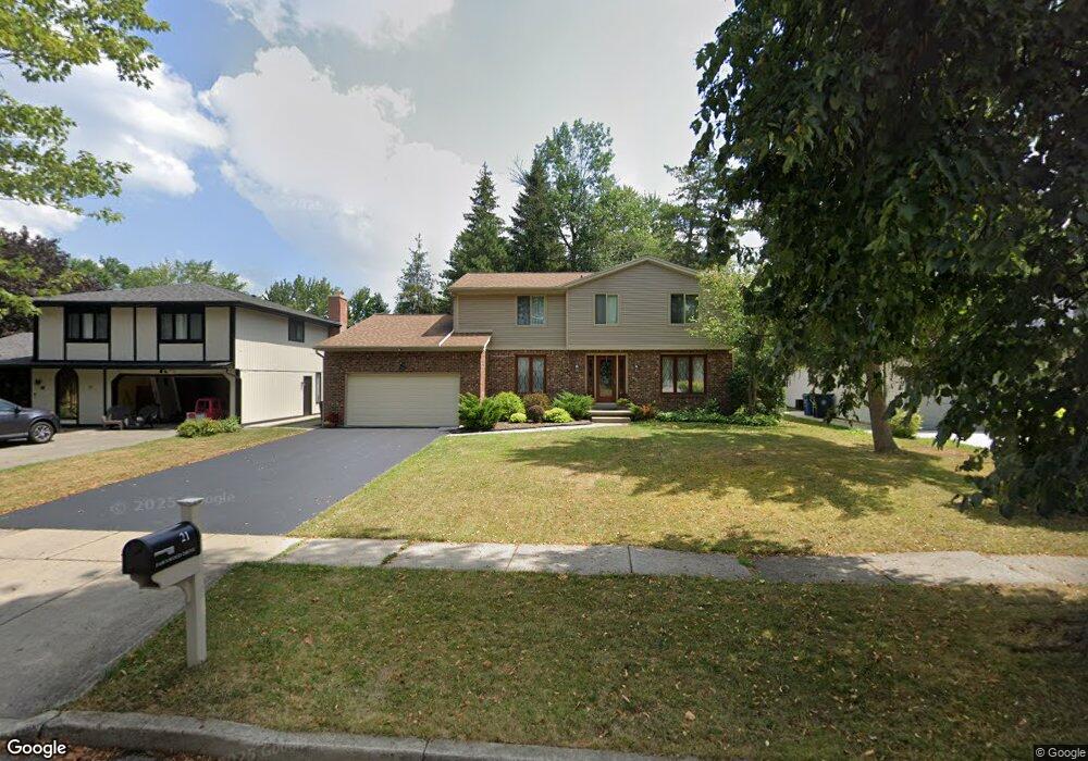
21 Fawnwood Dr Buffalo, NY 14221
South Amherst NeighborhoodEstimated Value: $457,000 - $499,000
4
Beds
3
Baths
2,429
Sq Ft
$196/Sq Ft
Est. Value
About This Home
This home is located at 21 Fawnwood Dr, Buffalo, NY 14221 and is currently estimated at $476,264, approximately $196 per square foot. 21 Fawnwood Dr is a home located in Erie County with nearby schools including Maple West Elementary School, Heim Middle School, and Williamsville North High School.
Ownership History
Date
Name
Owned For
Owner Type
Purchase Details
Closed on
Dec 4, 2011
Sold by
Scherr Brett J and Monroe Suzanne M
Bought by
Vande Casteele Cheryl A
Current Estimated Value
Home Financials for this Owner
Home Financials are based on the most recent Mortgage that was taken out on this home.
Original Mortgage
$198,000
Outstanding Balance
$135,445
Interest Rate
4.01%
Mortgage Type
New Conventional
Estimated Equity
$340,819
Purchase Details
Closed on
Oct 3, 2003
Sold by
Scherrer Brett J
Bought by
Scherrer Brett J and Monroe Suzanne M
Purchase Details
Closed on
Feb 8, 2003
Sold by
Schwartz James A
Bought by
Scherrer Brett J
Home Financials for this Owner
Home Financials are based on the most recent Mortgage that was taken out on this home.
Original Mortgage
$89,390
Interest Rate
5.35%
Mortgage Type
Purchase Money Mortgage
Create a Home Valuation Report for This Property
The Home Valuation Report is an in-depth analysis detailing your home's value as well as a comparison with similar homes in the area
Home Values in the Area
Average Home Value in this Area
Purchase History
| Date | Buyer | Sale Price | Title Company |
|---|---|---|---|
| Vande Casteele Cheryl A | $220,000 | None Available | |
| Scherrer Brett J | -- | -- | |
| Scherrer Brett J | $500 | -- |
Source: Public Records
Mortgage History
| Date | Status | Borrower | Loan Amount |
|---|---|---|---|
| Open | Vande Casteele Cheryl A | $198,000 | |
| Previous Owner | Scherrer Brett J | $89,390 |
Source: Public Records
Tax History Compared to Growth
Tax History
| Year | Tax Paid | Tax Assessment Tax Assessment Total Assessment is a certain percentage of the fair market value that is determined by local assessors to be the total taxable value of land and additions on the property. | Land | Improvement |
|---|---|---|---|---|
| 2024 | $8,701 | $418,000 | $59,000 | $359,000 |
| 2023 | $8,378 | $240,000 | $32,800 | $207,200 |
| 2022 | $7,420 | $240,000 | $32,800 | $207,200 |
| 2021 | $7,272 | $240,000 | $32,800 | $207,200 |
| 2020 | $6,805 | $240,000 | $32,800 | $207,200 |
| 2019 | $6,633 | $240,000 | $32,800 | $207,200 |
| 2018 | $6,506 | $240,000 | $32,800 | $207,200 |
| 2017 | $2,862 | $240,000 | $32,800 | $207,200 |
| 2016 | $6,688 | $220,000 | $32,800 | $187,200 |
| 2015 | -- | $220,000 | $32,800 | $187,200 |
| 2014 | -- | $220,000 | $32,800 | $187,200 |
Source: Public Records
Map
Nearby Homes
- 930 Hopkins Rd Unit H
- 26 Village Gate Ct
- 158 Old Farm Cir
- 85 Mahogany Dr
- 59 Laurie Lea
- 139 Presidents Walk
- 147 Ranch Trail W
- 42 Spicebush Ln
- 40 Spicebush Ln
- 12 Spicebush Ln Unit 12
- 67 Birchwood Dr
- 47 Birch Ln
- 23 Birch Ln
- 55 Birch Ln
- 88 W Klein Rd
- 114 Robin Hill Dr
- 180 Crestwood Ln
- 235 Old Lyme Dr
- 292 Oakbrook Dr
- 95 Carriage Cir