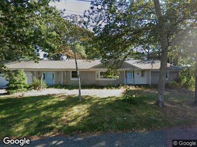
21 Harrington Way Hyannis, MA 02601
Hyannis NeighborhoodEstimated Value: $625,000 - $738,298
3
Beds
2
Baths
1,801
Sq Ft
$385/Sq Ft
Est. Value
About This Home
This home is located at 21 Harrington Way, Hyannis, MA 02601 and is currently estimated at $692,575, approximately $384 per square foot. 21 Harrington Way is a home located in Barnstable County with nearby schools including Hyannis West Elementary School, Barnstable United Elementary School, and Barnstable Intermediate School.
Ownership History
Date
Name
Owned For
Owner Type
Purchase Details
Closed on
May 11, 2004
Sold by
Freitas Sharon E and Carter Wanda Gay
Bought by
Magee Richard A
Current Estimated Value
Home Financials for this Owner
Home Financials are based on the most recent Mortgage that was taken out on this home.
Original Mortgage
$269,900
Outstanding Balance
$136,638
Interest Rate
5.39%
Mortgage Type
Purchase Money Mortgage
Create a Home Valuation Report for This Property
The Home Valuation Report is an in-depth analysis detailing your home's value as well as a comparison with similar homes in the area
Home Values in the Area
Average Home Value in this Area
Purchase History
| Date | Buyer | Sale Price | Title Company |
|---|---|---|---|
| Magee Richard A | $359,900 | -- |
Source: Public Records
Mortgage History
| Date | Status | Borrower | Loan Amount |
|---|---|---|---|
| Open | Magee Richard A | $269,900 | |
| Previous Owner | Freitas Malcolm P | $130,000 |
Source: Public Records
Tax History Compared to Growth
Tax History
| Year | Tax Paid | Tax Assessment Tax Assessment Total Assessment is a certain percentage of the fair market value that is determined by local assessors to be the total taxable value of land and additions on the property. | Land | Improvement |
|---|---|---|---|---|
| 2025 | $6,356 | $685,700 | $178,100 | $507,600 |
| 2024 | $6,108 | $674,900 | $178,100 | $496,800 |
| 2023 | $5,775 | $603,400 | $176,000 | $427,400 |
| 2022 | $5,769 | $498,600 | $125,100 | $373,500 |
| 2021 | $5,146 | $432,100 | $125,100 | $307,000 |
| 2020 | $5,164 | $418,800 | $125,100 | $293,700 |
| 2019 | $4,812 | $382,500 | $125,100 | $257,400 |
| 2018 | $4,351 | $353,700 | $137,200 | $216,500 |
| 2017 | $4,091 | $341,200 | $137,200 | $204,000 |
| 2016 | $4,016 | $342,400 | $138,400 | $204,000 |
| 2015 | $3,822 | $330,300 | $135,000 | $195,300 |
Source: Public Records
Map
Nearby Homes
- 113 Briarwood Ave
- 27 & 54 Circle Dr
- 48 Smith St
- 31 Arbor Way
- 106 Longwood Ave
- 35 Grayton Ave
- 18 Mount Vernon Ave
- 86 Seabrook Rd
- 20 Sunset Terrace
- 34 Crocker Dr
- 307 W Main St Unit 7
- 48 Kennedy Cir
- 329 W Main St Unit 26
- 329 W Main St Unit 30
- 172 Irving Ave
- 187 Sea St
- 39 Alden Way
- 230 Gosnold St Unit 11A-11B-11C
- 230 Gosnold St Unit 11ABC
- 21 Harrington Way
- 5 Harrington Way
- 16 Harrington Way
- 19 Redwood Lane Extension
- 19 Redwood Ln
- 333 Scudder Ave
- 28 Harrington Way
- 341 Scudder Ave
- 12 Redwood
- 12 Redwood Ln
- 75 Pinewood Rd
- 20 Redwood Ln
- 326 Scudder Ave
- 113 Briarwood Ave Unit 113
- 320 Scudder Ave
- 24 Redwood Lane Extension
- 36 Harrington Way
- 340 Scudder Ave
- 30 Redwood Ln
- 35 Rustic Ln