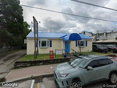
21 Kearsarge Rd North Conway, NH 03860
Estimated Value: $783,020
--
Bed
--
Bath
--
Sq Ft
5,227
Sq Ft Lot
About This Home
This home is located at 21 Kearsarge Rd, North Conway, NH 03860 and is currently estimated at $783,020. 21 Kearsarge Rd is a home located in Carroll County with nearby schools including A. Crosby Kennett Middle School, Kennett High School, and The Lilliputian School.
Ownership History
Date
Name
Owned For
Owner Type
Purchase Details
Closed on
Sep 26, 2016
Sold by
Hooligans Inc
Bought by
Jfd North Rt and Demonico
Current Estimated Value
Home Financials for this Owner
Home Financials are based on the most recent Mortgage that was taken out on this home.
Original Mortgage
$325,000
Outstanding Balance
$263,943
Interest Rate
3.45%
Mortgage Type
Commercial
Estimated Equity
$519,077
Purchase Details
Closed on
Oct 23, 1984
Bought by
Hooligans Inc
Create a Home Valuation Report for This Property
The Home Valuation Report is an in-depth analysis detailing your home's value as well as a comparison with similar homes in the area
Home Values in the Area
Average Home Value in this Area
Purchase History
| Date | Buyer | Sale Price | Title Company |
|---|---|---|---|
| Jfd North Rt | $515,000 | -- | |
| Jfd North Rt | $515,000 | -- | |
| Hooligans Inc | -- | -- |
Source: Public Records
Mortgage History
| Date | Status | Borrower | Loan Amount |
|---|---|---|---|
| Open | Jfd North Rt | $325,000 | |
| Closed | Hooligans Inc | $325,000 |
Source: Public Records
Tax History Compared to Growth
Tax History
| Year | Tax Paid | Tax Assessment Tax Assessment Total Assessment is a certain percentage of the fair market value that is determined by local assessors to be the total taxable value of land and additions on the property. | Land | Improvement |
|---|---|---|---|---|
| 2024 | $3,507 | $278,300 | $173,600 | $104,700 |
| 2023 | $3,189 | $278,300 | $173,600 | $104,700 |
| 2022 | $4,743 | $247,300 | $153,600 | $93,700 |
| 2021 | $4,041 | $247,300 | $153,600 | $93,700 |
| 2020 | $4,617 | $247,300 | $153,600 | $93,700 |
| 2019 | $4,283 | $247,300 | $153,600 | $93,700 |
| 2018 | $4,809 | $217,300 | $123,600 | $93,700 |
| 2017 | $4,342 | $217,300 | $123,600 | $93,700 |
| 2016 | $4,196 | $217,300 | $123,600 | $93,700 |
| 2015 | $4,148 | $217,300 | $123,600 | $93,700 |
| 2014 | $4,098 | $217,300 | $123,600 | $93,700 |
| 2013 | $3,874 | $216,900 | $123,600 | $93,300 |
Source: Public Records
Map
Nearby Homes
- 104 Kearsarge Rd
- 40 Swett St
- 2548 White Mountain Hwy
- 140 Grove St
- 207 Seavey St
- 37 Cranmore Rd
- 27 Cranmore Cir
- 261 Grove St
- 2955 White Mountain Hwy Unit 128 E25
- 2955 White Mountain Hwy Unit 115-116 E1
- 2955 White Mountain Hwy Unit 215-216 E26
- 2955 White Mountain Hwy Unit 124 E21
- 00 Artist Falls Rd
- 31 Black Diamond Rd Unit 9
- 21 Black Diamond Rd
- 243 Skimobile Rd Unit 252
- 243 Skimobile Rd Unit 354
- 243 Skimobile Rd Unit 352
- 235 Skimobile Rd Unit 2202
- 235 Skimobile Rd Unit 2104
- 21 Kearsarge Rd
- 23 Kearsarge Rd Unit 23
- 2677 White Mountain Hwy
- 7 Kearsarge Rd Unit 7
- 2655 White Mountain Hwy
- 2655 White Mountain Hwy Unit 3
- 2655 White Mountain Hwy Unit 4,5,6
- 36 Kearsarge Rd
- 2655-2 White Mountain Hwy Unit 2
- 44 Kearsarge Rd
- 2655 - 4,5 White Mountain Hwy Unit 4,5,6
- 2655 - 4,5,6 White Mountain Hwy Unit 4,5,6
- 2680 White Mountain Hwy
- 47 Kearsarge Rd
- 2655-3 White Mountain Hwy Unit 3
- 00 Kearsarge Rd
- 2655-1 White Mountain Hwy
- 10 Seavey St
- 45 Mechanic St
- 41 Mechanic St