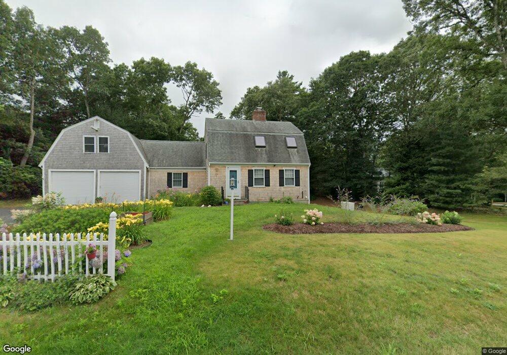
21 Michael Rd Pocasset, MA 02559
Pocasset NeighborhoodEstimated Value: $709,381 - $885,000
2
Beds
2
Baths
2,148
Sq Ft
$363/Sq Ft
Est. Value
About This Home
This home is located at 21 Michael Rd, Pocasset, MA 02559 and is currently estimated at $779,345, approximately $362 per square foot. 21 Michael Rd is a home located in Barnstable County with nearby schools including Bourne High School and Cadence Academy Preschool - Bourne.
Ownership History
Date
Name
Owned For
Owner Type
Purchase Details
Closed on
Mar 20, 1989
Sold by
Granger Margaret A
Bought by
Macphee Donald F
Current Estimated Value
Home Financials for this Owner
Home Financials are based on the most recent Mortgage that was taken out on this home.
Original Mortgage
$120,000
Interest Rate
10.46%
Mortgage Type
Purchase Money Mortgage
Create a Home Valuation Report for This Property
The Home Valuation Report is an in-depth analysis detailing your home's value as well as a comparison with similar homes in the area
Home Values in the Area
Average Home Value in this Area
Purchase History
| Date | Buyer | Sale Price | Title Company |
|---|---|---|---|
| Macphee Donald F | $158,000 | -- | |
| Macphee Donald F | $158,000 | -- |
Source: Public Records
Mortgage History
| Date | Status | Borrower | Loan Amount |
|---|---|---|---|
| Closed | Macphee Donald F | $148,800 | |
| Closed | Macphee Donald F | $120,000 |
Source: Public Records
Tax History
| Year | Tax Paid | Tax Assessment Tax Assessment Total Assessment is a certain percentage of the fair market value that is determined by local assessors to be the total taxable value of land and additions on the property. | Land | Improvement |
|---|---|---|---|---|
| 2025 | $5,055 | $647,200 | $224,800 | $422,400 |
| 2024 | $4,470 | $557,300 | $214,100 | $343,200 |
| 2023 | $4,305 | $488,700 | $181,300 | $307,400 |
| 2022 | $4,449 | $440,900 | $196,900 | $244,000 |
| 2021 | $4,322 | $401,300 | $179,200 | $222,100 |
| 2020 | $4,198 | $390,900 | $177,400 | $213,500 |
| 2019 | $3,982 | $378,900 | $177,400 | $201,500 |
| 2018 | $3,643 | $345,600 | $169,000 | $176,600 |
| 2017 | $3,397 | $329,800 | $155,000 | $174,800 |
| 2016 | $3,289 | $323,700 | $155,000 | $168,700 |
| 2015 | $3,260 | $323,700 | $155,000 | $168,700 |
Source: Public Records
Map
Nearby Homes
- 16 Michael Rd
- 254 Barlows Landing Rd
- 709 County Rd
- 3 4th Ave
- 7 4th Ave
- 3 1st St
- 14 Navajo Rd
- 48 Red Brook Harbor Rd
- 566 Shore Rd
- 1234 Route 28a
- 1234 Route 28a
- 20 Colony Ave
- 15 Oak Ave
- 75 Winsor Rd
- 4 Harbor Hill Dr
- 16 Amberwood Ct
- 31 Baxendale Rd
- 203 County Rd
- 12 Turnberry Rd Unit 12
- 4 Hollyhock Knoll Ct Unit 4
- 19 Michael Rd
- 23 Michael Rd
- 18 Michael Rd
- 20 Michael Rd
- 24 Michael Rd
- 22 Michael Rd
- 17 Michael Rd
- 25 Michael Rd
- 26 Michael Rd
- 15 Michael Rd
- 25 Keith Rd
- 247 Barlows Landing Rd
- 271 Barlows Landing Rd
- 255 Barlows Landing Rd
- 279 Barlows Landing Rd
- 14 Michael Rd
- 273 Barlows Landing Rd
- 257 Barlows Landing Rd
- 275 Barlows Landing Rd
- 23 Keith Rd
Your Personal Tour Guide
Ask me questions while you tour the home.