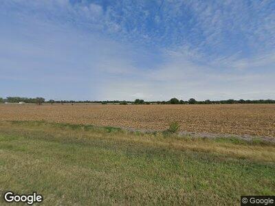
21 N 170th Rd Bennington, KS 67422
Estimated Value: $245,000 - $387,000
5
Beds
2
Baths
1,964
Sq Ft
$147/Sq Ft
Est. Value
About This Home
This home is located at 21 N 170th Rd, Bennington, KS 67422 and is currently estimated at $288,066, approximately $146 per square foot. 21 N 170th Rd is a home located in Ottawa County with nearby schools including Bennington Elementary School and Bennington Junior High/High School.
Ownership History
Date
Name
Owned For
Owner Type
Purchase Details
Closed on
May 29, 2008
Sold by
Federal Home Loan Mortgage Corporation
Bought by
Lindfors Aaron D
Current Estimated Value
Home Financials for this Owner
Home Financials are based on the most recent Mortgage that was taken out on this home.
Original Mortgage
$100,800
Interest Rate
5.99%
Create a Home Valuation Report for This Property
The Home Valuation Report is an in-depth analysis detailing your home's value as well as a comparison with similar homes in the area
Home Values in the Area
Average Home Value in this Area
Purchase History
| Date | Buyer | Sale Price | Title Company |
|---|---|---|---|
| Lindfors Aaron D | $126,000 | -- |
Source: Public Records
Mortgage History
| Date | Status | Borrower | Loan Amount |
|---|---|---|---|
| Open | Lindfors Aaron D | $126,400 | |
| Closed | Lindfors Aaron D | $120,000 | |
| Closed | Lindfors Aaron D | $21,190 | |
| Closed | Lindfors Aaron D | $100,800 |
Source: Public Records
Tax History Compared to Growth
Tax History
| Year | Tax Paid | Tax Assessment Tax Assessment Total Assessment is a certain percentage of the fair market value that is determined by local assessors to be the total taxable value of land and additions on the property. | Land | Improvement |
|---|---|---|---|---|
| 2024 | $4,556 | $30,221 | $2,875 | $27,346 |
| 2023 | $3,986 | $27,474 | $2,530 | $24,944 |
| 2022 | $3,465 | $22,980 | $2,530 | $20,450 |
| 2021 | $3,506 | $22,358 | $2,530 | $19,828 |
| 2020 | $3,506 | $22,148 | $2,185 | $19,963 |
| 2019 | $3,365 | $20,939 | $2,185 | $18,754 |
| 2018 | $3,213 | $19,926 | $2,185 | $17,741 |
| 2017 | $3,194 | $19,079 | $2,185 | $16,894 |
| 2016 | $3,153 | $18,631 | $2,185 | $16,446 |
| 2015 | -- | $18,265 | $2,185 | $16,080 |
| 2014 | -- | $18,265 | $2,185 | $16,080 |
Source: Public Records
Map
Nearby Homes
- 72 Alpine Ridge Ln
- 1711 Buffalo Rd
- 4039 N Crystal Springs Rd
- 221 N Struble St
- 302 N Struble St
- 502 N Putnam St
- 0000 W Pleasant Hill Rd
- 607 N Lincoln St
- 00000 N Ohio St
- 0000 Aspen Rd
- 0000 N 5th St
- 1003 N 12th St
- 915 N 8th St
- 00000 E Pacific Ave
- 718 N 13th St
- 626 N 10th St
- 1001 N 12th St
- 6202 W Watkins Rd
- 83 N 250th Rd
- 408 W Elm St
