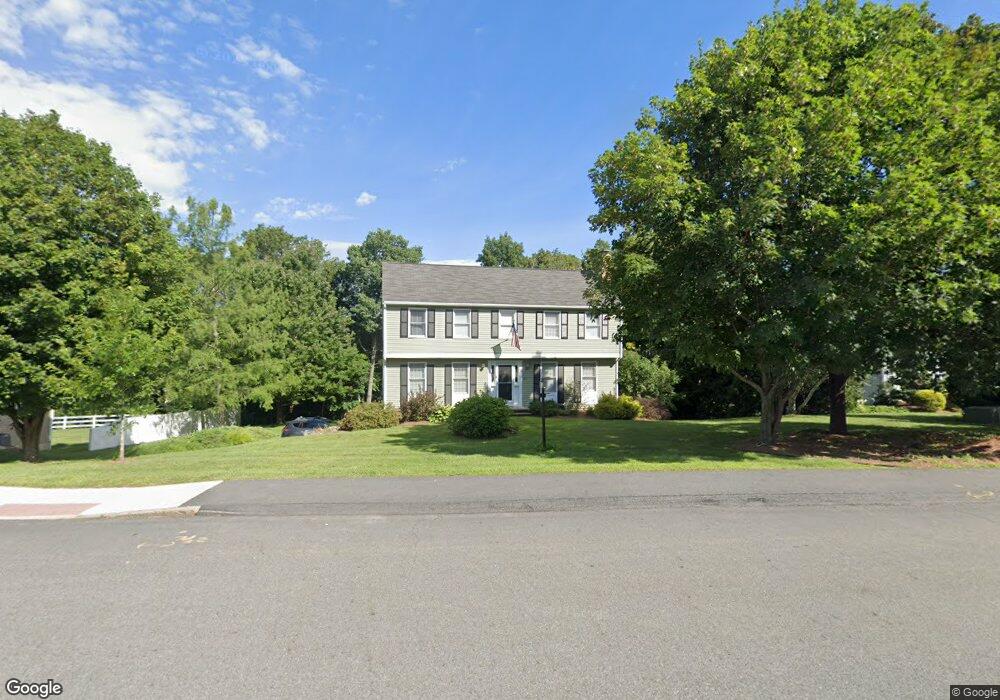
21 Otsego Dr Hudson, MA 01749
Estimated Value: $739,947 - $798,000
4
Beds
3
Baths
2,146
Sq Ft
$357/Sq Ft
Est. Value
About This Home
This home is located at 21 Otsego Dr, Hudson, MA 01749 and is currently estimated at $766,737, approximately $357 per square foot. 21 Otsego Dr is a home located in Middlesex County with nearby schools including David J. Quinn Middle School, Hudson High School, and Darnell School For Educational & Behavioral Service.
Ownership History
Date
Name
Owned For
Owner Type
Purchase Details
Closed on
Jan 5, 1988
Sold by
Quality Homes Rt
Bought by
Barnett Carl E
Current Estimated Value
Home Financials for this Owner
Home Financials are based on the most recent Mortgage that was taken out on this home.
Original Mortgage
$143,400
Interest Rate
10.59%
Mortgage Type
Purchase Money Mortgage
Create a Home Valuation Report for This Property
The Home Valuation Report is an in-depth analysis detailing your home's value as well as a comparison with similar homes in the area
Home Values in the Area
Average Home Value in this Area
Purchase History
| Date | Buyer | Sale Price | Title Company |
|---|---|---|---|
| Barnett Carl E | $243,420 | -- |
Source: Public Records
Mortgage History
| Date | Status | Borrower | Loan Amount |
|---|---|---|---|
| Open | Barnett Carl E | $100,000 | |
| Closed | Barnett Carl E | $137,000 | |
| Closed | Barnett Carl E | $35,000 | |
| Closed | Barnett Carl E | $143,400 |
Source: Public Records
Tax History Compared to Growth
Tax History
| Year | Tax Paid | Tax Assessment Tax Assessment Total Assessment is a certain percentage of the fair market value that is determined by local assessors to be the total taxable value of land and additions on the property. | Land | Improvement |
|---|---|---|---|---|
| 2025 | $9,672 | $696,800 | $195,900 | $500,900 |
| 2024 | $9,243 | $660,200 | $177,900 | $482,300 |
| 2023 | $8,418 | $576,600 | $171,300 | $405,300 |
| 2022 | $8,423 | $531,100 | $172,800 | $358,300 |
| 2021 | $24,042 | $482,500 | $164,700 | $317,800 |
| 2020 | $7,941 | $478,100 | $161,400 | $316,700 |
| 2019 | $9,343 | $440,000 | $161,400 | $278,600 |
| 2018 | $7,455 | $426,000 | $153,600 | $272,400 |
| 2017 | $7,403 | $423,000 | $146,400 | $276,600 |
| 2016 | $6,878 | $397,800 | $146,400 | $251,400 |
| 2015 | $6,639 | $384,400 | $146,400 | $238,000 |
| 2014 | $6,383 | $366,400 | $128,700 | $237,700 |
Source: Public Records
Map
Nearby Homes
- 48 Jewell Rd Unit Lot 6
- 46 Jewell Rd Unit Lot 5
- 44 Jewell Rd Unit Lot 4
- 30 Jewell Rd Unit Lot 2
- 36 Jewell Rd Unit Lot 3
- 1 Rotherham Way Unit B
- 129 Fort Meadow Dr
- 18 Collins Dr
- 0 Washington St
- 656 Bolton St
- 243 Washington St
- 3 Townsend Rd
- 18 Amory Rd
- 57 Paquin Dr
- 114 Lodi Rd
- 44 Stevens Rd
- 2 Blueberry Ln
- 135 Broad St Unit 2B3
- 56 Forest Ave
- 0 Chestnut Street L:2 Unit 73360104