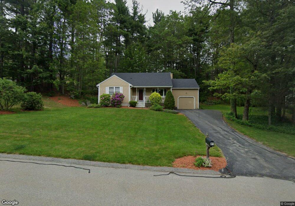
21 Scottsdale Dr Hudson, NH 03051
Estimated Value: $435,030 - $478,000
2
Beds
2
Baths
1,230
Sq Ft
$375/Sq Ft
Est. Value
About This Home
This home is located at 21 Scottsdale Dr, Hudson, NH 03051 and is currently estimated at $461,258, approximately $375 per square foot. 21 Scottsdale Dr is a home located in Hillsborough County with nearby schools including Tabernacle Christian School and Clearway High School.
Ownership History
Date
Name
Owned For
Owner Type
Purchase Details
Closed on
Jul 30, 2021
Sold by
Corbo Carolyn R
Bought by
Clough Lisa
Current Estimated Value
Home Financials for this Owner
Home Financials are based on the most recent Mortgage that was taken out on this home.
Original Mortgage
$262,500
Outstanding Balance
$238,801
Interest Rate
2.93%
Mortgage Type
Purchase Money Mortgage
Estimated Equity
$222,457
Purchase Details
Closed on
Jun 29, 1994
Bought by
Corbo Carolyn R and Corbo William T
Create a Home Valuation Report for This Property
The Home Valuation Report is an in-depth analysis detailing your home's value as well as a comparison with similar homes in the area
Home Values in the Area
Average Home Value in this Area
Purchase History
| Date | Buyer | Sale Price | Title Company |
|---|---|---|---|
| Clough Lisa | $350,000 | None Available | |
| Corbo Carolyn R | $100,300 | -- |
Source: Public Records
Mortgage History
| Date | Status | Borrower | Loan Amount |
|---|---|---|---|
| Open | Clough Lisa | $262,500 | |
| Previous Owner | Corbo Carolyn R | $393,000 |
Source: Public Records
Tax History Compared to Growth
Tax History
| Year | Tax Paid | Tax Assessment Tax Assessment Total Assessment is a certain percentage of the fair market value that is determined by local assessors to be the total taxable value of land and additions on the property. | Land | Improvement |
|---|---|---|---|---|
| 2024 | $5,782 | $351,500 | $0 | $351,500 |
| 2023 | $5,512 | $351,500 | $0 | $351,500 |
| 2022 | $5,164 | $351,500 | $0 | $351,500 |
| 2021 | $5,426 | $250,400 | $0 | $250,400 |
| 2020 | $5,285 | $247,300 | $0 | $247,300 |
| 2019 | $5,015 | $247,300 | $0 | $247,300 |
| 2018 | $4,971 | $247,300 | $0 | $247,300 |
| 2017 | $4,877 | $247,300 | $0 | $247,300 |
| 2016 | $4,719 | $214,800 | $0 | $214,800 |
| 2015 | $4,565 | $214,800 | $0 | $214,800 |
| 2014 | $4,474 | $214,800 | $0 | $214,800 |
| 2013 | $4,416 | $214,800 | $0 | $214,800 |
Source: Public Records
Map
Nearby Homes
- 11 Scottsdale Dr
- 36 Sutherland Dr
- 9 Sunshine Dr Unit A
- 319 Fox Run Rd
- 3 Robin Dr
- 16 Evergreen Dr
- 11 Cardinal Dr
- 152 Ferry St
- 22 Oliver Dr
- 73 Ferry St
- 27 Alvirne Dr
- 40B Brackett Ln
- 31 Shadowbrook Dr
- 15 Intervale Ct
- 29 Derry St
- 49 Cobblestone Dr
- 4 Hilltop Dr
- 434 Abbott Farm Ln
- 312 Abbott Farm Ln
- 27 Windsor Ln Unit B
- 1 Scottsdale Dr
- 3 Scottsdale Dr
- 15 Scottsdale Dr
- 19 Scottsdale Dr
- 29 Scottsdale Dr
- 37 Glasgow Cir
- 39 Glasgow Cir
- 57 Glasgow Cir
- 24 Glasgow Cir
- 22 Glasgow Cir
- 20 Glasgow Cir
- 12 Glasgow Cir
- 23 Glasgow Cir
- 5 Sterling Way
- 6 Sterling Way
- 4 Sterling Way
- 15 Scottsdale Dr Unit 98
- 3 Scottsdale Dr Unit 101
- 21 Scottsdale Dr Unit 95
- 41 Glasgow Cir