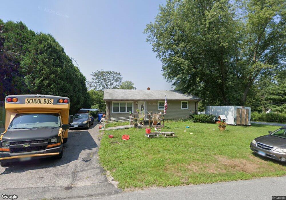
21 Sylvia Dr Moosup, CT 06354
Estimated Value: $266,000
3
Beds
2
Baths
960
Sq Ft
$277/Sq Ft
Est. Value
About This Home
This home is located at 21 Sylvia Dr, Moosup, CT 06354 and is currently estimated at $266,000, approximately $277 per square foot. 21 Sylvia Dr is a home located in Windham County with nearby schools including Plainfield Memorial School, Plainfield Central Middle School, and Plainfield High School.
Ownership History
Date
Name
Owned For
Owner Type
Purchase Details
Closed on
Mar 22, 1999
Sold by
Trudelle Brian J and Trudelle Dorothy R
Bought by
Reed Edmund K and Reed George A
Current Estimated Value
Home Financials for this Owner
Home Financials are based on the most recent Mortgage that was taken out on this home.
Original Mortgage
$83,000
Interest Rate
6.74%
Purchase Details
Closed on
Nov 5, 1993
Sold by
Savoie Scott T
Bought by
Trudell Brian J and Still Dorothy R
Create a Home Valuation Report for This Property
The Home Valuation Report is an in-depth analysis detailing your home's value as well as a comparison with similar homes in the area
Home Values in the Area
Average Home Value in this Area
Purchase History
| Date | Buyer | Sale Price | Title Company |
|---|---|---|---|
| Reed Edmund K | $83,000 | -- | |
| Reed Edmund K | $83,000 | -- | |
| Trudell Brian J | $94,900 | -- | |
| Trudell Brian J | $94,900 | -- |
Source: Public Records
Mortgage History
| Date | Status | Borrower | Loan Amount |
|---|---|---|---|
| Open | Trudell Brian J | $90,000 | |
| Closed | Trudell Brian J | $83,000 |
Source: Public Records
Tax History Compared to Growth
Tax History
| Year | Tax Paid | Tax Assessment Tax Assessment Total Assessment is a certain percentage of the fair market value that is determined by local assessors to be the total taxable value of land and additions on the property. | Land | Improvement |
|---|---|---|---|---|
| 2025 | $3,712 | $157,220 | $27,010 | $130,210 |
| 2024 | $3,624 | $157,220 | $27,010 | $130,210 |
| 2023 | $3,607 | $157,220 | $27,010 | $130,210 |
| 2022 | $4,607 | $97,420 | $23,170 | $74,250 |
| 2021 | $2,994 | $97,420 | $23,170 | $74,250 |
| 2020 | $2,974 | $97,420 | $23,170 | $74,250 |
| 2019 | $2,974 | $97,420 | $23,170 | $74,250 |
| 2018 | $2,928 | $97,420 | $23,170 | $74,250 |
| 2017 | $2,704 | $84,450 | $23,170 | $61,280 |
| 2016 | $2,614 | $84,450 | $23,170 | $61,280 |
| 2015 | $2,547 | $84,450 | $23,170 | $61,280 |
| 2014 | $2,547 | $84,450 | $23,170 | $61,280 |
Source: Public Records
Map
Nearby Homes
- 92 Lake St
- 50 High St
- 58 Milner Ave
- 84 Brunswick Ave
- 6 Ward Ln
- 6 Grace Ln
- 100 Squaw Rock Rd
- 29 Union St
- 6 Jacques St
- 12 Walas Rd
- 60 Sterling Hill Rd
- 331 Pond Hill Rd
- 8 Juniper Ln
- 279 Moosup Pond Rd
- 277 Moosup Pond Rd
- 181 Snake Meadow Rd
- 164 Starkweather Rd
- 45 Main St Unit 202
- 0 Putnam Rd Unit 24117166
- 133 Sachem Dr