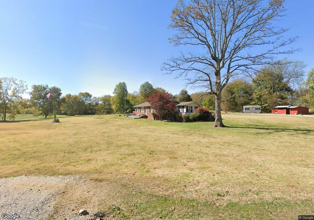
21 Tom Patton Ln Pelham, TN 37366
Estimated Value: $274,000 - $335,894
--
Bed
1
Bath
1,584
Sq Ft
$193/Sq Ft
Est. Value
About This Home
This home is located at 21 Tom Patton Ln, Pelham, TN 37366 and is currently estimated at $304,947, approximately $192 per square foot. 21 Tom Patton Ln is a home located in Grundy County.
Ownership History
Date
Name
Owned For
Owner Type
Purchase Details
Closed on
Nov 13, 2023
Sold by
Patton Edward Lee and Patton Mary Ellen
Bought by
Patton Edward Lee and Patton Jason
Current Estimated Value
Purchase Details
Closed on
Aug 19, 2022
Sold by
Lee Patton Edward
Bought by
Patton Mary Ellen
Purchase Details
Closed on
Aug 5, 2013
Sold by
Patton Mary Ellen
Bought by
Patton Edward Lee
Purchase Details
Closed on
May 10, 2011
Sold by
Patton Mary Ellen
Bought by
Patton Martin Diann
Purchase Details
Closed on
Apr 19, 2010
Sold by
William Patton Tom and William Ellen Mary
Bought by
Patton Edward Lee
Purchase Details
Closed on
Oct 19, 2006
Sold by
Patton Mary Ellen and Patton Tom
Bought by
Grundy County
Purchase Details
Closed on
Apr 20, 1989
Bought by
Patton Tom W and Mary Ellen
Purchase Details
Closed on
Aug 14, 1979
Purchase Details
Closed on
Jan 25, 1975
Create a Home Valuation Report for This Property
The Home Valuation Report is an in-depth analysis detailing your home's value as well as a comparison with similar homes in the area
Home Values in the Area
Average Home Value in this Area
Purchase History
| Date | Buyer | Sale Price | Title Company |
|---|---|---|---|
| Patton Edward Lee | -- | None Listed On Document | |
| Patton Mary Ellen | -- | Shawn C Trail Pc | |
| Patton Edward Lee | -- | Shawn C Trail Pc | |
| Patton Edward Lee | -- | Layne Nelson | |
| Patton Martin Diann | $1,000 | -- | |
| Patton Edward Lee | -- | Cross Paul | |
| Patton Edward Lee | -- | Cross Paul | |
| Grundy County | -- | -- | |
| Patton Tom W | $5,000 | -- | |
| -- | -- | -- | |
| -- | -- | -- |
Source: Public Records
Tax History Compared to Growth
Tax History
| Year | Tax Paid | Tax Assessment Tax Assessment Total Assessment is a certain percentage of the fair market value that is determined by local assessors to be the total taxable value of land and additions on the property. | Land | Improvement |
|---|---|---|---|---|
| 2024 | $924 | $64,825 | $7,100 | $57,725 |
| 2023 | $924 | $73,800 | $16,075 | $57,725 |
| 2022 | $1,143 | $51,625 | $17,325 | $34,300 |
| 2021 | $1,143 | $51,625 | $17,325 | $34,300 |
| 2020 | $1,143 | $51,625 | $17,325 | $34,300 |
| 2019 | $929 | $48,075 | $16,600 | $31,475 |
| 2018 | $929 | $36,600 | $6,750 | $29,850 |
| 2017 | $916 | $36,600 | $6,750 | $29,850 |
| 2016 | $916 | $36,100 | $6,750 | $29,350 |
| 2015 | $916 | $36,100 | $6,750 | $29,350 |
| 2014 | $916 | $36,096 | $0 | $0 |
Source: Public Records
Map
Nearby Homes
- 0 White Ridge Rd
- 0 Laxton Rd Unit RTC2957818
- 0 Providence Rd
- 774 Sherrell Rd
- 11 Jess Long Ln
- 0 Clouse Hill Rd
- 388 Charlie Roberts Rd
- 0 U S Highway 64
- 72 Lady Slipper Ln
- 4012 Payne Cove Rd
- 0 Claiborne View Rd Unit RTC2797207
- 1106 N Bluff Cir
- 0 Deep Woods Rd
- 849 N Bluff Cir
- 9616 Old Alto Hwy
- 256 Vista Vue Trail
- 1863 Lake Louisa Loop
- 375 Nickajack Trail
- 80 Mountain Laurel Ln
- 0 Longview Ln Unit 1510528
- 2521 Sr 50
- 1592 Us 41
- 1212 Us 41
- 8584 Us Highway 50
- 15 Tom Patton Ln
- 1615 U S 41
- 0 State Rt 50 Unit 20133096
- 0 State Rt 50 Unit 1223882
- 0 State Rt 50 Unit 1222288
- 0 State Rt 50 Unit 1196523
- 1279 Us 41
- 1642 Us 41
- 1642 Us Highway 41
- 0 Red Sartain Rd Unit 1944318
- 1174 Us 41
- 1152 Us 41
- 1146 Us 41
- 1664 Us 41
- 1677 Us 41
- 0 Ballpark Rd