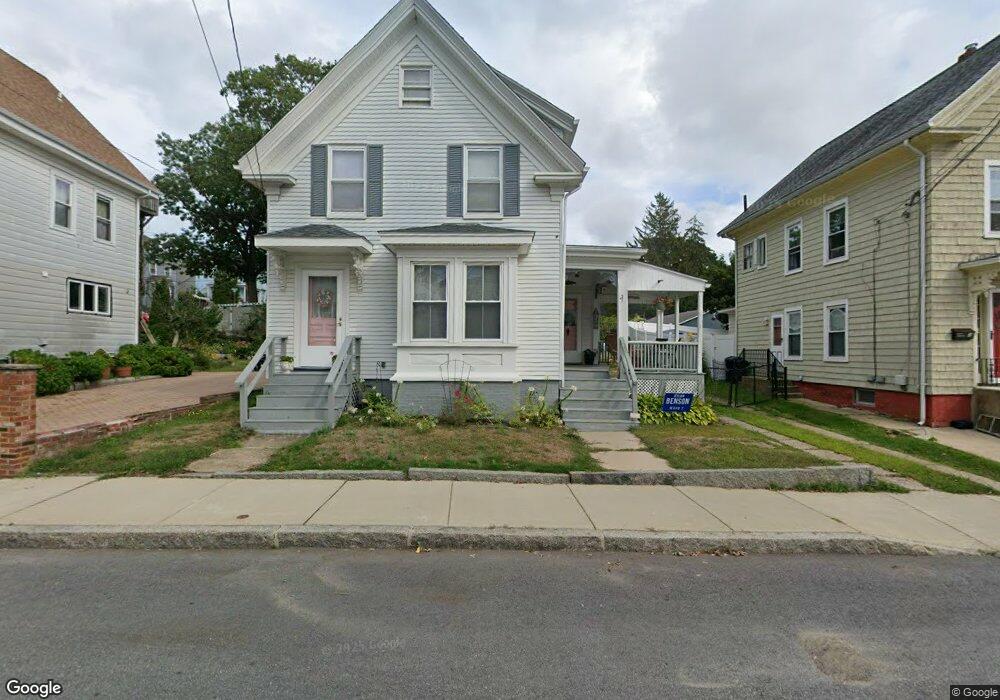
21 Trask St Gloucester, MA 01930
Central Gloucester NeighborhoodEstimated Value: $449,000 - $559,000
3
Beds
1
Bath
1,128
Sq Ft
$463/Sq Ft
Est. Value
About This Home
This home is located at 21 Trask St, Gloucester, MA 01930 and is currently estimated at $521,848, approximately $462 per square foot. 21 Trask St is a home located in Essex County with nearby schools including East Veterans Memorial Elementary, Ralph B O'maley Middle School, and Gloucester High School.
Ownership History
Date
Name
Owned For
Owner Type
Purchase Details
Closed on
Feb 1, 1994
Sold by
Curcuru Nicholas J and Curcuru Donna
Bought by
Parisi Paul T and Parisi Grace
Current Estimated Value
Home Financials for this Owner
Home Financials are based on the most recent Mortgage that was taken out on this home.
Original Mortgage
$75,000
Interest Rate
7.11%
Mortgage Type
Purchase Money Mortgage
Create a Home Valuation Report for This Property
The Home Valuation Report is an in-depth analysis detailing your home's value as well as a comparison with similar homes in the area
Home Values in the Area
Average Home Value in this Area
Purchase History
| Date | Buyer | Sale Price | Title Company |
|---|---|---|---|
| Parisi Paul T | $103,400 | -- |
Source: Public Records
Mortgage History
| Date | Status | Borrower | Loan Amount |
|---|---|---|---|
| Open | Parisi Paul T | $6,024 | |
| Closed | Parisi Paul T | $75,000 |
Source: Public Records
Tax History
| Year | Tax Paid | Tax Assessment Tax Assessment Total Assessment is a certain percentage of the fair market value that is determined by local assessors to be the total taxable value of land and additions on the property. | Land | Improvement |
|---|---|---|---|---|
| 2025 | $4,657 | $479,100 | $138,200 | $340,900 |
| 2024 | $4,597 | $472,500 | $131,600 | $340,900 |
| 2023 | $4,401 | $415,600 | $117,600 | $298,000 |
| 2022 | $4,263 | $363,400 | $102,200 | $261,200 |
| 2021 | $4,115 | $330,800 | $92,900 | $237,900 |
| 2020 | $4,013 | $325,500 | $92,900 | $232,600 |
| 2019 | $3,784 | $298,200 | $92,900 | $205,300 |
| 2018 | $3,597 | $278,200 | $92,900 | $185,300 |
| 2017 | $3,423 | $259,500 | $83,700 | $175,800 |
| 2016 | $3,177 | $233,400 | $83,700 | $149,700 |
| 2015 | $3,029 | $221,900 | $83,700 | $138,200 |
Source: Public Records
Map
Nearby Homes
- 19 Trask St Unit 2
- 50 Warner St
- 40 Sargent St
- 113 Pleasant St
- 12 Arthur St
- 9 Cleveland Place
- 33 Maplewood Ave Unit 310
- 139A Prospect St
- 98 Maplewood Ave
- 13 Mystic Ave
- 8 Mystic Ave
- 191 Main St Unit 3
- 191 Main St Unit 2A
- 36 Eastern Ave
- 120 Washington St
- 6 Monroe Ct
- 35 Middle St Unit 4
- 33 Middle St
- 20 Beacon St
- 20 Beacon St Unit 2
Your Personal Tour Guide
Ask me questions while you tour the home.