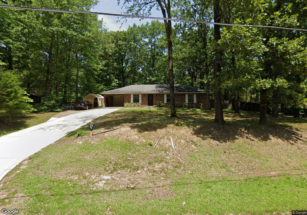
210 Britton Dr Oxford, MS 38655
Estimated Value: $243,000 - $383,000
3
Beds
2
Baths
1,370
Sq Ft
$231/Sq Ft
Est. Value
About This Home
This home is located at 210 Britton Dr, Oxford, MS 38655 and is currently estimated at $316,082, approximately $230 per square foot. 210 Britton Dr is a home located in Lafayette County with nearby schools including Central Elementary School, Bramlett Elementary School, and Della Davidson Elementary School.
Ownership History
Date
Name
Owned For
Owner Type
Purchase Details
Closed on
Feb 28, 2022
Sold by
Harwood Linda P
Bought by
Pearson Marvin E
Current Estimated Value
Home Financials for this Owner
Home Financials are based on the most recent Mortgage that was taken out on this home.
Original Mortgage
$159,200
Outstanding Balance
$146,981
Interest Rate
3.55%
Mortgage Type
New Conventional
Estimated Equity
$169,101
Purchase Details
Closed on
Apr 5, 2005
Sold by
Legrand John Oneal and Legrand Edwin C
Bought by
Harwood Linda P
Create a Home Valuation Report for This Property
The Home Valuation Report is an in-depth analysis detailing your home's value as well as a comparison with similar homes in the area
Purchase History
| Date | Buyer | Sale Price | Title Company |
|---|---|---|---|
| Pearson Marvin E | -- | None Listed On Document | |
| Harwood Linda P | -- | None Available |
Source: Public Records
Mortgage History
| Date | Status | Borrower | Loan Amount |
|---|---|---|---|
| Open | Pearson Marvin E | $159,200 |
Source: Public Records
Tax History
| Year | Tax Paid | Tax Assessment Tax Assessment Total Assessment is a certain percentage of the fair market value that is determined by local assessors to be the total taxable value of land and additions on the property. | Land | Improvement |
|---|---|---|---|---|
| 2025 | $289 | $12,550 | $0 | $0 |
| 2024 | $289 | $10,407 | $0 | $0 |
| 2023 | $295 | $10,407 | $0 | $0 |
| 2022 | $289 | $14,513 | $0 | $0 |
| 2021 | $551 | $14,513 | $0 | $0 |
| 2020 | $531 | $14,352 | $0 | $0 |
| 2019 | $531 | $14,363 | $0 | $0 |
| 2018 | $531 | $14,363 | $0 | $0 |
| 2017 | $531 | $14,363 | $0 | $0 |
| 2016 | $500 | $13,979 | $0 | $0 |
| 2015 | -- | $13,979 | $0 | $0 |
| 2014 | -- | $13,979 | $0 | $0 |
Source: Public Records
Map
Nearby Homes
- 632 Northwoods Trail
- 211 Town Center Dr
- 524 Shreve Oak Cir
- 204 Town Center Dr
- 230 Town Center Dr
- 716 Ironwood Ln
- 701 Ironwood Ln
- 723 Ironwood Ln
- 110 Heights Dr
- 607 Happy Ln
- 3048 Oxford Way
- 3060 Oxford Way
- 29 County Road 140
- 4144 Fieldstone Loop
- 4146 Fieldstone Loop
- 1500 Wilkes Ave
- 4170 Fieldstone Loop
- 4138 Fieldstone Loop
- 1048 Fieldstone Ln
- 1054 Fieldstone Ln
- 206 Britton Dr
- 214 Britton Dr
- 119 Heights Dr
- 217 Britton Dr
- Lot 26 Britton Dr
- NA Britton Dr
- 00 Britton Dr
- 217 Britton Dr
- 213 Britton Dr
- 123 County Road 102
- 201 Britton Dr
- 115 Heights Dr
- 27 Britton Dr
- 124 Heights Dr
- 301 Palmer Dr
- 215 Britton Dr
- 130 Heights Dr
- 127 County Road 102
- 127 Cr 102
- 204 Town Center Dr Unit 35
Your Personal Tour Guide
Ask me questions while you tour the home.