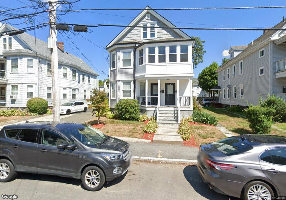
210 Brown St Unit 212 Waltham, MA 02453
South Side NeighborhoodEstimated Value: $1,064,000 - $1,160,000
4
Beds
3
Baths
2,812
Sq Ft
$391/Sq Ft
Est. Value
About This Home
This home is located at 210 Brown St Unit 212, Waltham, MA 02453 and is currently estimated at $1,099,365, approximately $390 per square foot. 210 Brown St Unit 212 is a home located in Middlesex County with nearby schools including Henry Whittemore Elementary School, John W. Mcdevitt Middle School, and Waltham Sr High School.
Ownership History
Date
Name
Owned For
Owner Type
Purchase Details
Closed on
Aug 22, 2025
Sold by
Preys Candace M and Preys Joseph F
Bought by
Mcardle Cyril and Mcardle Cristin
Current Estimated Value
Home Financials for this Owner
Home Financials are based on the most recent Mortgage that was taken out on this home.
Original Mortgage
$735,000
Outstanding Balance
$733,723
Interest Rate
6.72%
Mortgage Type
Purchase Money Mortgage
Estimated Equity
$365,642
Purchase Details
Closed on
Oct 4, 2016
Sold by
Preys Matthew J
Bought by
Preys Joseph F and Preys Candace M
Purchase Details
Closed on
Aug 1, 2012
Sold by
Preys Joseph J
Bought by
Preys Matthew J
Purchase Details
Closed on
Apr 27, 2007
Sold by
Preys Candace M and Preys Jospeh F
Bought by
Preys Candace M and Preys Joseph F
Purchase Details
Closed on
Mar 20, 2007
Sold by
Preys Joseph J and Preys Patricia A
Bought by
Preys Joseph J
Purchase Details
Closed on
Nov 10, 2006
Sold by
Preys Candace M and Preys Joseph F
Bought by
Preys Candace M and Preys Joseph F
Home Financials for this Owner
Home Financials are based on the most recent Mortgage that was taken out on this home.
Original Mortgage
$60,000
Interest Rate
6.31%
Purchase Details
Closed on
Jan 18, 2006
Sold by
Foley Alfred J and Foley Lorraine E
Bought by
Preys Candace M and Preys Joseph F
Create a Home Valuation Report for This Property
The Home Valuation Report is an in-depth analysis detailing your home's value as well as a comparison with similar homes in the area
Home Values in the Area
Average Home Value in this Area
Purchase History
| Date | Buyer | Sale Price | Title Company |
|---|---|---|---|
| Mcardle Cyril | $1,050,000 | -- | |
| Mcardle Cyril | $1,050,000 | -- | |
| Preys Joseph F | -- | -- | |
| Preys Joseph F | -- | -- | |
| Preys Matthew J | -- | -- | |
| Preys Matthew J | -- | -- | |
| Preys Matthew J | -- | -- | |
| Preys Candace M | -- | -- | |
| Preys Candace M | -- | -- | |
| Preys Candace M | -- | -- | |
| Preys Joseph J | -- | -- | |
| Preys Joseph J | -- | -- | |
| Preys Joseph J | -- | -- | |
| Preys Candace M | -- | -- | |
| Preys Candace M | -- | -- | |
| Preys Candace M | -- | -- | |
| Preys Candace M | $525,000 | -- | |
| Preys Candace M | $525,000 | -- | |
| Preys Candace M | $525,000 | -- |
Source: Public Records
Mortgage History
| Date | Status | Borrower | Loan Amount |
|---|---|---|---|
| Open | Mcardle Cyril | $735,000 | |
| Closed | Mcardle Cyril | $735,000 | |
| Previous Owner | Preys Candace M | $60,000 |
Source: Public Records
Tax History Compared to Growth
Tax History
| Year | Tax Paid | Tax Assessment Tax Assessment Total Assessment is a certain percentage of the fair market value that is determined by local assessors to be the total taxable value of land and additions on the property. | Land | Improvement |
|---|---|---|---|---|
| 2025 | $8,300 | $845,200 | $363,600 | $481,600 |
| 2024 | $7,678 | $796,500 | $363,600 | $432,900 |
| 2023 | $7,725 | $748,500 | $331,200 | $417,300 |
| 2022 | $7,818 | $701,800 | $302,400 | $399,400 |
| 2021 | $7,392 | $653,000 | $273,600 | $379,400 |
| 2020 | $7,310 | $611,700 | $259,200 | $352,500 |
| 2019 | $6,871 | $542,700 | $256,600 | $286,100 |
| 2018 | $6,197 | $491,400 | $237,600 | $253,800 |
| 2017 | $5,901 | $469,800 | $216,000 | $253,800 |
| 2016 | $5,442 | $444,600 | $190,800 | $253,800 |
| 2015 | $5,201 | $396,100 | $187,200 | $208,900 |
Source: Public Records
Map
Nearby Homes
- 25 Tolman St Unit 2
- 138 Myrtle St Unit 2
- 24 Tolman St Unit A
- 81 Alder St
- 162 Myrtle St Unit 1
- 312 Newton St Unit 1A
- 47 Alder St Unit 6
- 40 Myrtle St Unit 9
- 308 Newton St Unit 1
- 42 Alder St
- 31-37 Washington Ave
- 15 Alder St Unit 1
- 39 Clinton St Unit 2
- 39 Clinton St Unit 1
- 659 Moody St Unit 2
- 61 Hall St Unit 9
- 61 Hall St Unit 7
- 75 Cherry St
- 73 Orange St Unit 2
- 9 John St
- 206 Brown St Unit 208
- 214 Brown St Unit 3
- 216 Brown St Unit 216
- 214 Brown St Unit 216
- 214 Brown St Unit 1
- 214 Brown St Unit 2
- 214 Brown St Unit 214
- 218 Brown St Unit 4
- 218 Brown St Unit 3
- 218 Brown St Unit 2
- 218 Brown St Unit 1
- 211 Ash St
- 202 Brown St Unit 204
- 213 Ash St
- 209 Ash St Unit 2
- 213 Brown St
- 224 Brown St Unit 1
- 224 Brown St Unit 224
- 222 Brown St Unit 224
- 215 Ash St Unit 4