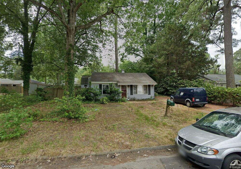
210 Forrest St Hampton, VA 23669
Willow Oaks NeighborhoodEstimated Value: $234,000 - $269,000
3
Beds
2
Baths
1,080
Sq Ft
$232/Sq Ft
Est. Value
About This Home
This home is located at 210 Forrest St, Hampton, VA 23669 and is currently estimated at $250,302, approximately $231 per square foot. 210 Forrest St is a home located in Hampton City with nearby schools including Albert W. Patrick III Elementary School, Benjamin Syms Middle School, and Kecoughtan High School.
Ownership History
Date
Name
Owned For
Owner Type
Purchase Details
Closed on
Nov 24, 2015
Sold by
Ferris Kathleen O
Bought by
Folsom Trevor S
Current Estimated Value
Home Financials for this Owner
Home Financials are based on the most recent Mortgage that was taken out on this home.
Original Mortgage
$133,536
Outstanding Balance
$105,317
Interest Rate
3.87%
Mortgage Type
FHA
Estimated Equity
$144,985
Create a Home Valuation Report for This Property
The Home Valuation Report is an in-depth analysis detailing your home's value as well as a comparison with similar homes in the area
Home Values in the Area
Average Home Value in this Area
Purchase History
| Date | Buyer | Sale Price | Title Company |
|---|---|---|---|
| Folsom Trevor S | $136,000 | Home Title Of Virginia Llc |
Source: Public Records
Mortgage History
| Date | Status | Borrower | Loan Amount |
|---|---|---|---|
| Open | Folsom Trevor S | $133,536 |
Source: Public Records
Tax History
| Year | Tax Paid | Tax Assessment Tax Assessment Total Assessment is a certain percentage of the fair market value that is determined by local assessors to be the total taxable value of land and additions on the property. | Land | Improvement |
|---|---|---|---|---|
| 2025 | $2,946 | $255,600 | $50,000 | $205,600 |
| 2024 | $2,683 | $233,300 | $50,000 | $183,300 |
| 2023 | $2,344 | $202,100 | $50,000 | $152,100 |
| 2022 | $2,087 | $176,900 | $45,000 | $131,900 |
| 2021 | $2,223 | $152,700 | $40,000 | $112,700 |
| 2020 | $1,716 | $138,400 | $30,000 | $108,400 |
| 2019 | $1,716 | $138,400 | $30,000 | $108,400 |
| 2018 | $1,584 | $140,600 | $30,000 | $110,600 |
| 2017 | $1,837 | $0 | $0 | $0 |
| 2016 | $1,837 | $140,600 | $0 | $0 |
| 2015 | $1,358 | $0 | $0 | $0 |
| 2014 | $1,367 | $101,900 | $30,000 | $71,900 |
Source: Public Records
Map
Nearby Homes
- 201 Shawen Dr
- 7 White Oak Trail
- 312 Shawen Dr
- 16 Riverchase Dr
- 400 Cedar Dr
- 12 Kingslee Ln
- 23 Long Bridge Rd
- 105 Glenwood Rd
- 161 Chickamauga Pike
- 69 W Little Back River Rd
- 67 W Little Back River Rd
- 4 Crew House Rising
- 2 Boeing Ave
- 19 Michele Dr
- 222 Clemwood Pkwy
- 73 Longwood Dr
- 39 Longwood Dr
- 1263 N King St
- 118 Margaret Dr
- 35 Westover St
- 208 Forrest St
- 207 Pine Grove Ave
- 205 Pine Grove Ave
- 206 Forrest St
- 203 Pine Grove Ave
- 211 Walnut St
- 209 Walnut St
- 211 Pine Grove Ave
- 204 Forrest St
- 207 Walnut St
- 211 Forrest St
- 209 Forrest St
- 207 Forrest St
- 205 Walnut St
- 202 Forrest St
- 213 Pine Grove Ave
- 205 Forrest St
- 208 Pine Grove Ave
- 203 Walnut St
- 206 Pine Grove Ave
Your Personal Tour Guide
Ask me questions while you tour the home.