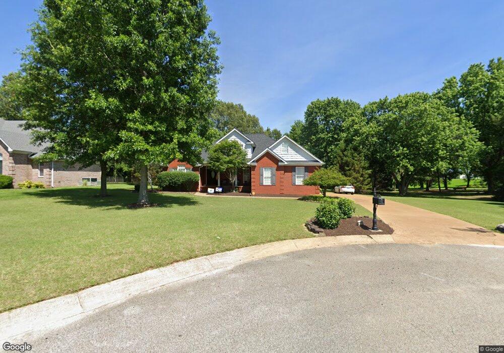
210 Larkin Dr Martin, TN 38237
Estimated Value: $434,676 - $593,000
3
Beds
4
Baths
2,414
Sq Ft
$207/Sq Ft
Est. Value
About This Home
This home is located at 210 Larkin Dr, Martin, TN 38237 and is currently estimated at $499,419, approximately $206 per square foot. 210 Larkin Dr is a home located in Weakley County with nearby schools including Central Christian Academy and Unity Christian School.
Ownership History
Date
Name
Owned For
Owner Type
Purchase Details
Closed on
Jul 7, 2017
Sold by
Spencer Sherri
Bought by
Mcguffin Kurt Michael and Mcguffin Jessica Ann
Current Estimated Value
Home Financials for this Owner
Home Financials are based on the most recent Mortgage that was taken out on this home.
Original Mortgage
$236,000
Outstanding Balance
$195,450
Interest Rate
3.95%
Mortgage Type
New Conventional
Estimated Equity
$303,969
Purchase Details
Closed on
Apr 30, 2007
Sold by
Butler Larry W and Butler Chris
Bought by
Danny Spencer
Purchase Details
Closed on
May 1, 2006
Sold by
Tyner Janey C
Bought by
Butler Larry W
Purchase Details
Closed on
Apr 30, 1998
Sold by
Austin Jon L
Bought by
Tyner Janey C
Create a Home Valuation Report for This Property
The Home Valuation Report is an in-depth analysis detailing your home's value as well as a comparison with similar homes in the area
Home Values in the Area
Average Home Value in this Area
Purchase History
| Date | Buyer | Sale Price | Title Company |
|---|---|---|---|
| Mcguffin Kurt Michael | $295,000 | None Available | |
| Danny Spencer | $267,187 | -- | |
| Butler Larry W | $23,000 | -- | |
| Tyner Janey C | $24,000 | -- |
Source: Public Records
Mortgage History
| Date | Status | Borrower | Loan Amount |
|---|---|---|---|
| Open | Mcguffin Kurt Michael | $236,000 |
Source: Public Records
Tax History
| Year | Tax Paid | Tax Assessment Tax Assessment Total Assessment is a certain percentage of the fair market value that is determined by local assessors to be the total taxable value of land and additions on the property. | Land | Improvement |
|---|---|---|---|---|
| 2025 | -- | $110,400 | $9,125 | $101,275 |
| 2024 | -- | $110,400 | $9,125 | $101,275 |
| 2023 | $3,332 | $110,400 | $9,125 | $101,275 |
| 2022 | $2,713 | $72,800 | $6,900 | $65,900 |
| 2021 | $2,713 | $72,800 | $6,900 | $65,900 |
| 2020 | $2,713 | $72,800 | $6,900 | $65,900 |
| 2019 | $2,458 | $72,800 | $6,900 | $65,900 |
| 2018 | $2,458 | $72,800 | $6,900 | $65,900 |
| 2017 | $2,495 | $68,700 | $5,750 | $62,950 |
| 2016 | $2,495 | $68,700 | $0 | $0 |
| 2015 | $2,495 | $68,703 | $0 | $0 |
| 2014 | $2,495 | $68,703 | $0 | $0 |
Source: Public Records
Map
Nearby Homes
- 206 S Dodd Dr
- 0 Hawks Rd Unit Brooks
- 110 Hidden Hill Cove
- 130 Hidden Hill Cove
- 933 University St
- 138 Tennessee 431
- 137 Courtright Rd
- 157 Mockingbird Ln
- 0 Skyhawk Pkwy Unit Brooks RRA45195
- 121 Tyler Austin Rd
- 0 Kennedy Dr Unit RRA40830
- 0 Kennedy Dr Unit 187533
- 126 Lilly Pond Ln
- 322 Mount Pelia Rd
- 338 Mount Pelia Rd
- 462 Jowers Rd
- 137 Boyte Dr
- 128 Baker Rd
- 101 Baker Rd
- 107 Baker Rd
Your Personal Tour Guide
Ask me questions while you tour the home.