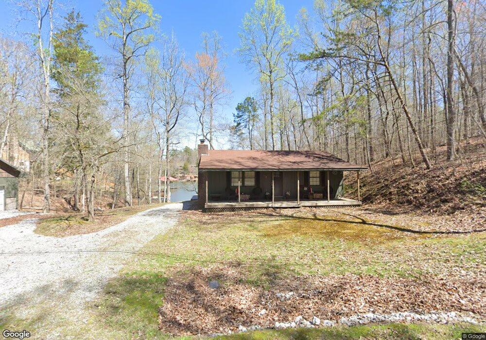
210 Pearl Harbor Dr Ten Mile, TN 37880
Estimated Value: $399,000 - $541,000
2
Beds
1
Bath
960
Sq Ft
$495/Sq Ft
Est. Value
About This Home
This home is located at 210 Pearl Harbor Dr, Ten Mile, TN 37880 and is currently estimated at $474,810, approximately $494 per square foot. 210 Pearl Harbor Dr is a home located in Meigs County with nearby schools including Meigs County High School.
Ownership History
Date
Name
Owned For
Owner Type
Purchase Details
Closed on
Jun 7, 2016
Sold by
Carroll Jerry W
Bought by
Cook Sean Edward and Cook Melanie Shannon
Current Estimated Value
Home Financials for this Owner
Home Financials are based on the most recent Mortgage that was taken out on this home.
Original Mortgage
$147,050
Outstanding Balance
$116,718
Interest Rate
3.57%
Mortgage Type
New Conventional
Estimated Equity
$358,092
Purchase Details
Closed on
Jun 26, 1984
Bought by
Carroll Jerry W and Carroll Linda G
Purchase Details
Closed on
Oct 28, 1980
Create a Home Valuation Report for This Property
The Home Valuation Report is an in-depth analysis detailing your home's value as well as a comparison with similar homes in the area
Home Values in the Area
Average Home Value in this Area
Purchase History
| Date | Buyer | Sale Price | Title Company |
|---|---|---|---|
| Cook Sean Edward | $173,000 | -- | |
| Cook Sean Edward | $173,000 | -- | |
| Carroll Jerry W | -- | -- | |
| Carroll Jerry W | -- | -- | |
| -- | -- | -- | |
| -- | -- | -- |
Source: Public Records
Mortgage History
| Date | Status | Borrower | Loan Amount |
|---|---|---|---|
| Open | Cook Sean Edward | $147,050 | |
| Closed | Cook Sean Edward | $147,050 |
Source: Public Records
Tax History Compared to Growth
Tax History
| Year | Tax Paid | Tax Assessment Tax Assessment Total Assessment is a certain percentage of the fair market value that is determined by local assessors to be the total taxable value of land and additions on the property. | Land | Improvement |
|---|---|---|---|---|
| 2025 | $1,029 | $60,925 | $0 | $0 |
| 2024 | $1,029 | $60,925 | $27,500 | $33,425 |
| 2023 | $1,029 | $60,925 | $27,500 | $33,425 |
| 2022 | $1,029 | $60,925 | $27,500 | $33,425 |
| 2021 | $1,029 | $60,925 | $27,500 | $33,425 |
| 2020 | $978 | $60,925 | $27,500 | $33,425 |
| 2019 | $978 | $49,350 | $23,750 | $25,600 |
| 2018 | $919 | $49,350 | $23,750 | $25,600 |
| 2017 | $919 | $46,400 | $23,750 | $22,650 |
| 2016 | $919 | $46,400 | $23,750 | $22,650 |
| 2015 | $869 | $46,400 | $23,750 | $22,650 |
| 2014 | $700 | $37,375 | $18,375 | $19,000 |
Source: Public Records
Map
Nearby Homes
- 0 Pearl Harbor Unit 670607
- 202 Pearl Harbor Dr
- 225 Pearl Harbor Dr
- 225 Pearl Harbor Dr Unit R-247
- 244 Pearl Harbor Dr
- 205 Pearl Harbor Dr
- 262 Pearl Harbor Dr
- 157 Lakeside Ln
- 195 Pearl Harbor Dr
- 185 Pearl Harbor Dr
- 155 Pearl Harbor Dr
- 173 Lakeside Ln
- 409 Red Cloud Ln
- 320 Pearl Harbor Dr
- 533 Red Cloud Ln
- 563 Red Cloud Ln
- 207 Lakeside Ln
- 436 Red Cloud Ln
- 0 Red Cloud Ln Unit RTC2960188
- 0 Red Cloud Ln Unit 1342040