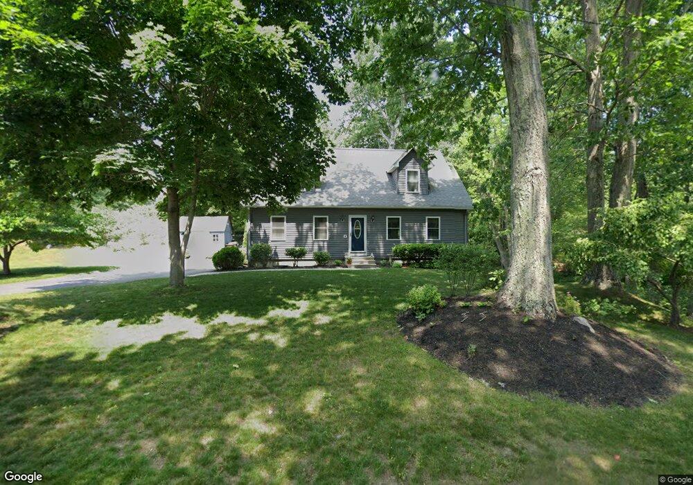
210 Rochdale St Auburn, MA 01501
West Auburn NeighborhoodEstimated Value: $441,000 - $526,000
4
Beds
3
Baths
1,856
Sq Ft
$257/Sq Ft
Est. Value
About This Home
This home is located at 210 Rochdale St, Auburn, MA 01501 and is currently estimated at $477,340, approximately $257 per square foot. 210 Rochdale St is a home located in Worcester County with nearby schools including Auburn Senior High School, Canterbury Street School, and Shrewsbury Montessori School - Auburn Campus.
Ownership History
Date
Name
Owned For
Owner Type
Purchase Details
Closed on
Apr 28, 1995
Sold by
Delollis David
Bought by
Blais Steven M and Blais Karen
Current Estimated Value
Home Financials for this Owner
Home Financials are based on the most recent Mortgage that was taken out on this home.
Original Mortgage
$90,750
Interest Rate
8.33%
Mortgage Type
Purchase Money Mortgage
Create a Home Valuation Report for This Property
The Home Valuation Report is an in-depth analysis detailing your home's value as well as a comparison with similar homes in the area
Home Values in the Area
Average Home Value in this Area
Purchase History
| Date | Buyer | Sale Price | Title Company |
|---|---|---|---|
| Blais Steven M | $89,000 | -- |
Source: Public Records
Mortgage History
| Date | Status | Borrower | Loan Amount |
|---|---|---|---|
| Open | Blais Steven M | $124,844 | |
| Closed | Blais Steven M | $92,300 | |
| Closed | Blais Steven M | $90,750 |
Source: Public Records
Tax History Compared to Growth
Tax History
| Year | Tax Paid | Tax Assessment Tax Assessment Total Assessment is a certain percentage of the fair market value that is determined by local assessors to be the total taxable value of land and additions on the property. | Land | Improvement |
|---|---|---|---|---|
| 2025 | $53 | $370,000 | $107,700 | $262,300 |
| 2024 | $5,388 | $360,900 | $103,600 | $257,300 |
| 2023 | $5,304 | $334,000 | $94,200 | $239,800 |
| 2022 | $4,911 | $292,000 | $94,200 | $197,800 |
| 2021 | $3,898 | $258,100 | $83,200 | $174,900 |
| 2020 | $4,491 | $249,800 | $83,200 | $166,600 |
| 2019 | $4,439 | $241,000 | $82,400 | $158,600 |
| 2018 | $4,287 | $232,500 | $77,100 | $155,400 |
| 2017 | $0 | $225,200 | $69,800 | $155,400 |
| 2016 | $4,029 | $222,700 | $72,000 | $150,700 |
| 2015 | $3,751 | $217,300 | $72,000 | $145,300 |
| 2014 | $3,640 | $210,500 | $68,700 | $141,800 |
Source: Public Records
Map
Nearby Homes
- Lot 2 Leicester St
- 37 Inwood Rd
- 30 Briarcliff Dr
- 88 Wallace Ave
- 3 Old Cart Rd
- 7 Sara Dr
- 707 Stafford St
- 19-20 Williams St
- 28 Lorna Dr
- 381 Oxford St N
- 16 Homestead Ave
- 177 Oxford St N
- 88 Vine St
- 5 Main St
- 19 Virginia Dr Unit 19
- 6 Ryans Way Unit 6
- 34 Rockland Rd
- 25 Vinal St Unit 30
- 177 Boyce St
- 35 Pinehurst Ave
- 208 Rochdale St
- 191 Rochdale St
- 189 Rochdale St
- 206 Rochdale St
- 195 Rochdale St
- 197 Rochdale St
- 187 Rochdale St
- 204 Rochdale St
- 0 Leicester St
- 199 Rochdale St
- 13 Drake Ct
- 2 Rotary Rd
- 404 Leicester St
- 4 Rotary Rd
- 401 Leicester St
- 185 Rochdale St
- 403 Leicester St
- 19 Drake Ct
- 21 Drake Ct
- 200 Rochdale St