Estimated Value: $186,260 - $205,000
--
Bed
1
Bath
850
Sq Ft
$231/Sq Ft
Est. Value
About This Home
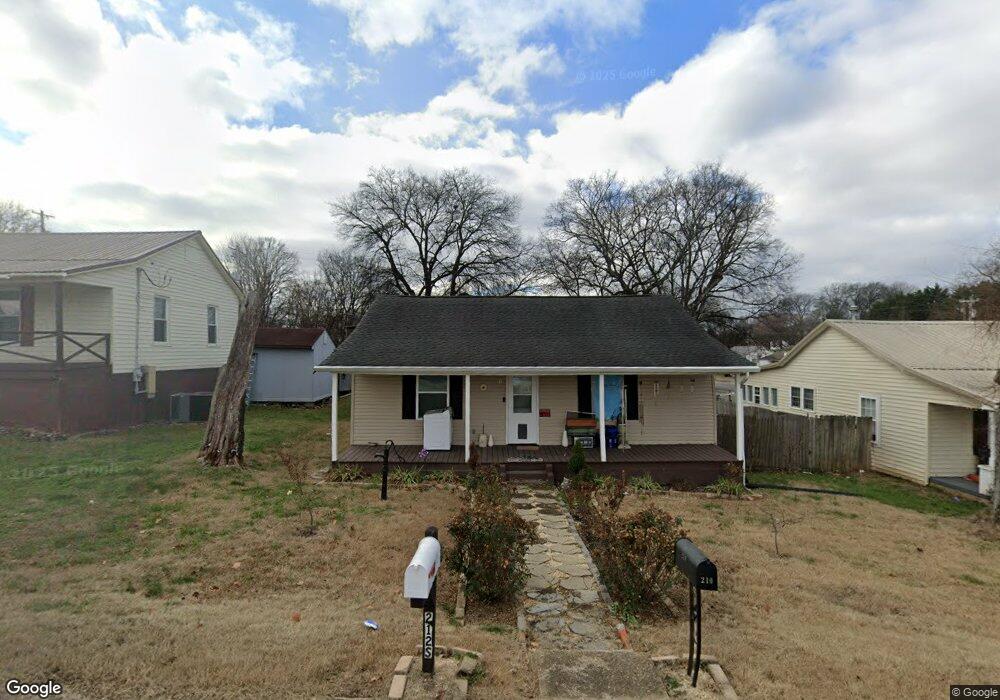
This home is located at 210 S Rankin Rd, Alcoa, TN 37701 and is currently estimated at $196,565, approximately $231 per square foot. 210 S Rankin Rd is a home located in Blount County with nearby schools including Alcoa Elementary School, Alcoa Middle School, and Alcoa High School.
Ownership History
Date
Name
Owned For
Owner Type
Purchase Details
Closed on
Sep 15, 2017
Bought by
Pollard John M
Current Estimated Value
Home Financials for this Owner
Home Financials are based on the most recent Mortgage that was taken out on this home.
Original Mortgage
$76,000
Outstanding Balance
$63,448
Interest Rate
3.89%
Mortgage Type
New Conventional
Estimated Equity
$133,117
Purchase Details
Closed on
Sep 22, 2004
Bought by
Stewart John E and Stewart Elizabeth
Home Financials for this Owner
Home Financials are based on the most recent Mortgage that was taken out on this home.
Original Mortgage
$42,750
Interest Rate
5.75%
Purchase Details
Closed on
Mar 1, 1994
Bought by
Herzburn Eric S and Herzburn Janet H
Purchase Details
Closed on
Dec 27, 1984
Bought by
Bryant Norman Kenneth
Purchase Details
Closed on
Jan 1, 1984
Create a Home Valuation Report for This Property
The Home Valuation Report is an in-depth analysis detailing your home's value as well as a comparison with similar homes in the area
Home Values in the Area
Average Home Value in this Area
Purchase History
| Date | Buyer | Sale Price | Title Company |
|---|---|---|---|
| Pollard John M | $95,000 | -- | |
| Stewart John E | $47,500 | -- | |
| Herzburn Eric S | $62,000 | -- | |
| Bryant Norman Kenneth | -- | -- | |
| -- | $15,800 | -- |
Source: Public Records
Mortgage History
| Date | Status | Borrower | Loan Amount |
|---|---|---|---|
| Open | Pollard John M | $76,000 | |
| Previous Owner | Not Available | $42,750 |
Source: Public Records
Tax History Compared to Growth
Tax History
| Year | Tax Paid | Tax Assessment Tax Assessment Total Assessment is a certain percentage of the fair market value that is determined by local assessors to be the total taxable value of land and additions on the property. | Land | Improvement |
|---|---|---|---|---|
| 2024 | $1,166 | $35,550 | $8,750 | $26,800 |
| 2023 | $1,166 | $35,550 | $8,750 | $26,800 |
| 2022 | $1,171 | $24,700 | $7,500 | $17,200 |
| 2021 | $1,171 | $24,700 | $7,500 | $17,200 |
| 2020 | $1,171 | $24,700 | $7,500 | $17,200 |
| 2019 | $1,171 | $24,700 | $7,500 | $17,200 |
| 2018 | $488 | $11,000 | $4,050 | $6,950 |
| 2017 | $488 | $11,000 | $4,050 | $6,950 |
| 2016 | $488 | $11,000 | $4,050 | $6,950 |
| 2015 | $450 | $10,950 | $4,050 | $6,900 |
| 2014 | $543 | $10,950 | $4,050 | $6,900 |
| 2013 | $543 | $13,200 | $0 | $0 |
Source: Public Records
Map
Nearby Homes
- 239 Lindsay St
- 250 S Rankin Rd
- 255 Sanderson St
- 252 Glascock St
- 227 Gill St
- 233 Olympia Dr
- 124 Olympia Dr
- 304 W Lincoln Rd
- 0 Hannum St
- 111 Regal Tower
- 106 Regal Tower
- 110 Regal Tower
- 607 Regal Tower
- 218 Burns St
- 161 E Harper Ave
- 135 E Harper Ave
- 450 E Church Ave
- 125 E Harper Ave
- 1208 Madison Ave
- 410 E Church Ave
- 216 S Rankin Rd
- 206 S Rankin Rd
- 222 S Rankin Rd
- 219 Lindsay St
- 205 Rankin Rd
- 228 S Rankin Rd
- 168 S Rankin Rd
- 225 Lindsay St
- 220 Sanderson St
- 232 S Rankin Rd
- 0 S Rankin Rd
- 231 Lindsay St
- 162 S Rankin Rd
- 220 Lindsay St
- 224 Sanderson St
- 226 Lindsay St
- 230 Sanderson St
- S S Rankin Rd
- 156 S Rankin Rd
- 232 Lindsay St