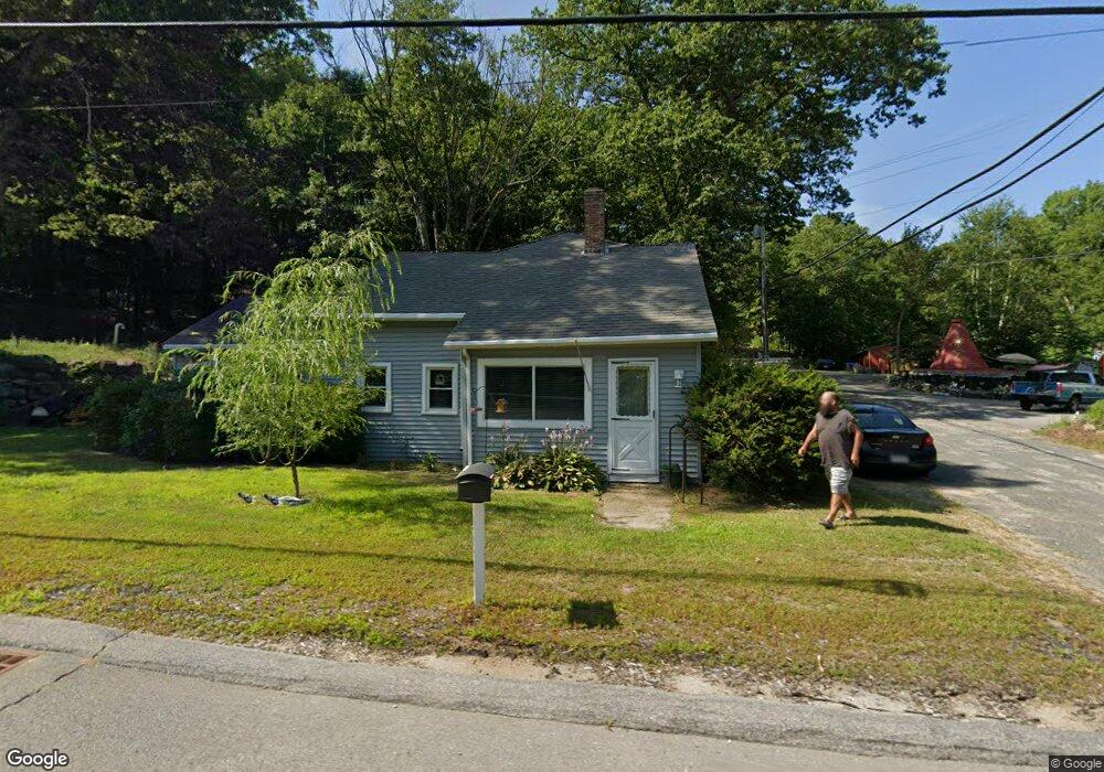
210 State Rd Phillipston, MA 01331
Estimated Value: $356,000 - $496,000
4
Beds
2
Baths
2,515
Sq Ft
$169/Sq Ft
Est. Value
About This Home
This home is located at 210 State Rd, Phillipston, MA 01331 and is currently estimated at $423,891, approximately $168 per square foot. 210 State Rd is a home located in Worcester County with nearby schools including Narragansett Regional High School.
Ownership History
Date
Name
Owned For
Owner Type
Purchase Details
Closed on
Jun 3, 2011
Sold by
Mhfa
Bought by
Martel Tamie M
Current Estimated Value
Purchase Details
Closed on
Dec 21, 2009
Sold by
Roberts Gary R
Bought by
Mhfa
Purchase Details
Closed on
Sep 1, 2000
Sold by
Patrick James B and Wallace Jay A
Bought by
Roberts Gary R
Home Financials for this Owner
Home Financials are based on the most recent Mortgage that was taken out on this home.
Original Mortgage
$92,150
Interest Rate
8.16%
Mortgage Type
Purchase Money Mortgage
Purchase Details
Closed on
Aug 12, 1994
Sold by
Orange Sb
Bought by
Patrick James B and Wallace Jay A
Home Financials for this Owner
Home Financials are based on the most recent Mortgage that was taken out on this home.
Original Mortgage
$38,500
Interest Rate
8.52%
Mortgage Type
Purchase Money Mortgage
Purchase Details
Closed on
Apr 22, 1994
Sold by
Geffert William R
Bought by
Orange Sb
Create a Home Valuation Report for This Property
The Home Valuation Report is an in-depth analysis detailing your home's value as well as a comparison with similar homes in the area
Home Values in the Area
Average Home Value in this Area
Purchase History
| Date | Buyer | Sale Price | Title Company |
|---|---|---|---|
| Martel Tamie M | $40,000 | -- | |
| Mhfa | $60,000 | -- | |
| Roberts Gary R | $95,000 | -- | |
| Patrick James B | $27,300 | -- | |
| Orange Sb | $26,500 | -- |
Source: Public Records
Mortgage History
| Date | Status | Borrower | Loan Amount |
|---|---|---|---|
| Previous Owner | Orange Sb | $25,000 | |
| Previous Owner | Orange Sb | $92,150 | |
| Previous Owner | Orange Sb | $38,500 |
Source: Public Records
Tax History
| Year | Tax Paid | Tax Assessment Tax Assessment Total Assessment is a certain percentage of the fair market value that is determined by local assessors to be the total taxable value of land and additions on the property. | Land | Improvement |
|---|---|---|---|---|
| 2025 | $3,956 | $351,000 | $43,400 | $307,600 |
| 2024 | $3,991 | $333,100 | $41,300 | $291,800 |
| 2023 | $3,947 | $307,400 | $41,300 | $266,100 |
| 2022 | $3,407 | $228,600 | $31,000 | $197,600 |
| 2021 | $6,502 | $211,500 | $31,000 | $180,500 |
| 2020 | $8,407 | $202,900 | $31,000 | $171,900 |
| 2018 | $8,043 | $181,300 | $30,000 | $151,300 |
| 2017 | $2,911 | $174,500 | $30,000 | $144,500 |
| 2016 | $2,949 | $174,600 | $30,000 | $144,600 |
| 2015 | $2,689 | $171,300 | $37,000 | $134,300 |
| 2014 | $2,790 | $171,300 | $37,000 | $134,300 |
Source: Public Records
Map
Nearby Homes
- 145 Baldwinville Rd
- lot 53 Secret Lake Rd
- 555 Highland Ave
- 554 Highland Ave
- 102 Lyons Hill Rd
- 198 S Royalston Rd
- 1 Carruth Rd
- 180 Petersham Rd
- 12 King Rd
- 0 Lyons Hill Rd
- 240 Barre Rd
- Lot 3 Petersham Rd
- Lot-2 Petersham Rd
- 0 Burma Rd N
- 0 Miles Rd
- 53 Lake Ellis Rd
- Lot 2 S Royalston Rd
- 321 Doe Valley Rd
- 1386 Pleasant St
- 140 Spring St
- LOT D2 Blake Corner Rd
- Lot E State Rd
- L-31 Highland Ave
- LOT 2 Lincoln Rd
- LOT 4 Barre Rd
- LOT 8 Willis Rd
- LOT123 Petersham Rd
- 200 State Rd
- 230 State Rd
- 5 Blake Corner Rd
- 250 State Rd
- 15 Blake Corner Rd
- 240 Athol Rd
- 20 Old Highland Ave
- 25 Blake Corner Rd
- 40 Old Highland Ave
- 45 Old Highland Ave
- 160 State Rd
- 235 Athol Rd
- 0 Athol Road Route 32 Unit 72026797
Your Personal Tour Guide
Ask me questions while you tour the home.