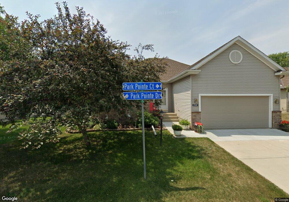
2100 Park Pointe Dr Northfield, MN 55057
Estimated Value: $340,674 - $458,000
2
Beds
2
Baths
2,984
Sq Ft
$133/Sq Ft
Est. Value
About This Home
This home is located at 2100 Park Pointe Dr, Northfield, MN 55057 and is currently estimated at $397,169, approximately $133 per square foot. 2100 Park Pointe Dr is a home located in Rice County with nearby schools including Bridgewater Elementary School, Northfield Middle School, and Northfield Senior High School.
Ownership History
Date
Name
Owned For
Owner Type
Purchase Details
Closed on
Jun 19, 2020
Sold by
Gustafson Reuben F and Gustafson Joan K
Bought by
Johnston Robert and Johnston Maxine
Current Estimated Value
Purchase Details
Closed on
Feb 13, 2020
Sold by
Gustafson Reuben F and Gustafson Joan K
Bought by
Gustafson Reuben F
Purchase Details
Closed on
Dec 1, 2006
Sold by
Olson Brothers Construction Inc
Bought by
Gustafson Reuben F and Gustafson Joan K
Purchase Details
Closed on
Jul 31, 2006
Sold by
Renander Hubert B and Renander Susan A
Bought by
Olson Brothers Construction Inc
Purchase Details
Closed on
Jan 3, 2000
Sold by
Jasnoch Family Ltd Partnership
Bought by
Renander Hubert B and Renander Susan A
Create a Home Valuation Report for This Property
The Home Valuation Report is an in-depth analysis detailing your home's value as well as a comparison with similar homes in the area
Home Values in the Area
Average Home Value in this Area
Purchase History
| Date | Buyer | Sale Price | Title Company |
|---|---|---|---|
| Johnston Robert | $269,900 | Knight Barry Ttl United Llc | |
| Gustafson Reuben F | -- | None Available | |
| Gustafson Reuben F | -- | -- | |
| Olson Brothers Construction Inc | $50,000 | -- | |
| Renander Hubert B | $29,000 | -- |
Source: Public Records
Tax History Compared to Growth
Tax History
| Year | Tax Paid | Tax Assessment Tax Assessment Total Assessment is a certain percentage of the fair market value that is determined by local assessors to be the total taxable value of land and additions on the property. | Land | Improvement |
|---|---|---|---|---|
| 2025 | $3,198 | $340,900 | $69,000 | $271,900 |
| 2024 | $4,910 | $319,400 | $64,000 | $255,400 |
| 2023 | $4,570 | $319,400 | $64,000 | $255,400 |
| 2022 | $4,174 | $290,800 | $56,000 | $234,800 |
| 2021 | $4,050 | $260,000 | $45,000 | $215,000 |
| 2020 | $4,124 | $249,500 | $45,000 | $204,500 |
| 2019 | $3,916 | $248,700 | $45,000 | $203,700 |
| 2018 | $3,822 | $234,300 | $45,000 | $189,300 |
| 2017 | $3,244 | $225,200 | $45,000 | $180,200 |
| 2016 | $3,240 | $209,800 | $45,000 | $164,800 |
| 2015 | $2,944 | $200,200 | $45,000 | $155,200 |
| 2014 | -- | $185,100 | $39,500 | $145,600 |
Source: Public Records
Map
Nearby Homes
- 709 Carter Dr
- 2116 Park Pointe Dr
- 1819 Truman Ct
- 2206 Grant Ct
- 2200 Greenfield Dr W
- 1741 Roosevelt Dr
- 2220 Greenfield Dr E
- 1707 Jackson Ct
- 2004 Lincoln St S
- 1513 Senate Ln
- XXXX Division St S
- 1301 Presidential Dr
- 1603 Washington St
- 2620 Oak Lawn Dr
- 2704 Oak Lawn Dr
- 2708 Oak Lawn Dr
- Outlot Honeylocust Dr
- 318 Ford St E
- 421 Ford St E
- 402 Ford St E
- 2016 Park Pointe Ct
- 2104 Park Pointe Dr
- 2012 Park Pointe Ct
- 703 Pointe Ln
- 702 Pointe Ln
- 2108 Park Pointe Dr
- 701 Pointe Ln
- 2008 Park Pointe Ct
- 700 Pointe Ln
- 2112 Park Pointe Dr
- 701 Carter Dr
- 2107 Park Pointe Dr
- 705 Carter Dr
- 2005 Park Pointe Ct
- 2111 Park Pointe Dr
- 2004 Park Pointe Ct
- 2001 Park Pointe Ct
- 2000 Park Pointe Ct
- 2115 Park Pointe Dr
- 713 Carter Dr