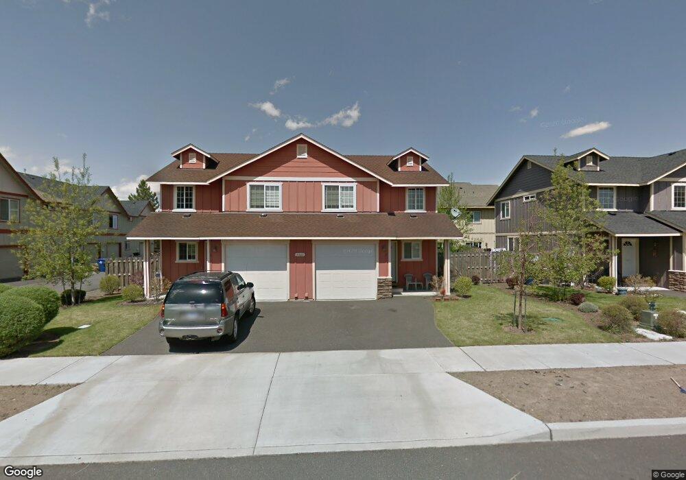
21022 Damascus Ln Bend, OR 97701
Larkspur NeighborhoodEstimated Value: $695,938 - $797,000
6
Beds
4
Baths
2,430
Sq Ft
$311/Sq Ft
Est. Value
About This Home
This home is located at 21022 Damascus Ln, Bend, OR 97701 and is currently estimated at $755,985, approximately $311 per square foot. 21022 Damascus Ln is a home located in Deschutes County with nearby schools including Bear Creek Elementary School, Pilot Butte Middle School, and Bend Senior High School.
Ownership History
Date
Name
Owned For
Owner Type
Purchase Details
Closed on
Oct 29, 2007
Sold by
Cary Robert Todd
Bought by
Cary Robert Todd and Robert Todd Cary 2005 Trust
Current Estimated Value
Purchase Details
Closed on
Sep 23, 2005
Sold by
Bernhardt Construction Inc
Bought by
Cary Robert Todd
Purchase Details
Closed on
Mar 26, 2004
Sold by
Level Iii Development Corp
Bought by
Bernhardt Construction Inc
Create a Home Valuation Report for This Property
The Home Valuation Report is an in-depth analysis detailing your home's value as well as a comparison with similar homes in the area
Home Values in the Area
Average Home Value in this Area
Purchase History
| Date | Buyer | Sale Price | Title Company |
|---|---|---|---|
| Cary Robert Todd | -- | None Available | |
| Cary Robert Todd | $320,000 | Western Title & Escrow Co | |
| Bernhardt Construction Inc | $127,000 | Western Title & Escrow Co |
Source: Public Records
Tax History
| Year | Tax Paid | Tax Assessment Tax Assessment Total Assessment is a certain percentage of the fair market value that is determined by local assessors to be the total taxable value of land and additions on the property. | Land | Improvement |
|---|---|---|---|---|
| 2025 | $4,828 | $285,720 | -- | -- |
| 2024 | $4,645 | $277,400 | -- | -- |
| 2023 | $4,306 | $269,330 | $0 | $0 |
| 2022 | $4,017 | $253,880 | $0 | $0 |
| 2021 | $4,023 | $246,490 | $0 | $0 |
| 2020 | $3,817 | $246,490 | $0 | $0 |
| 2019 | $3,711 | $239,320 | $0 | $0 |
| 2018 | $3,606 | $232,350 | $0 | $0 |
| 2017 | $3,500 | $225,590 | $0 | $0 |
| 2016 | $3,338 | $219,020 | $0 | $0 |
| 2015 | $3,246 | $212,650 | $0 | $0 |
| 2014 | $3,150 | $206,460 | $0 | $0 |
Source: Public Records
Map
Nearby Homes
- 62062 Dean Swift Rd
- 29850 NE Highway 20
- 98 NE Telima Ln
- 2200 NE Hwy 20 Unit 15
- 21138 SE Kayla Ct
- 940 NE Purcell Blvd
- 61969 SE 27th St
- 929 NE Lena Place
- 161 SE Rice Way
- 1540 NE Bear Creek Rd
- 132 SE 16th St
- 1052 NE Francis Ct
- 61839 Avonlea Cir
- 21024 SE Azalia Ave
- 61813 Azalia Place
- 21315 Livingston Dr
- 61839 SE 27th St
- 268 SE 15th St Unit 268/270
- 21503 Oconnor Way
- 21489 Oconnor Way Unit 17
- 21028 Damascus Ln
- 62048 NE Nates Place Unit 2
- 62048 NE Nates Place
- 62044 NE Nates Place
- 62056 NE Nates Place Unit 4
- 62056 NE Nates Place
- 62060 NE Nates Place Unit 5
- 62060 NE Nates Place
- 62052 NE Nates Place Unit 3
- 62052 NE Nates Place
- 21027 Carl St
- 62064 NE Nates Place
- 62032 NE Nate's Place
- 62032 NE Nates Place
- 21034 Damascus Ln
- 21025 Damascus Ln
- 21029 Damascus Ln
- 21015 Carl St Unit 11
- 21015 Carl St Unit 10
- 21015 Carl St Unit 7
Your Personal Tour Guide
Ask me questions while you tour the home.