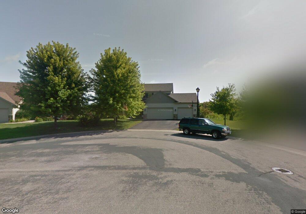
2103 Diamond Point Waconia, MN 55387
Estimated Value: $548,000 - $611,914
5
Beds
4
Baths
2,234
Sq Ft
$259/Sq Ft
Est. Value
About This Home
This home is located at 2103 Diamond Point, Waconia, MN 55387 and is currently estimated at $578,479, approximately $258 per square foot. 2103 Diamond Point is a home located in Carver County with nearby schools including Southview Elementary School, Waconia Middle School, and Waconia High School.
Ownership History
Date
Name
Owned For
Owner Type
Purchase Details
Closed on
Nov 14, 2014
Sold by
Hanson Steven F and Hanson Shelly A
Bought by
Hoxie Jeffrey R and Hoxie Gretchen F
Current Estimated Value
Home Financials for this Owner
Home Financials are based on the most recent Mortgage that was taken out on this home.
Original Mortgage
$272,000
Outstanding Balance
$152,237
Interest Rate
4.1%
Mortgage Type
New Conventional
Estimated Equity
$426,242
Purchase Details
Closed on
Oct 15, 2003
Sold by
Mattamy Minneapolis Partnership
Bought by
Hanson Steven P and Hanson Shelly A
Purchase Details
Closed on
Mar 7, 2003
Sold by
Homes By Chase Inc
Bought by
Mattamy Minneapolis Partnership
Purchase Details
Closed on
Jul 31, 2002
Sold by
Hartman Communities Llc
Bought by
Homes By Chase Inc
Create a Home Valuation Report for This Property
The Home Valuation Report is an in-depth analysis detailing your home's value as well as a comparison with similar homes in the area
Home Values in the Area
Average Home Value in this Area
Purchase History
| Date | Buyer | Sale Price | Title Company |
|---|---|---|---|
| Hoxie Jeffrey R | $340,000 | Carver Cnty Abstract & Title | |
| Hanson Steven P | $332,739 | -- | |
| Mattamy Minneapolis Partnership | $3,611,187 | -- | |
| Homes By Chase Inc | $79,900 | -- |
Source: Public Records
Mortgage History
| Date | Status | Borrower | Loan Amount |
|---|---|---|---|
| Open | Hoxie Jeffrey R | $272,000 |
Source: Public Records
Tax History Compared to Growth
Tax History
| Year | Tax Paid | Tax Assessment Tax Assessment Total Assessment is a certain percentage of the fair market value that is determined by local assessors to be the total taxable value of land and additions on the property. | Land | Improvement |
|---|---|---|---|---|
| 2025 | $7,544 | $591,000 | $125,000 | $466,000 |
| 2024 | $7,068 | $581,000 | $120,000 | $461,000 |
| 2023 | $7,202 | $566,600 | $120,000 | $446,600 |
| 2022 | $6,408 | $588,500 | $113,400 | $475,100 |
| 2021 | $6,276 | $442,300 | $88,200 | $354,100 |
| 2020 | $6,066 | $441,700 | $88,200 | $353,500 |
| 2019 | $5,902 | $400,000 | $84,000 | $316,000 |
| 2018 | $5,338 | $400,000 | $84,000 | $316,000 |
| 2017 | $4,854 | $382,800 | $75,300 | $307,500 |
| 2016 | $4,948 | $356,200 | $0 | $0 |
| 2015 | $4,338 | $340,900 | $0 | $0 |
| 2014 | $4,338 | $288,200 | $0 | $0 |
Source: Public Records
Map
Nearby Homes
- 2040 Fountain Ln
- 1851 Campfire Dr E
- 1843 Campfire Dr E
- 1958 Campfire Dr E
- 1954 Campfire Dr E
- 1956 Campfire Dr E
- 1951 Woods Point
- Shadowood Plan at Woodland Creek
- Legend Plan at Woodland Creek
- 1774 Campfire Dr W
- 1887 Campfire Dr W
- 1767 Campfire Dr W
- 1617 Island Ct
- 629 Sierra Pkwy
- 1719 Fountain Ln
- 152 Mill Rd
- 565 Waterford Place
- 124 Mill Rd
- 561 Waterford Place
- 558 Waterford Place
- 2101 Diamond Point
- 2105 Diamond Point
- 2086 Silver St
- 2108 Diamond Point
- 2100 Diamond Point
- 2104 Diamond Point
- 2088 Silver St
- 2085 Silver St
- 2083 Silver St
- 2087 Silver St
- 2090 Silver St
- 2081 Silver St
- 2076 Silver St
- 2089 Silver St
- 2092 Silver St
- 2079 Silver St
- 2070 Silver St
- 2057 Starlight Dr
- 2061 Starlight Dr
- 2094 Silver St