2108 Roland Hayes Pkwy SW Calhoun, GA 30701
Estimated payment $1,296/month
Highlights
- Hot Property
- Wood Flooring
- 1 Fireplace
- Seasonal View
- Country Style Home
- No HOA
About This Home
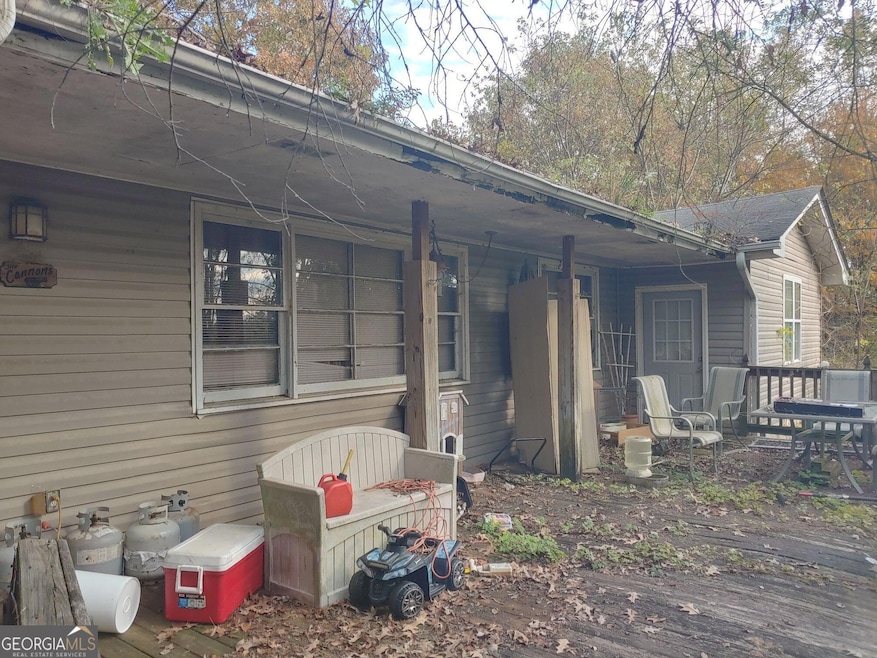
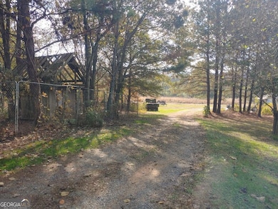
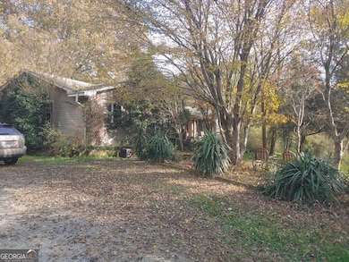
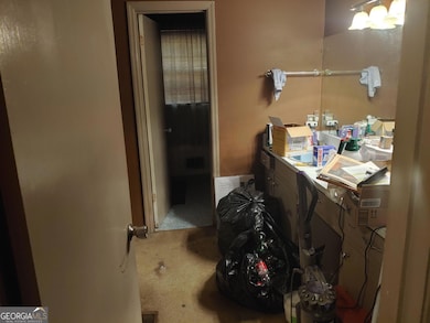
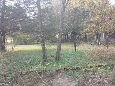
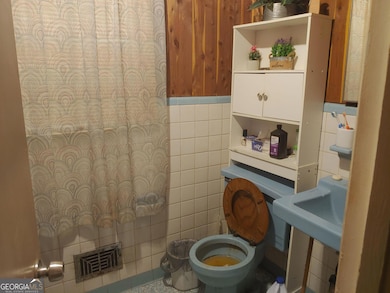
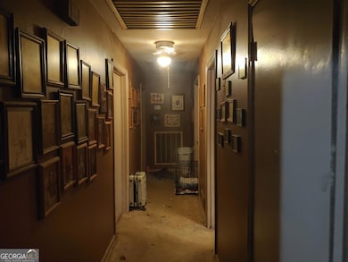
Welcome to 2108 Roland Hayes Parkway SW - a wonderful opportunity to own a spacious 5-acre property in Calhoun with a solid home that's been thoughtfully updated where it counts! This 3-bedroom, 2-bath residence offers a strong foundation and room to create your ideal country retreat. Inside, you'll find important upgrades already completed, including all-new electrical wiring, a brand-new tankless water heater, and stainless steel appliances in the kitchen. The home is move-in ready but leaves plenty of room for your personal touch with just a bit of cosmetic updating. Outside, the 5-acre lot provides ample space for privacy, gardening, recreation, or even future expansion. Don't miss out!
Home Details
Home Type
- Single Family
Est. Annual Taxes
- $2,907
Year Built
- Built in 2006
Lot Details
- 5.02 Acre Lot
Home Design
- Country Style Home
- Composition Roof
- Vinyl Siding
Interior Spaces
- 2,607 Sq Ft Home
- 1-Story Property
- 1 Fireplace
- Seasonal Views
- Crawl Space
- Laundry closet
Kitchen
- Built-In Oven
- Cooktop
- Dishwasher
- Stainless Steel Appliances
Flooring
- Wood
- Carpet
- Tile
Bedrooms and Bathrooms
- 3 Main Level Bedrooms
- 2 Full Bathrooms
- Bathtub Includes Tile Surround
Parking
- 2 Parking Spaces
- Off-Street Parking
Schools
- Swain Elementary School
- Ashworth Middle School
- Gordon Central High School
Utilities
- Central Heating and Cooling System
- Tankless Water Heater
Community Details
- No Home Owners Association
- Countywide Subdivision
Map
Home Values in the Area
Average Home Value in this Area
Tax History
| Year | Tax Paid | Tax Assessment Tax Assessment Total Assessment is a certain percentage of the fair market value that is determined by local assessors to be the total taxable value of land and additions on the property. | Land | Improvement |
|---|---|---|---|---|
| 2024 | $2,907 | $116,440 | $5,280 | $111,160 |
| 2023 | $2,690 | $107,880 | $5,280 | $102,600 |
| 2022 | $2,650 | $100,080 | $5,280 | $94,800 |
| 2021 | $2,195 | $80,360 | $5,280 | $75,080 |
| 2020 | $2,232 | $79,920 | $5,280 | $74,640 |
| 2019 | $2,244 | $79,920 | $5,280 | $74,640 |
| 2018 | $2,027 | $72,360 | $5,280 | $67,080 |
| 2017 | $1,954 | $67,920 | $5,280 | $62,640 |
| 2016 | $1,958 | $67,920 | $5,280 | $62,640 |
| 2015 | $1,933 | $66,480 | $5,280 | $61,200 |
| 2014 | $1,774 | $62,935 | $5,295 | $57,640 |
Property History
| Date | Event | Price | List to Sale | Price per Sq Ft |
|---|---|---|---|---|
| 11/11/2025 11/11/25 | For Sale | $199,900 | -- | $77 / Sq Ft |
Purchase History
| Date | Type | Sale Price | Title Company |
|---|---|---|---|
| Foreclosure Deed | $61,500 | -- | |
| Deed | $362,320 | -- |
Mortgage History
| Date | Status | Loan Amount | Loan Type |
|---|---|---|---|
| Previous Owner | $370,000 | New Conventional |
Source: Georgia MLS
MLS Number: 10642011
APN: 023-045A
Disclaimer: Certain information contained herein is derived from information provided by parties other than Homes.com. All information provided is deemed reliable, but is not guaranteed to be accurate and should be independently verified.
![]() The data relating to real estate for sale on this web site comes in part from the Broker Reciprocity Program of Georgia MLS. Real estate listings held by brokerage firms other than Redfin are marked with the Broker Reciprocity logo and detailed information about them includes the name of the listing brokers. Information deemed reliable but not guaranteed. Copyright 2025 Georgia MLS. All rights reserved.
The data relating to real estate for sale on this web site comes in part from the Broker Reciprocity Program of Georgia MLS. Real estate listings held by brokerage firms other than Redfin are marked with the Broker Reciprocity logo and detailed information about them includes the name of the listing brokers. Information deemed reliable but not guaranteed. Copyright 2025 Georgia MLS. All rights reserved.
- The Braselton II Plan at Fair Oak
- The Reynolds Plan at Fair Oak
- The Buford II Plan at Fair Oak
- The Lawson Plan at Fair Oak
- The Caldwell Plan at Fair Oak
- The Benson II Plan at Fair Oak
- The Greenbrier II Plan at Fair Oak
- 176 Village Way SW
- 515 Hunt Bend Rd NW
- 413 Beamer Rd SW
- 210 Madison Dr SW
- 301 Switch Rd SW
- 130 Brookstone Dr SW
- 137 Regency Row SW
- 0 Highway 53 Spur SW Unit 7529096
- 0 Reeves Station Rd SW Unit 10548197
- 0 Reeves Station Rd SW Unit 7601645
- 1943 Rome Rd SW
- 121 Foxhall Dr SW
- 215 Wilson St
- 150 Oakleigh Dr
- 73 Professional Place
- 59 Professional Place
- 83 Professional Place
- 67 Professional Place
- 77 Professional Place
- 75 Professional Place
- 67 Professional Place
- 213 Cornwell Way
- 204 Cornwell Way
- 108 Cornwell Way
- 509 Mount Vernon Dr
- 81 Professional Place
- 415 Curtis Pkwy SE
- 156 Cook Rd NW
- 100 Harvest Grove Ln
- 109 Creekside Dr NW Unit 3
- 100 Watlington Dr
- 622 Soldiers Pathway
- 351 Valley View Cir SE
