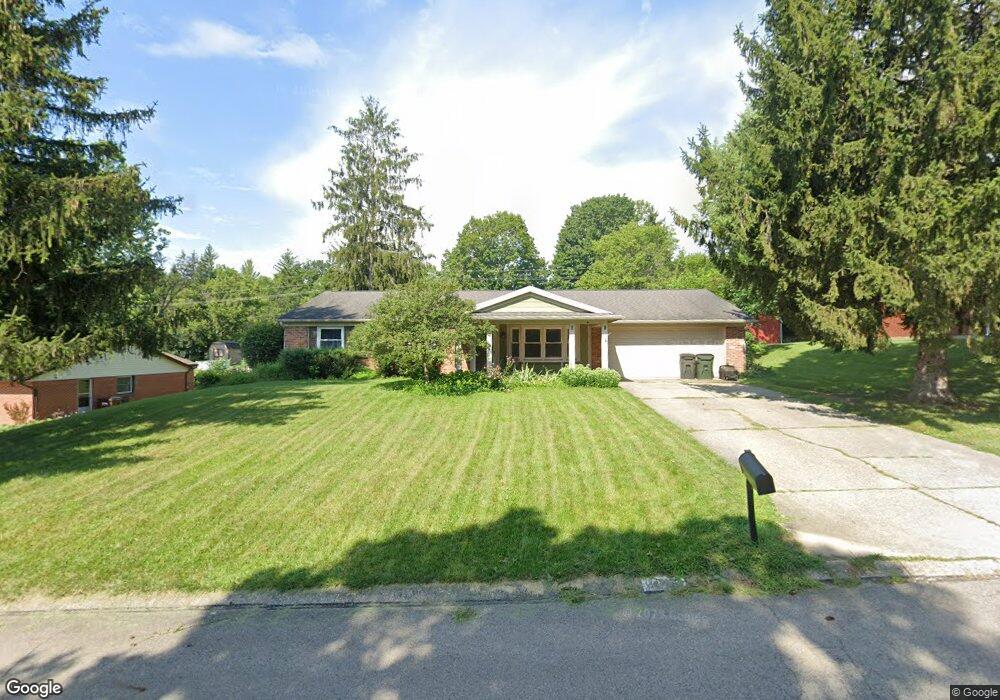
2109 Firebird Dr Bellbrook, OH 45305
Estimated Value: $287,000 - $324,000
3
Beds
2
Baths
1,638
Sq Ft
$187/Sq Ft
Est. Value
About This Home
This home is located at 2109 Firebird Dr, Bellbrook, OH 45305 and is currently estimated at $306,250, approximately $186 per square foot. 2109 Firebird Dr is a home located in Greene County with nearby schools including Stephen Bell Elementary School, Bell Creek Intermediate School, and Bellbrook Middle School.
Ownership History
Date
Name
Owned For
Owner Type
Purchase Details
Closed on
Aug 9, 2021
Sold by
Pitts Andrew D and Pitts Amanda
Bought by
Buxa Peter E and Buxa Aileen E
Current Estimated Value
Home Financials for this Owner
Home Financials are based on the most recent Mortgage that was taken out on this home.
Original Mortgage
$157,425
Interest Rate
3.05%
Mortgage Type
New Conventional
Purchase Details
Closed on
May 8, 2014
Sold by
Graves Mary R
Bought by
Pitts Andrew D and Pitts Amanda
Home Financials for this Owner
Home Financials are based on the most recent Mortgage that was taken out on this home.
Original Mortgage
$147,959
Interest Rate
4.41%
Mortgage Type
New Conventional
Purchase Details
Closed on
Sep 17, 1997
Sold by
Stevens M Frank
Bought by
Graves William R and Graves R
Create a Home Valuation Report for This Property
The Home Valuation Report is an in-depth analysis detailing your home's value as well as a comparison with similar homes in the area
Home Values in the Area
Average Home Value in this Area
Purchase History
| Date | Buyer | Sale Price | Title Company |
|---|---|---|---|
| Buxa Peter E | -- | None Listed On Document | |
| Pitts Andrew D | $145,000 | None Available | |
| Graves William R | $121,000 | -- |
Source: Public Records
Mortgage History
| Date | Status | Borrower | Loan Amount |
|---|---|---|---|
| Previous Owner | Buxa Peter E | $157,425 | |
| Previous Owner | Pitts Andrew D | $147,959 |
Source: Public Records
Tax History Compared to Growth
Tax History
| Year | Tax Paid | Tax Assessment Tax Assessment Total Assessment is a certain percentage of the fair market value that is determined by local assessors to be the total taxable value of land and additions on the property. | Land | Improvement |
|---|---|---|---|---|
| 2024 | $4,683 | $81,500 | $15,730 | $65,770 |
| 2023 | $4,683 | $81,500 | $15,730 | $65,770 |
| 2022 | $4,275 | $60,700 | $12,590 | $48,110 |
| 2021 | $4,133 | $59,410 | $12,590 | $46,820 |
| 2020 | $3,862 | $59,410 | $12,590 | $46,820 |
| 2019 | $3,784 | $52,880 | $9,790 | $43,090 |
| 2018 | $3,788 | $52,880 | $9,790 | $43,090 |
| 2017 | $3,506 | $52,880 | $9,790 | $43,090 |
| 2016 | $3,507 | $48,540 | $9,790 | $38,750 |
| 2015 | $3,517 | $48,540 | $9,790 | $38,750 |
| 2014 | $3,351 | $48,540 | $9,790 | $38,750 |
Source: Public Records
Map
Nearby Homes
- 3930 Beechwood Dr
- 2013 Wentworth Village Dr Unit 2013
- 3720 Shiraz Ct
- 2426 Portage Path
- 2264 S Linda Dr
- 2215 S Linda Dr
- 1692 Glenwood Way
- 3553 Shellbark Dr
- 4184 Wood Acre Dr
- 2298 S Lakeman Dr
- 3509 Marwood Dr
- 2193 Tampico Trail
- 4353 Napa Valley Dr
- 4267 Sugar Point Way
- 4206 N Golden Clove Bend Unit 56-303
- 1630 S Golden Clove Bend Unit 52A
- 4204 N Golden Clove Bend Unit 56-305
- 4208 N Golden Clove Bend Unit 56-103
- 4222 N Golden Clove Bend Unit 56-201
- 4220 N Golden Clove Bend Unit 56-301
- 2099 Firebird Dr
- 2119 Firebird Dr
- 3924 Dane Ct
- 2089 Firebird Dr
- 2129 Firebird Dr
- 2114 Firebird Dr
- 2124 Firebird Dr
- 2104 Firebird Dr
- 2134 Firebird Dr
- 2079 Firebird Dr
- 2139 Firebird Dr
- 2094 Firebird Dr
- 3927 Dane Ct
- 3930 Dane Ct
- 2076 Dane Ln
- 2109 Sheffield Place
- 2144 Firebird Dr
- 2121 Sheffield Place
- 2061 Dane Ln
- 2149 Firebird Dr