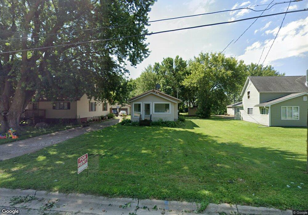
211 Main St W Clarks Grove, MN 56016
Estimated Value: $107,750 - $163,000
2
Beds
1
Bath
660
Sq Ft
$198/Sq Ft
Est. Value
About This Home
This home is located at 211 Main St W, Clarks Grove, MN 56016 and is currently estimated at $130,688, approximately $198 per square foot. 211 Main St W is a home located in Freeborn County with nearby schools including Lakeview Elementary School, Southwest Middle School, and Albert Lea Senior High School.
Ownership History
Date
Name
Owned For
Owner Type
Purchase Details
Closed on
Jan 13, 2022
Sold by
Engel Bonnie Bonnie
Bought by
Malakowsky Forrest Forrest
Current Estimated Value
Home Financials for this Owner
Home Financials are based on the most recent Mortgage that was taken out on this home.
Original Mortgage
$497,650
Outstanding Balance
$460,649
Interest Rate
3.45%
Estimated Equity
-$329,961
Create a Home Valuation Report for This Property
The Home Valuation Report is an in-depth analysis detailing your home's value as well as a comparison with similar homes in the area
Home Values in the Area
Average Home Value in this Area
Purchase History
| Date | Buyer | Sale Price | Title Company |
|---|---|---|---|
| Malakowsky Forrest Forrest | $497,700 | -- |
Source: Public Records
Mortgage History
| Date | Status | Borrower | Loan Amount |
|---|---|---|---|
| Open | Malakowsky Forrest Forrest | $497,650 | |
| Closed | Malakowsky Forrest Forrest | -- |
Source: Public Records
Tax History Compared to Growth
Tax History
| Year | Tax Paid | Tax Assessment Tax Assessment Total Assessment is a certain percentage of the fair market value that is determined by local assessors to be the total taxable value of land and additions on the property. | Land | Improvement |
|---|---|---|---|---|
| 2025 | $952 | $83,800 | $14,300 | $69,500 |
| 2024 | $920 | $68,200 | $11,000 | $57,200 |
| 2023 | $902 | $65,400 | $11,000 | $54,400 |
| 2022 | $736 | $63,600 | $11,000 | $52,600 |
| 2021 | $720 | $43,200 | $7,900 | $35,300 |
| 2020 | $686 | $40,200 | $7,900 | $32,300 |
| 2019 | $594 | $34,300 | $7,900 | $26,400 |
| 2018 | $700 | $0 | $0 | $0 |
| 2016 | $380 | $0 | $0 | $0 |
| 2015 | $364 | $0 | $0 | $0 |
| 2014 | $400 | $0 | $0 | $0 |
| 2012 | $570 | $0 | $0 | $0 |
Source: Public Records
Map
Nearby Homes
- 199 2nd St NE
- 000 County Highway 45
- 378 Hillcrest Cir
- 77201 270th St
- 720XX 255th St
- 26444 740th Ave
- 77348 325th St
- 28674 810th Ave
- 74500 240th St
- 305 1st St SW
- 309 Central Ave S
- 26795 820th Ave
- tbd 2nd St SE
- TBD Tbd
- TBA SE 2nd
- 75976 230th St
- XXXX Bridge Ave N
- TBD Bridgeport Subdivision
- xxx Hi Tec Ave
- TBD 2709 - 2715 Bridge Ave