Estimated Value: $361,612 - $373,000
3
Beds
1
Bath
1,878
Sq Ft
$196/Sq Ft
Est. Value
About This Home
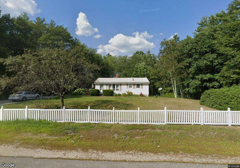
This home is located at 2110 Dover Rd, Epsom, NH 03234 and is currently estimated at $367,903, approximately $195 per square foot. 2110 Dover Rd is a home located in Merrimack County with nearby schools including Epsom Central School, Cornerstone Christian Academy, and Epsom Better Buddies.
Ownership History
Date
Name
Owned For
Owner Type
Purchase Details
Closed on
Jun 20, 2023
Sold by
Roberta Bailey Ret and Mihachik
Bought by
Beauchesne Blake
Current Estimated Value
Home Financials for this Owner
Home Financials are based on the most recent Mortgage that was taken out on this home.
Original Mortgage
$230,000
Outstanding Balance
$222,809
Interest Rate
6.35%
Mortgage Type
Purchase Money Mortgage
Estimated Equity
$145,094
Purchase Details
Closed on
Oct 4, 2019
Sold by
Bailey Roberta S
Bought by
Roberta Bailey Ret
Create a Home Valuation Report for This Property
The Home Valuation Report is an in-depth analysis detailing your home's value as well as a comparison with similar homes in the area
Home Values in the Area
Average Home Value in this Area
Purchase History
| Date | Buyer | Sale Price | Title Company |
|---|---|---|---|
| Beauchesne Blake | $230,000 | None Available | |
| Roberta Bailey Ret | -- | -- |
Source: Public Records
Mortgage History
| Date | Status | Borrower | Loan Amount |
|---|---|---|---|
| Open | Beauchesne Blake | $230,000 |
Source: Public Records
Tax History
| Year | Tax Paid | Tax Assessment Tax Assessment Total Assessment is a certain percentage of the fair market value that is determined by local assessors to be the total taxable value of land and additions on the property. | Land | Improvement |
|---|---|---|---|---|
| 2024 | $6,298 | $236,400 | $82,000 | $154,400 |
| 2023 | $5,832 | $236,800 | $82,000 | $154,800 |
| 2022 | $5,645 | $236,800 | $82,000 | $154,800 |
| 2021 | $5,598 | $236,800 | $82,000 | $154,800 |
| 2020 | $5,169 | $236,800 | $82,000 | $154,800 |
| 2019 | $5,391 | $199,000 | $71,700 | $127,300 |
| 2018 | $5,168 | $199,000 | $71,700 | $127,300 |
| 2017 | $5,108 | $199,000 | $71,700 | $127,300 |
| 2016 | $4,981 | $199,000 | $71,700 | $127,300 |
| 2015 | $4,740 | $199,000 | $71,700 | $127,300 |
| 2014 | $4,334 | $194,700 | $60,600 | $134,100 |
| 2013 | $4,394 | $194,700 | $60,600 | $134,100 |
Source: Public Records
Map
Nearby Homes
- 333 Dover Rd
- 0 Dover Unit 33 & 35
- 14 Short Falls Rd
- 2 Depot Rd
- 520 Goboro Rd
- 21 Depot Rd
- 14 Deer Ln
- 2 Archer Cir
- 5 Old Turnpike Rd
- 9 Princess Ln
- 157 Old Turnpike Rd
- 361 Dover Rd
- 0 Poor Town Rd Unit 4
- 80 Center Hill Rd
- 11 Nash Ln
- 15 Nash Ln
- 13 Lottie Ln
- 821 Cross Country Rd
- 19 Meadow Lark Ln
- 667 Borough Rd
- 0 Rt 4 Map U06 Lot 8 Unit 4255564
- 2131 Dover Rd
- 2131 Dover Road - Route 4 202
- 2102 Dover Rd
- 2100 Dover Rd
- 2121 Dover Rd
- 2146 Dover Rd
- 2080 Dover Rd
- 2137 Dover Rd
- 1 Dover Rd
- 4 Dover Rd
- 2 Dover Rd
- 0 Dover Road Route 4 Unit 2755143
- 0 Dover Road Route 4 Unit 2755090
- 2078 Dover Rd
- 2060 Dover Rd
- 10 Dover Rd
- 10 Dover Rd
- 10 Dover Rd
- 1080 Granny Howe Rd
Your Personal Tour Guide
Ask me questions while you tour the home.