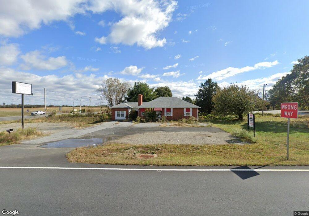
2110 Dupont Pkwy Middletown, DE 19709
Estimated Value: $287,347 - $392,000
2
Beds
1
Bath
1,140
Sq Ft
$300/Sq Ft
Est. Value
About This Home
This home is located at 2110 Dupont Pkwy, Middletown, DE 19709 and is currently estimated at $342,087, approximately $300 per square foot. 2110 Dupont Pkwy is a home located in New Castle County with nearby schools including Southern Elementary School and Gunning Bedford Middle School.
Ownership History
Date
Name
Owned For
Owner Type
Purchase Details
Closed on
Jul 15, 2022
Sold by
Ralph V Estep Irrevocable Family Trust
Bought by
Two Farms Inc
Current Estimated Value
Purchase Details
Closed on
Feb 3, 2016
Sold by
Ralph V Estep Irrevocable Family Trust
Bought by
Ralph V Estep Irrevocable Family Trust
Purchase Details
Closed on
Oct 22, 2012
Sold by
Estep Ralph V and The Ralph V Estep Irrevocable
Bought by
Department Of Transportation
Create a Home Valuation Report for This Property
The Home Valuation Report is an in-depth analysis detailing your home's value as well as a comparison with similar homes in the area
Home Values in the Area
Average Home Value in this Area
Purchase History
| Date | Buyer | Sale Price | Title Company |
|---|---|---|---|
| Two Farms Inc | -- | None Listed On Document | |
| Ralph V Estep Irrevocable Family Trust | -- | Attorney | |
| Department Of Transportation | $12,600 | None Available |
Source: Public Records
Tax History Compared to Growth
Tax History
| Year | Tax Paid | Tax Assessment Tax Assessment Total Assessment is a certain percentage of the fair market value that is determined by local assessors to be the total taxable value of land and additions on the property. | Land | Improvement |
|---|---|---|---|---|
| 2024 | $1,274 | $38,200 | $3,000 | $35,200 |
| 2023 | $1,155 | $38,200 | $3,000 | $35,200 |
| 2022 | $1,211 | $38,200 | $3,000 | $35,200 |
| 2021 | $1,211 | $38,200 | $3,000 | $35,200 |
| 2020 | $1,219 | $38,200 | $3,000 | $35,200 |
| 2019 | $1,194 | $38,200 | $3,000 | $35,200 |
| 2018 | $1,194 | $38,200 | $3,000 | $35,200 |
| 2017 | $997 | $38,200 | $3,000 | $35,200 |
| 2016 | $997 | $38,200 | $3,000 | $35,200 |
| 2015 | $997 | $38,200 | $3,000 | $35,200 |
| 2014 | $998 | $38,200 | $3,000 | $35,200 |
Source: Public Records
Map
Nearby Homes
- 0 Port Penn Rd
- Kerr Plan at K. Hovnanian’s® Four Seasons at Pennfield
- Aberdeen II Plan at K. Hovnanian’s® Four Seasons at Pennfield
- Carver Plan at K. Hovnanian’s® Four Seasons at Pennfield
- Morse Plan at K. Hovnanian’s® Four Seasons at Pennfield
- Asheville Plan at K. Hovnanian’s® Four Seasons at Pennfield
- 1422 Pennfield Dr
- 1521 Lesterfield Way
- 1518 Lesterfield Way
- 467 Hyetts Corner Rd
- 243 Sugar Pine Dr
- 832 Lissicasey Loop
- 1221 N Olmsted Pkwy
- 1218 N Olmsted Pkwy
- 142 Parker Dr
- 301 White Pine Dr
- 1169 S Olmsted Pkwy
- 105 Parker Dr
- 319 Pheasant Dr
- 133 Pine Valley Dr
- 6641 Port Penn Rd
- 318 Port Penn Rd
- 324 Port Penn Rd
- 2093 Dupont Pkwy
- 330 Port Penn Rd
- 336 Port Penn Rd
- 2120 Dupont Pkwy
- 380 Port Penn Rd
- 412 Port Penn Rd
- 381 Port Penn Rd
- 1113 E Nutmeg Place
- 1115 E Nutmeg Place
- 1111 E Nutmeg Place
- 393 Port Penn Rd
- 1109 E Nutmeg Place
- 392 Port Penn Rd
- 1114 E Nutmeg Place
- 1103 E Nutmeg Place
- 1107 E Nutmeg Place
- 1105 E Nutmeg Place